Map of Port Lavaca, Texas
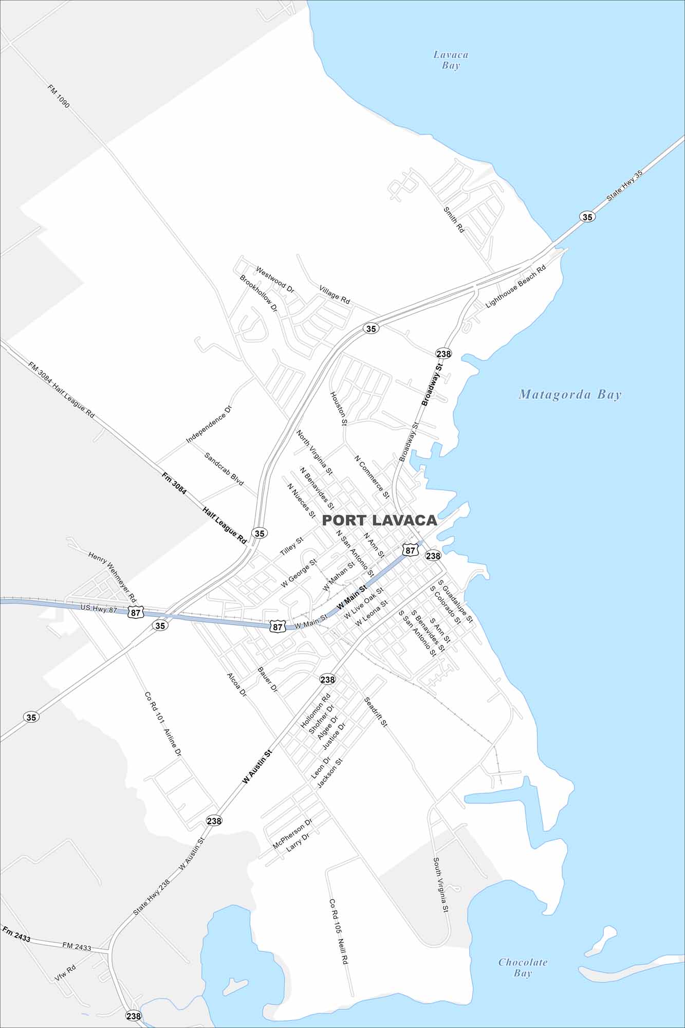
Take a look our map of Port Lavaca. This map shows connections to the Gulf Coast and local parks. Fishing and birdwatching are major draws in the area.
Map Information
On the Map
Interstates/Highways: US Hwy 87, State Hwy 35, State Hwy 238 Major Roads: Main St, Austin St, Broadway St, Virginia St, Half League Rd, Henry Wehmeyer Rd, Airline Dr, George St, Mahan St, Live Oak St, Leona St, San Antonio St, Benavides St, Nueces St, Commerce St, Ann St, Colorado St, Guadalupe St, Seadrift St, Jackson St Lakes and Reservoirs: Lavaca Bay, Matagorda Bay, Chocolate BayTexas State Maps
Scan our maps of the massive southern state of Texas.


City Maps of Texas
Explore our map collection of Texas cities.


