Map of Port Arthur, Texas
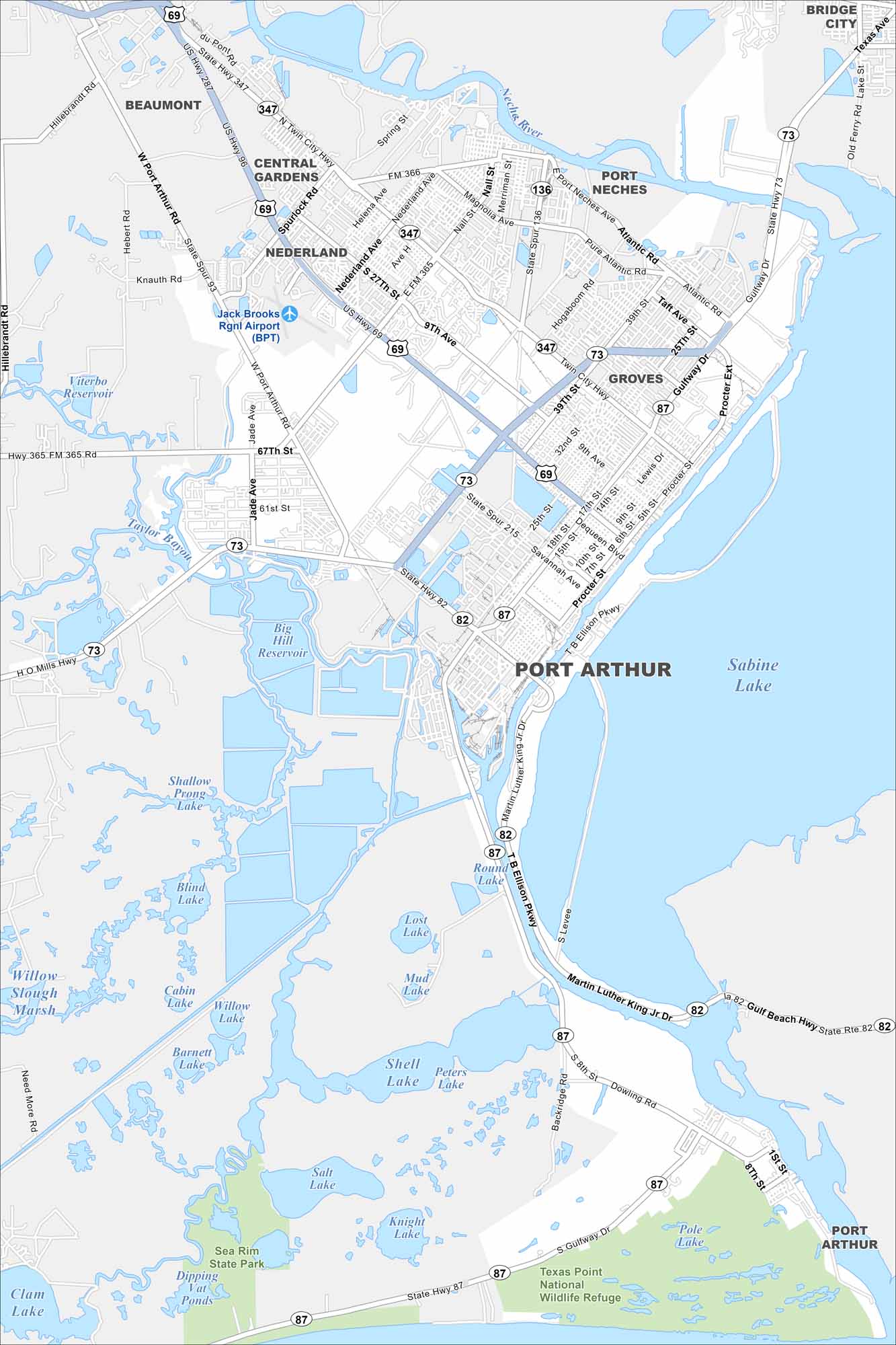
Our map of Port Arthur outlines its waterfront location on Sabine Lake. Refineries dominate much of the landscape, alongside residential neighborhoods. The city is a key gateway to the Gulf Coast.
Map Information
On the Map
Interstates/Highways: US Hwy 69, US Hwy 287, US Hwy 96, State Hwy 73, State Hwy 82, State Hwy 87 Major Roads: Port Arthur Rd, Twin City Hwy, Gulfway Dr, Savannah Ave, Procter St, Memorial Blvd, Martin Luther King Jr Dr, Main St, Nederland Ave, 9th Ave, 25th St, 32nd St, 39th St, Atlantic Rd, Taft Ave, Lewis Dr, Dowling Rd, Backridge Rd, Jade Ave, Knauth Rd Airports: Jack Brooks Rgnl Airport (BPT) Lakes and Reservoirs: Sabine Lake, Big Hill Reservoir, Shallow Prong Lake, Blind Lake, Cabin Lake, Willow Lake, Barnett Lake, Salt Lake, Shell Lake, Peters Lake, Mud Lake, Lost Lake, Round Lake, Knight Lake, Pole Lake, Dipping Vat Ponds Major Rivers: Neches River Parks and Preserves: Sea Rim State Park, Texas Point National Wildlife Refuge Nearby Communities: Beaumont, Central Gardens, Nederland, Port Neches, Groves, Bridge CityTexas State Maps
Scan our maps of the massive southern state of Texas.


City Maps of Texas
Explore our map collection of Texas cities.


