Map of Plano, Texas
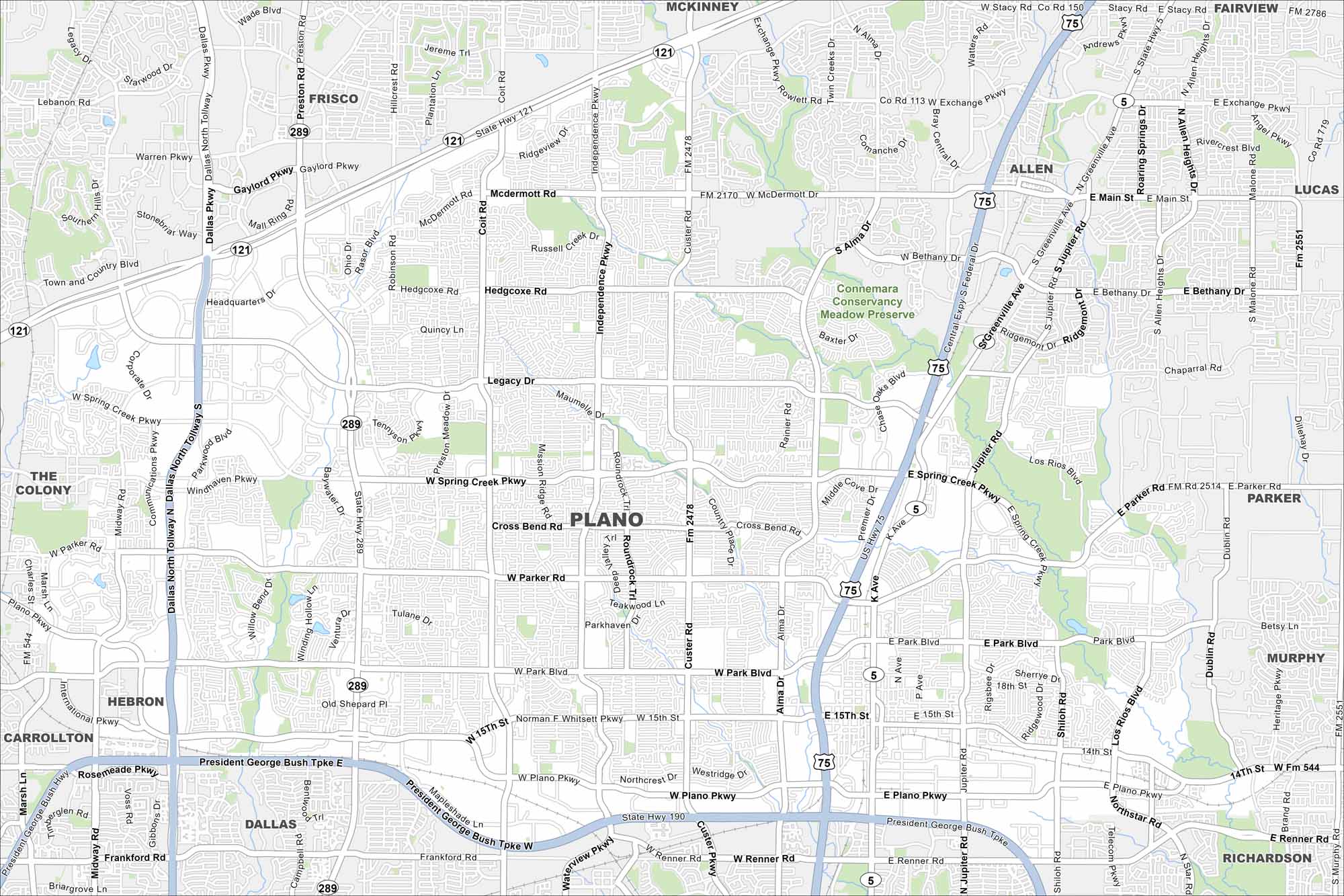
Our map of Plano shows a fast-growing suburb north of Dallas. Highways cut across the city, linking business districts and neighborhoods. It’s also home to major corporate headquarters and expansive parks.
Map Information
On the Map
Interstates/Highways: US Hwy 75, State Hwy 121, State Hwy 289, US Hwy 380, State Hwy 190 Major Roads: Spring Creek Pkwy, Parker Rd, Park Blvd, Plano Pkwy, Preston Rd, Coit Rd, Independence Pkwy, Custer Rd, Alma Dr, Jupiter Rd, Dallas North Tollway, President George Bush Tpke, Legacy Dr, McDermott Rd, Bethany Dr, 15th St, Renner Rd, Los Rios Blvd, Shiloh Rd, K Ave Parks and Preserves: Connemara Conservancy Meadow Preserve Nearby Communities: Frisco, McKinney, Allen, Lucas, Parker, Murphy, Richardson, Dallas, Carrollton, Hebron, The ColonyTexas State Maps
Scan our maps of the massive southern state of Texas.


City Maps of Texas
Explore our map collection of Texas cities.


