Map of Pittsfield, Massachusetts
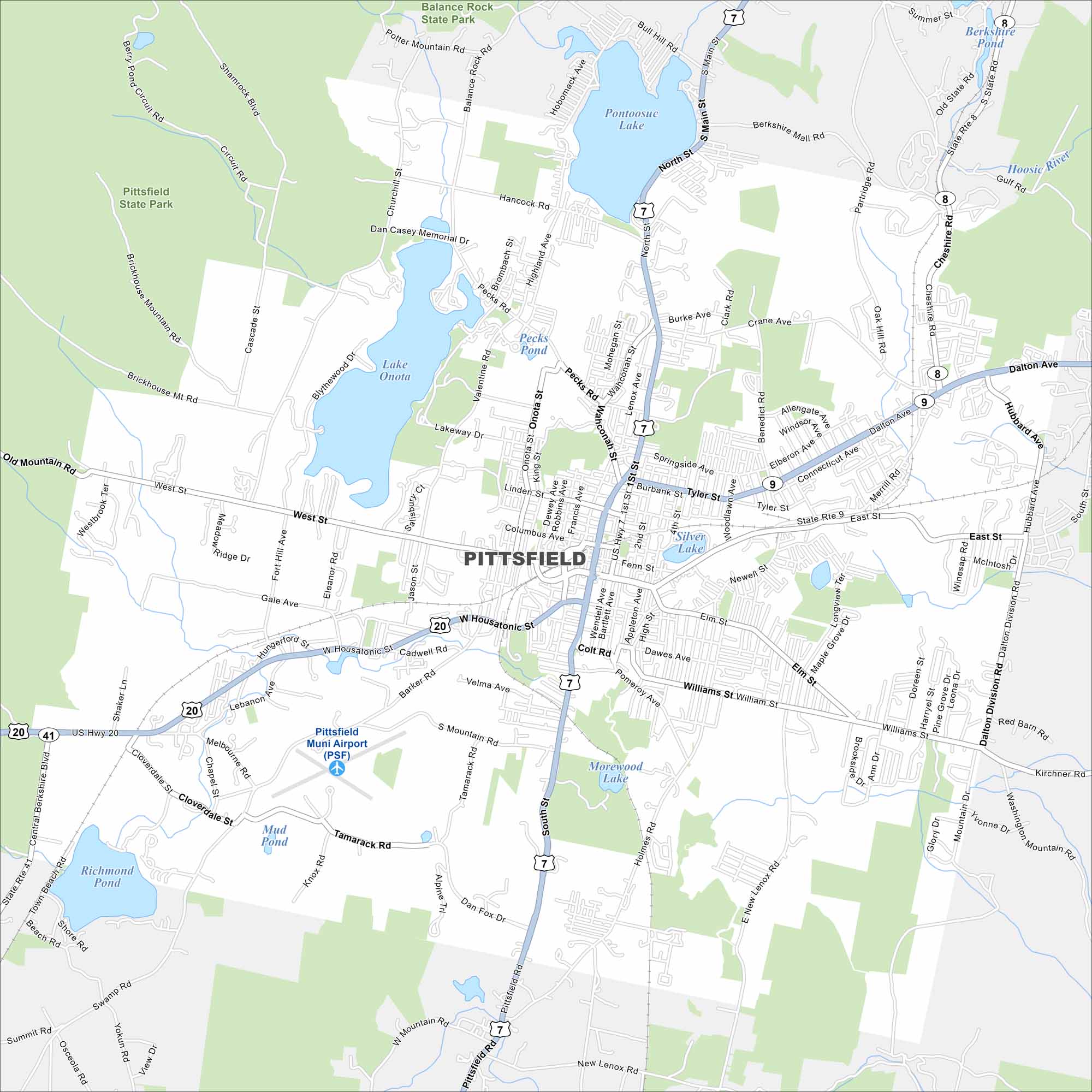
Check out Pittsfield in the heart of the Berkshires. This map highlights its compact downtown and nearby lakes. It’s a cultural hub surrounded by hiking trails and mountain scenery.
Map Information
On the Map
Interstates/Highways: US Hwy 20, US Hwy 7, State Rte 8, State Rte 9, State Rte 41 Major Roads: North St, South St, East St, West St, Tyler St, Dalton Ave, Williams St, Wahconah St, Cheshire Rd, Elm St, Holmes Rd, Tamarack Rd, Barker Rd, Hungerford St, Hancock Rd, Pecks Rd, Crane Ave Airports: Pittsfield Muni Airport (PSF) Lakes and Reservoirs: Onota Lake, Pontoosuc Lake, Richmond Pond, Silver Lake, Morewood Lake, Mud Pond, Pecks Pond, Berkshire Pond Major Rivers: Hoosic River Parks and Preserves: Pittsfield State Park, Balance Rock State Park Nearby Communities: New LenoxMassachusetts State Maps
Here’s our state maps of Massachusetts


City Maps of Massachusetts
Explore Boston and other urban areas in Massachusetts


