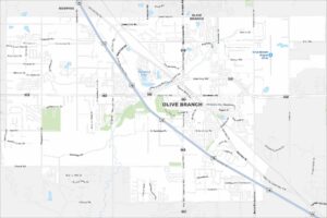
Map of Olive Branch, Mississippi
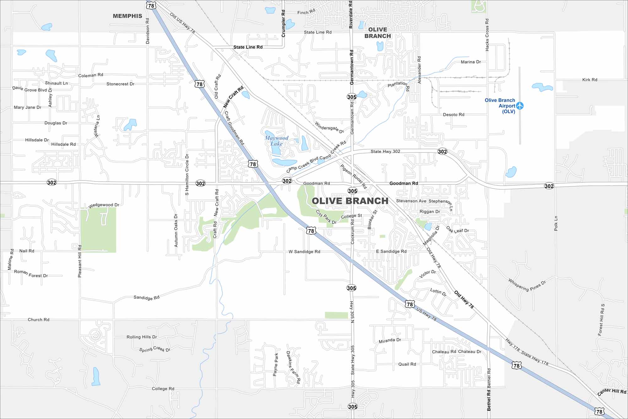
Take a look at Olive Branch just outside Memphis. Our map shows suburban neighborhoods mixed with open farmland. The city has grown quickly as part of the greater Memphis metro.
Map Information
On the Map
Interstates/Highways: US Hwy 78, State Hwy 302, State Hwy 305, State Hwy 178 Major Roads: Goodman Rd, Germantown Rd, Cockrum Rd, College St, Bethel Rd, Craft Rd, Alexander Rd, Hacks Cross Rd, Davidson Rd, Pigeon Roost Rd, Sandidge Rd, Pleasant Hill Rd, Malone Rd, Church Rd, Rolling Hills Dr, Spring Creek Dr, Victor Dr, Loftin Dr, Quail Rd, Miranda Dr Airports: Olive Branch Airport (OLV) Lakes and Reservoirs: Maywood Lake Nearby Communities: Memphis, Center HillMississippi State Maps
Explore maps of Mississippi’s towns, rivers, and roads.


Mississippi City Maps
Discover Mississippi with our city maps