Map of Northampton, Massachusetts
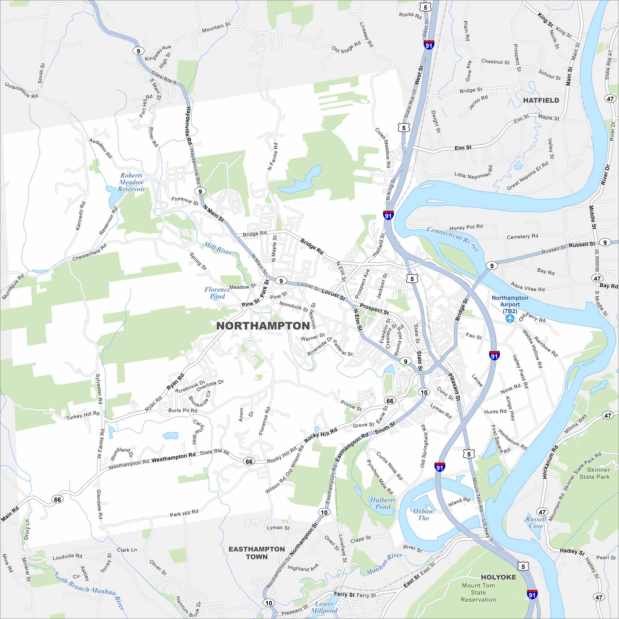
Northampton lies in the Pioneer Valley along the Connecticut River. Take a look at our map to see its downtown grid and nearby parks. The city is known for its cultural and academic presence.
Map Information
On the Map
Interstates/Highways: I-91, State Rte 9, State Rte 10, State Rte 5, State Rte 66, State Rte 47 Major Roads: Main St, King St, Elm St, Locust St, Bridge St, Pleasant St, South St, Easthampton Rd, West St, Bridge Rd, N Main St, Damon Rd, Hockanum Rd, Mount Tom Rd, Wright Ave Airports: Northampton Airport (7B2) Lakes and Reservoirs: The Oxbow, Hulberts Pond, Lower Millpond, Roberts Meadow Reservoir, Florence Pond Major Rivers: Connecticut River, Mill River, Manhan River, North Branch Manhan River Parks and Preserves: Mount Tom State Reservation, Skinner State Park Nearby Communities: Hatfield, Hadley, Holyoke, Easthampton TownMassachusetts State Maps
Here’s our state maps of Massachusetts


City Maps of Massachusetts
Explore Boston and other urban areas in Massachusetts


