Map of North Little Rock, Arkansas
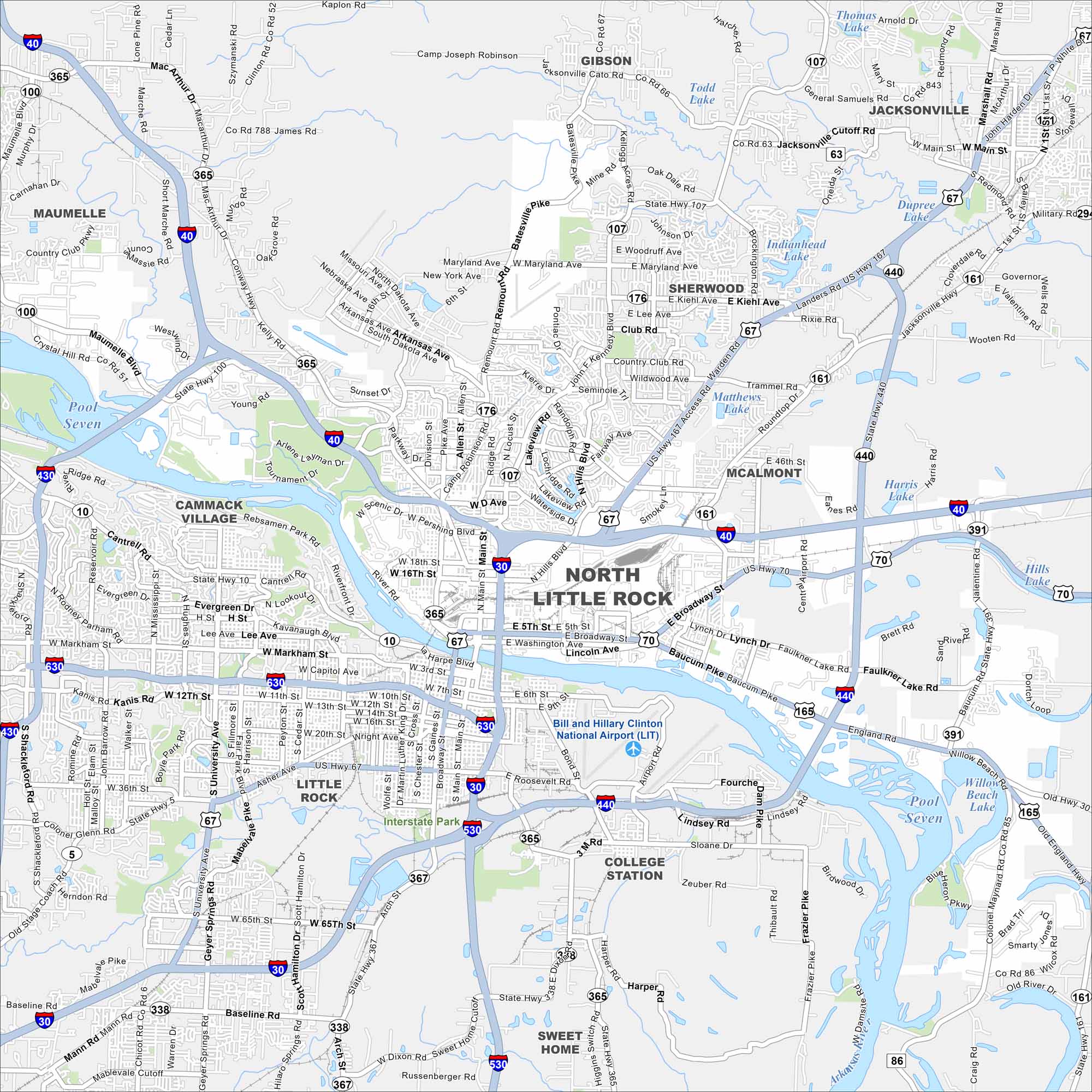
North Little Rock sits directly across the Arkansas River from Little Rock. Check out our map to see its riverfront parks, neighborhoods, and highway system. The two cities are connected by multiple bridges.
Arkansas State Maps
Check out our Arkansas maps here


Map Information
On the Map
Interstates/Highways: I-40, I-30, I-430, I-440, US Hwy 167, US Hwy 67, US Hwy 70, State Hwy 107, State Hwy 365, State Hwy 161, State Hwy 176, State Hwy 391 Major Roads: Broadway St, Main St, JFK Blvd, McCain Blvd, Riverfront Dr, Pike Ave, Camp Robinson Rd, Pershing Blvd, Lynch Dr, Faulkner Lake Rd, Baucum Pike, Remount Rd, Batesville Pike, Smokey Ln, Valentine Rd, Crystal Hill Rd, Maumelle Blvd, Counts Willie Rd, Landers Rd, Warden Rd Airports: Bill and Hillary Clinton National Airport (LIT) Lakes and Reservoirs: Indianhead Lake, Dupree Lake, Matthews Lake, Harris Lake, Hills Lake, Todd Lake, Thomas Lake, Pool Seven Major Rivers: Arkansas River Parks/Preserves/Forests: Interstate Park Nearby Communities: Sherwood, Jacksonville, Maumelle, Gibson, McAlmont, College Station, Little RockArkansas City Maps
Discover Arkansas through our city maps


