Map of Newcastle, Oklahoma
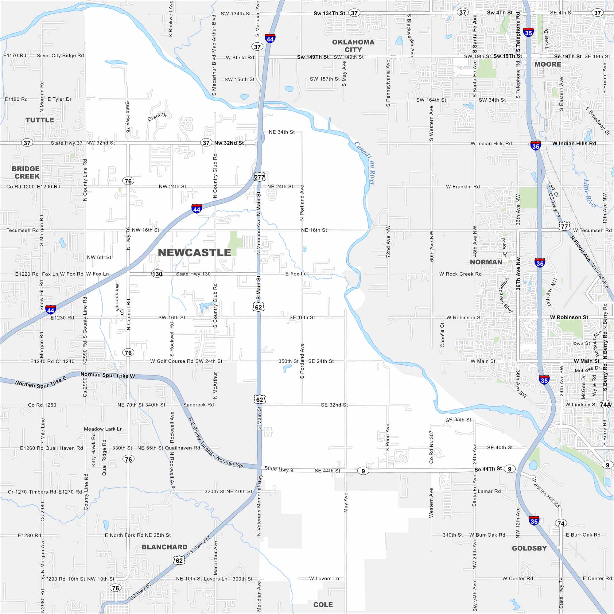
Newcastle lies just southwest of Oklahoma City. This map shows the Canadian River, highways, and open farmland. It’s part of the fast-growing OKC metro area.
Map Information
On the Map
Interstates/Highways: I-44, US Hwy 62, US Hwy 277, State Rte 9, State Rte 37, State Rte 74, State Rte 76, State Rte 130 Major Roads: Main St, 16th St, 24th St, 32nd St, 44th St, Indian Hills Rd, Robinson St, Veterans Memorial Hwy, Fox Ln, Rock Creek Rd, Tecumseh Rd, Main St (Norman), 36th Ave, Santa Fe Ave, Telephone Rd, May Ave, Pennsylvania Ave, Western Ave, Portland Ave, Meridian Ave Major Rivers: Canadian River, Little River Nearby Communities: Oklahoma City, Moore, Norman, Blanchard, Tuttle, Bridge Creek, Goldsby, ColeOklahoma State Maps
Here is our map collection of the Sooner State.


City Maps of Oklahoma
Explore Oklahoma’s cities with our maps


