Map of Newburyport, Massachusetts
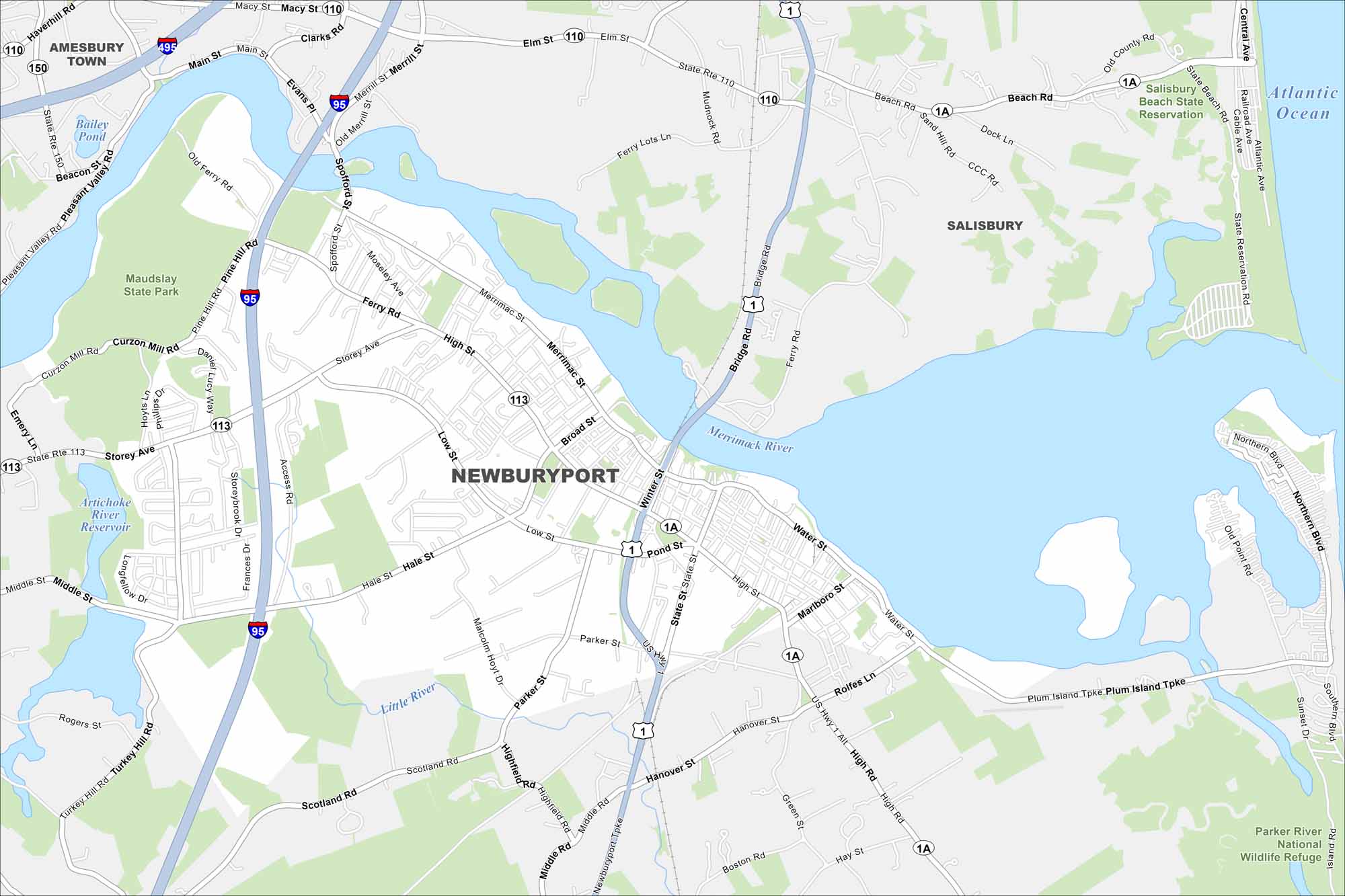
Newburyport sits at the mouth of the Merrimack River. Our map highlights its state parks, compact downtown, and coastal neighborhoods. The waterfront has been central since its shipbuilding days.
Map Information
On the Map
Interstates/Highways: I-95, I-495, US Hwy 1, State Rte 113, State Rte 1A, State Rte 110, State Rte 150 Major Roads: High St, Merrimac St, Storey Ave, Ferry Rd, Low St, Parker St, Water St, Plum Island Tpke, Scotland Rd, Hale St, Spofford St, Winter St, Pond St, Marlboro St, Rolfe Ln Lakes and Reservoirs: Atlantic Ocean, Artichoke River Reservoir, Bailey Pond Major Rivers: Merrimack River, Little River Parks and Preserves: Maudsley State Park, Salisbury Beach State Reservation, Parker River National Wildlife Refuge Nearby Communities: Amesbury Town, SalisburyMassachusetts State Maps
Here’s our state maps of Massachusetts


City Maps of Massachusetts
Explore Boston and other urban areas in Massachusetts


