Map of New Brighton, Minnesota
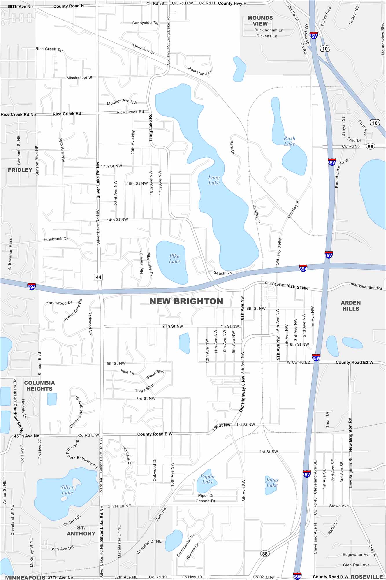
Our map of New Brighton shows a northern suburb of Minneapolis-St. Paul. The layout includes lakes, parks, and a mix of residential areas. It’s well connected by major highways like I-694 and I-35W.
Map Information
On the Map
Interstates/Highways: I-694, I-35W, US Hwy 10, State Rte 96 Major Roads: Silver Lake Rd, Old Highway 8, Cleveland Ave, 8th St, 37th Ave, County Rd E, County Rd H, Long Lake Rd, Pike Lake Dr, 7th St, 5th St, 10th St, Innsbruck Dr, 14th St, 16th St, 17th St, Mounds Ave, Rice Creek Rd, Stinson Blvd, New Brighton Rd Lakes and Reservoirs: Long Lake, Pike Lake, Rush Lake, Poplar Lake, Jones Lake, Silver Lake Nearby Communities: Mounds View, Fridley, Arden Hills, Columbia Heights, St. Anthony, Roseville, MinneapolisMinnesota State Maps
Explore every lake in our state maps of Minnesota


Minnesota City Maps
Browse through our city maps of Minnesota


