Map of Minneapolis, Minnesota
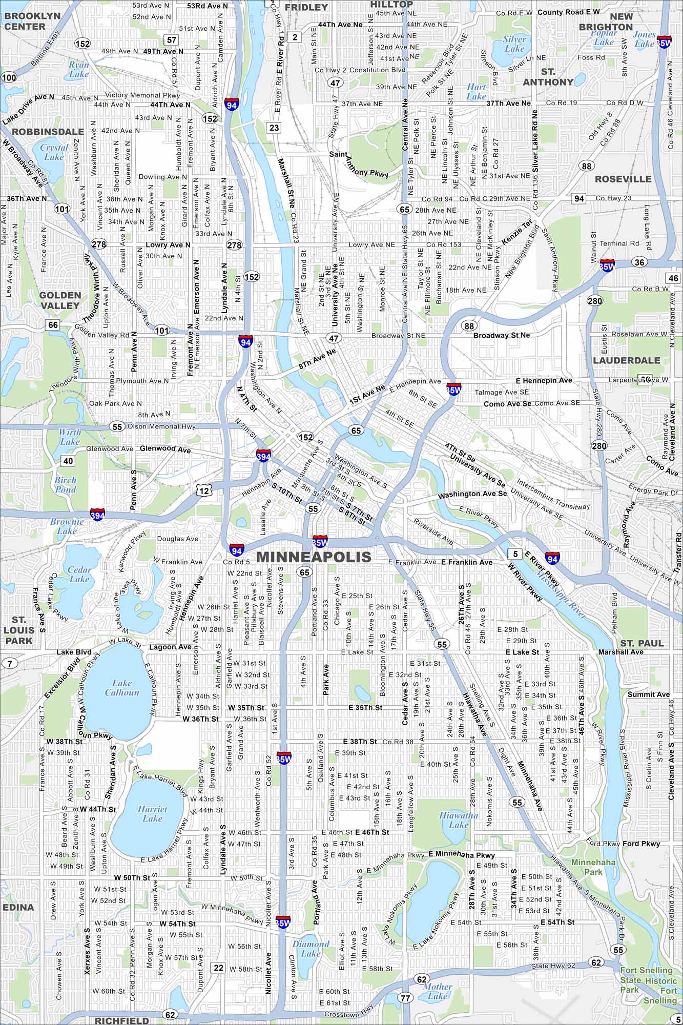
Step into Minneapolis, Minnesota with our map. The Mississippi River divides the city, with lakes and parkways throughout. As part of the Twin Cities, its urban core is surrounded by thriving neighborhoods.
Map Information
On the Map
Interstates/Highways: I-35W, I-94, I-394, State Rte 55, State Rte 65, State Rte 62, State Rte 77 Major Roads: Hennepin Ave, Washington Ave, Broadway St, University Ave, Franklin Ave, Lake St, Lyndale Ave, Nicollet Ave, Hiawatha Ave, Cedar Ave, Portland Ave, Central Ave, Lowry Ave, 36th St, 42nd St, 46th St, 50th St, 54th St, 60th St, Excelsior Blvd Lakes and Reservoirs: Lake Calhoun, Lake Harriet, Lake of the Isles, Cedar Lake, Brownie Lake, Lake Nokomis, Diamond Lake, Mother Lake, Hiawatha Lake, Silver Lake, Hart Lake, Jones Lake Major Rivers: Mississippi River Parks and Preserves: Fort Snelling State Historic Park Nearby Communities: Brooklyn Center, Fridley, Hilltop, New Brighton, St Anthony, Roseville, Lauderdale, St Paul, Richfield, Edina, St Louis Park, Golden Valley, RobbinsdaleMinnesota State Maps
Explore every lake in our state maps of Minnesota


Minnesota City Maps
Browse through our city maps of Minnesota


