Map of Midwest City, Oklahoma
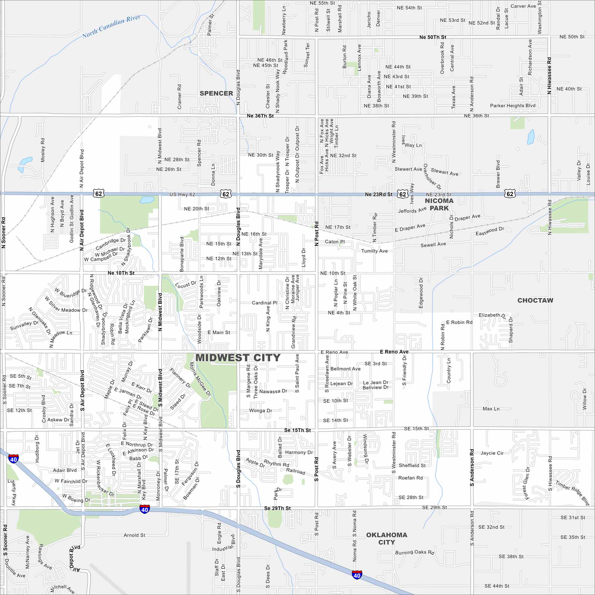
Our map of Midwest City highlights its suburban layout just east of Oklahoma City. Tinker Air Force Base is a defining feature. Highways and neighborhoods fill the rest of the city.
Map Information
On the Map
Interstates/Highways: I-40, US Hwy 62 Major Roads: 23rd St, 15th St, 29th St, Midwest Blvd, Douglas Blvd, Post Rd, Air Depot Blvd, Reno Ave, 36th St, 10th St, Sooner Rd, Westminster Rd, Anderson Rd, Hiwassee Rd, Main St, Spencer Rd, Palmer St, Lariat Dr, Orchard Dr, Trosper Rd Major Rivers: North Canadian River Nearby Communities: Spencer, Nicoma Park, Choctaw, Oklahoma CityOklahoma State Maps
Here is our map collection of the Sooner State.


City Maps of Oklahoma
Explore Oklahoma’s cities with our maps


