Map of McKinney, Texas
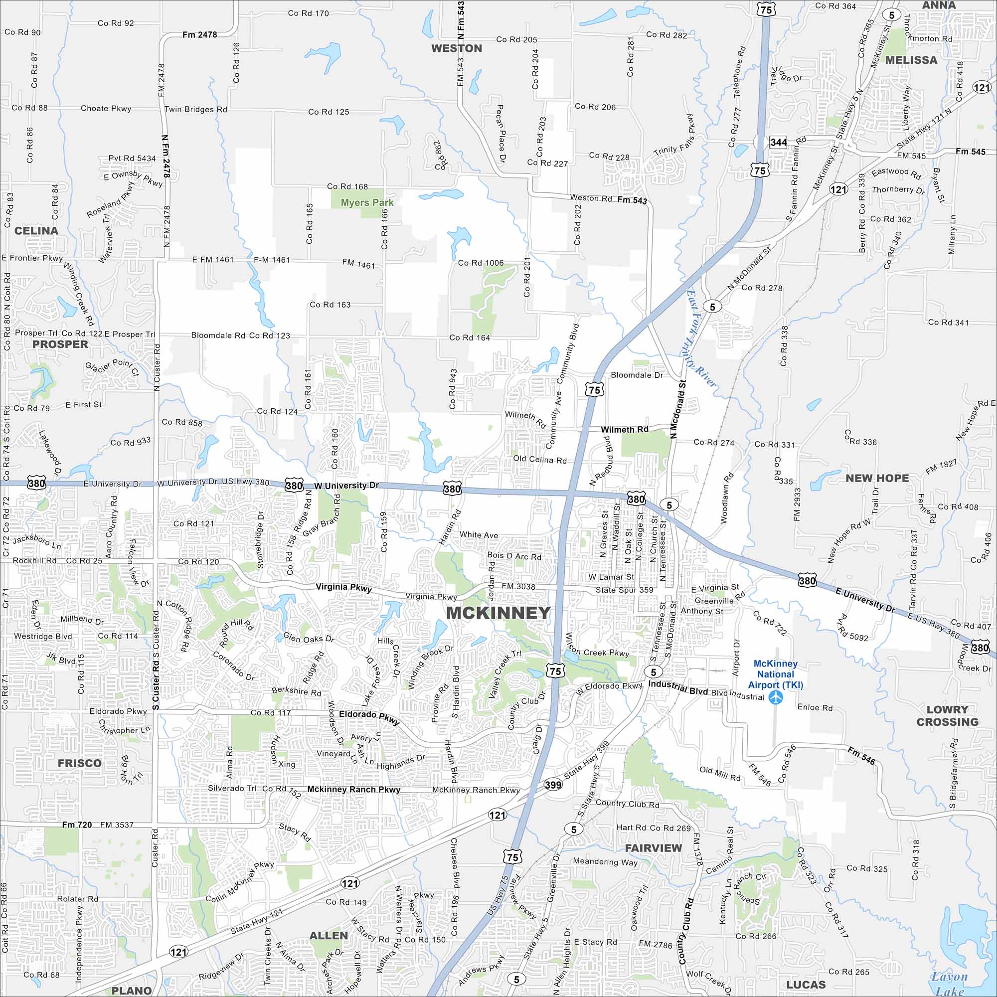
Our map of McKinney shows rapid suburban growth north of Dallas. The historic downtown blends with new housing developments. You’ll find highways, waterways and parks in our map.
Map Information
On the Map
Interstates/Highways: US Hwy 75, US Hwy 380, State Rte 121, State Rte 5 Major Roads: Virginia Pkwy, Eldorado Pkwy, University Dr, McDonald St, Lake Forest Dr, Hardin Blvd, Custer Rd, Ridge Rd, Alma Rd, Stacy Rd, Community Ave, Wilmeth Rd, Bloomdale Rd, Laud Howell Pkwy, McKinney Ranch Pkwy, Industrial Blvd, Airport Dr, Ridgeview Dr, Chelsea Blvd, Watters Rd Airports: McKinney National Airport (TKI) Lakes and Reservoirs: Lavon Lake Major Rivers: East Fork Trinity River Parks and Preserves: Myers Park Nearby Communities: Allen, Frisco, Fairview, Prosper, Melissa, Anna, Weston, New Hope, Lowry Crossing, LucasTexas State Maps
Scan our maps of the massive southern state of Texas.


City Maps of Texas
Explore our map collection of Texas cities.


