Georgia Counties and Cities Map
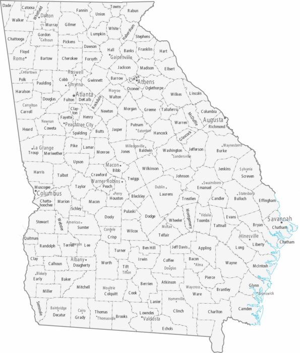
Our map displays Georgia’s 159 counties, many with small county seats. Metro Atlanta dominates Fulton and surrounding counties.
Our map displays Georgia’s 159 counties, many with small county seats. Metro Atlanta dominates Fulton and surrounding counties.
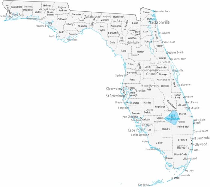
Our map shows Florida’s cities concentrate on the coasts. Miami, Fort Lauderdale, and West Palm Beach are all in the southeast.
Only three counties divide the state from north to south. As shown on our map, cities thin out as the map moves south.
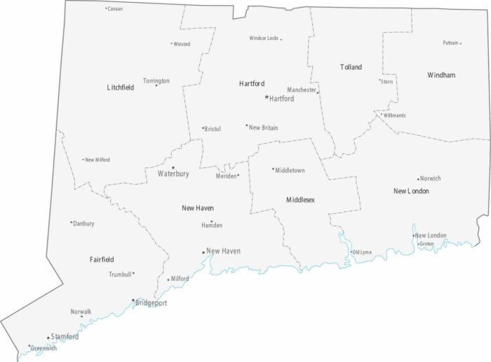
Connecticut’s small size means cities are packed close together, especially along the coast and the Connecticut River valley.
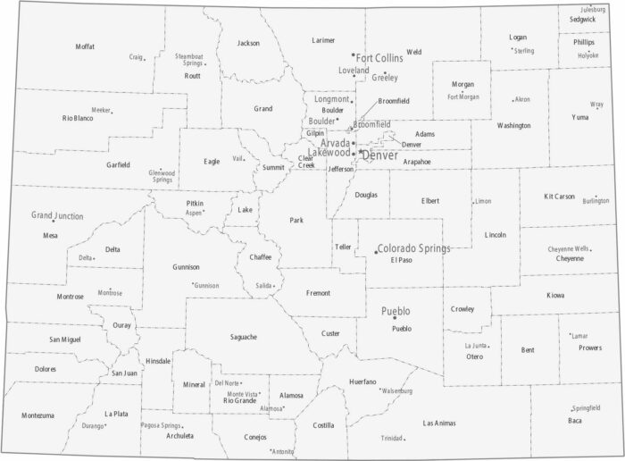
Colorado counties have irregular shapes in the mountains. Cities line up along the Front Range in counties like Denver, Boulder, and El Paso.
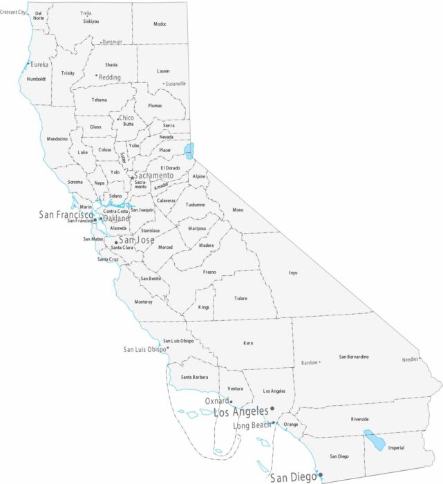
California is organized into 58 counties as shown on our map. California’s cities line up along the coast and in the Central Valley.
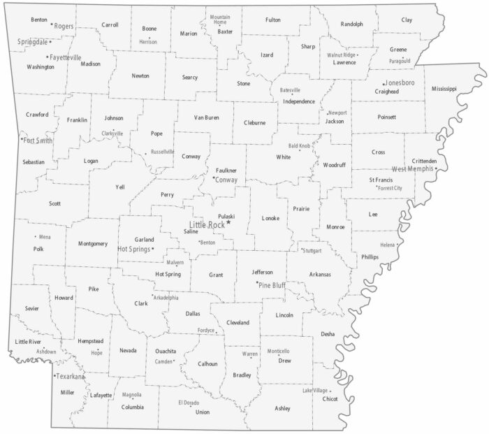
Our map of Arkansas is split into 75 counties. Little Rock is the capital and sits at the state’s geographic center in Pulaski County.
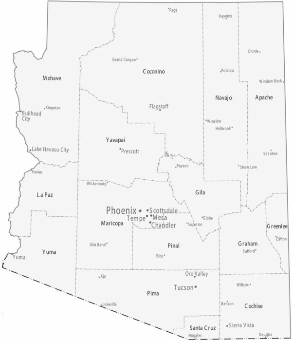
County boundaries are large and expansive, especially in the north of Arizona. Most cities sit in Maricopa and Pima counties.
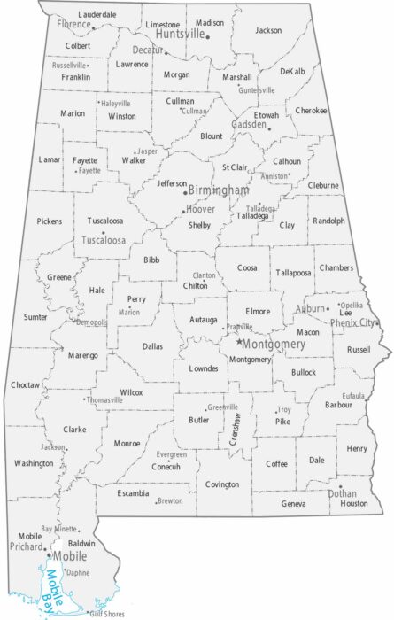
This map shows Alabama’s counties alongside major and minor cities. Population centers cluster along the Tennessee River.
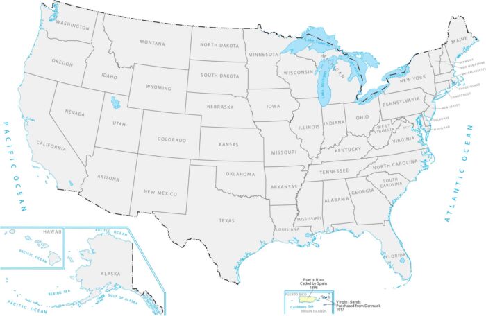
Our territory acquisition map shows these Caribbean islands that became US territories after a war with Spain and a purchase from Denmark.
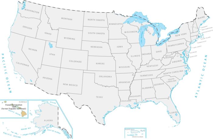
Our Hawaii Annexation of 1898 map displays this chain of islands surrounded by the Pacific Ocean far from the mainland United States.
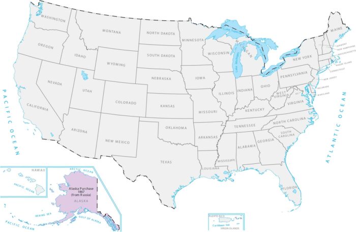
The US bought Alaska from Russia for about $7 million. This added massive northern territory way up by the Arctic in our Alaska Purchase map.
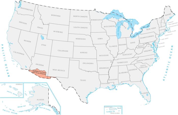
Our Gadsden Purchase map shows a small strip along the bottom of Arizona and New Mexico that the US bought from Mexico.
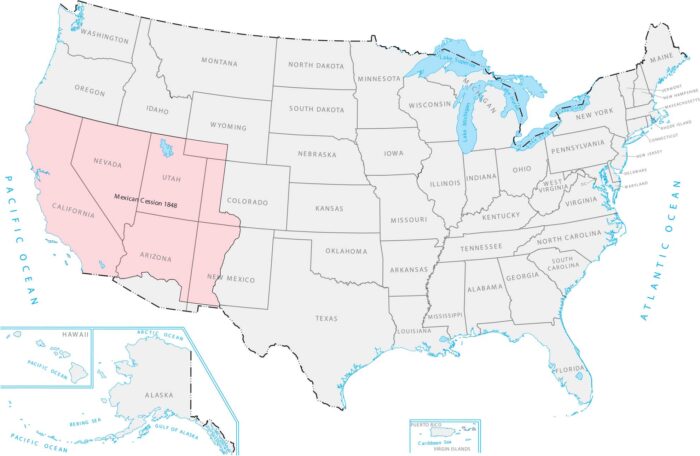
Our Mexican Cession 1848 Map shows how it included California, the Pacific Coast, and a bunch of mountains and deserts in between.
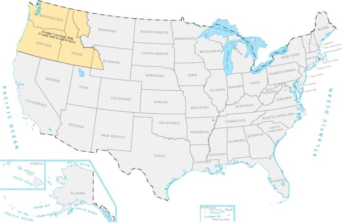
The US and Britain split up the Pacific Northwest in 1846. Our Oregon Territory 1846 map shows how it links the Pacific Coast to the Rockies.