Texas Counties and Cities Map
Our map of Texas is the most complex, featuring 254 counties. Major cities are spread statewide rather than concentrated in one area.
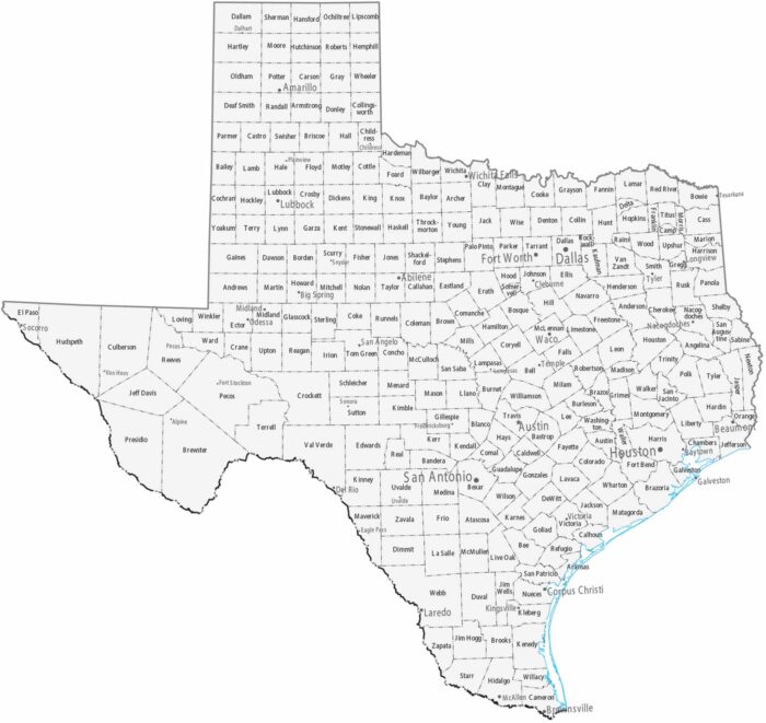
Our map of Texas is the most complex, featuring 254 counties. Major cities are spread statewide rather than concentrated in one area.
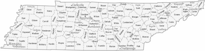
The 95 counties on our map of Tennessee highlights this state’s layout and geography. Nashville is the capital and largest city.
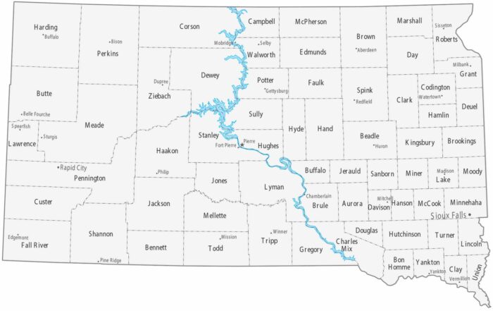
Our map of South Dakota shows how it’s bisected by the Missouri River. This state has 66 counties with Sioux Falls as the largest city.
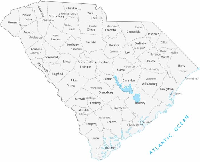
Organized into 46 counties, our map of South Carolina shows its major cities and populated areas. Columbia is the central capital.
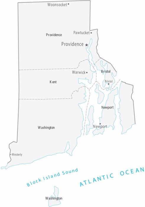
Our map of Rhode Island is the smallest in the series, containing just five counties. Providence is the capital and largest city.
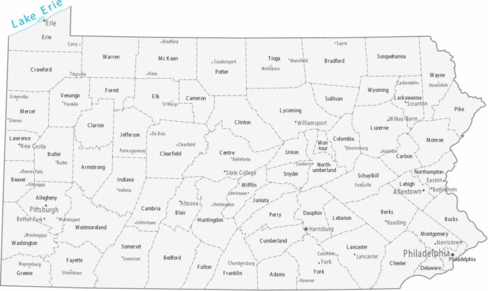
The 67 counties on our map of Pennsylvania are defined by the Appalachian Mountains. Harrisburg is between Philadelphia and Pittsburgh.
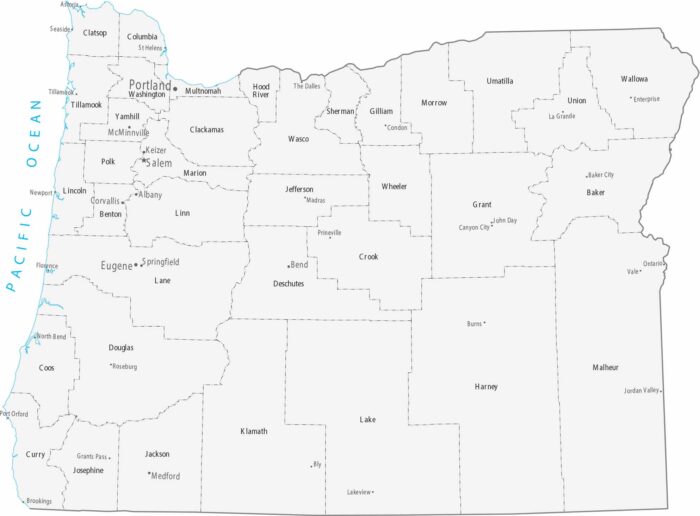
Our map of Oregon shows smaller, denser counties west of the Cascades. Portland and the capital, Salem, are in the fertile Willamette Valley.
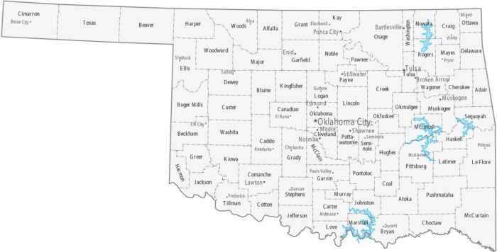
With 77 counties and a distinctive western panhandle, our map of Oklahoma shows its major cities and county boundaries.
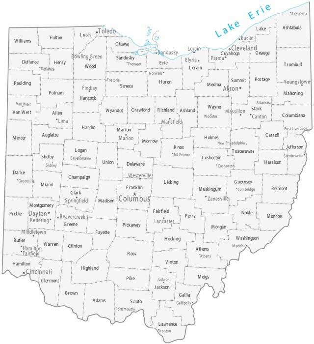
Our map of Ohio shows counties and three big metros. Cleveland is on Lake Erie in the north. Then, there’s Columbus and Cincinnati.

On our map of North Dakota, you will find its 53 counties mostly in agricultural areas. Fargo sits on the eastern border as the largest city.
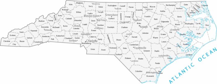
There are 100 counties in North Carolina and they’re fairly uniform in size. Our map shows cities spread from mountains to the coastal plain.
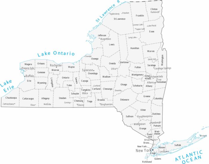
Spanning from the Atlantic to the Great Lakes, our map of New York identifies its 62 counties and major cities like New York City and Albany.
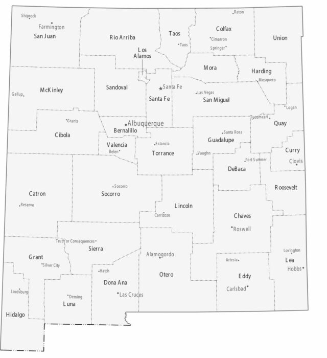
Our map of New Mexico highlights 33 counties filled with high deserts and alpine peaks. Albuquerque serves as the central metropolitan hub.
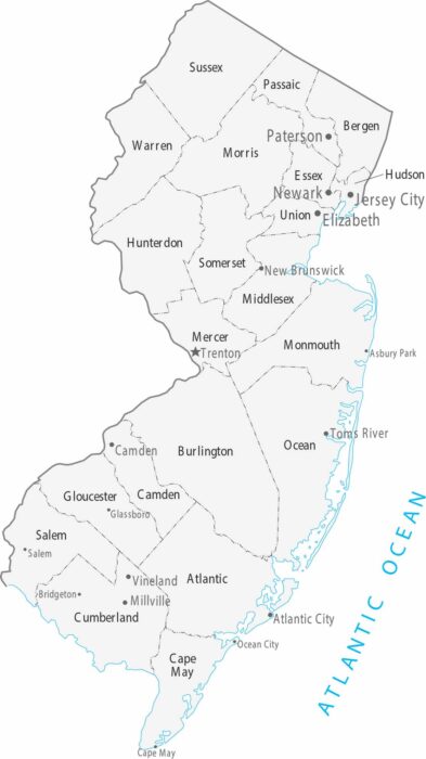
As the most densely populated state, our map of New Jersey organizes 21 counties between the urban centers of New York City and Philadelphia.
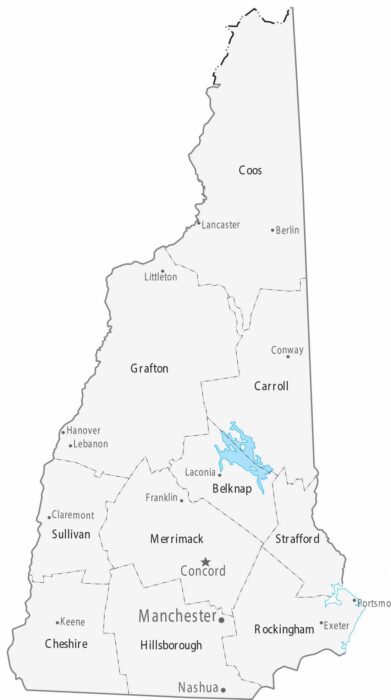
The 10 counties on our map of New Hampshire stretch from the small Atlantic coastline to the White Mountains.