Missouri Counties and Cities Map
Our map shows two big metro areas. Kansas City is situated in the west and St. Louis is in the east. Lots of small cities are between the two.
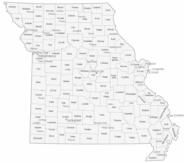
Our map shows two big metro areas. Kansas City is situated in the west and St. Louis is in the east. Lots of small cities are between the two.

Our map shows fairly evenly sized counties covering the state of Mississippi. Cities tend to follow the Mississippi River and corridors.
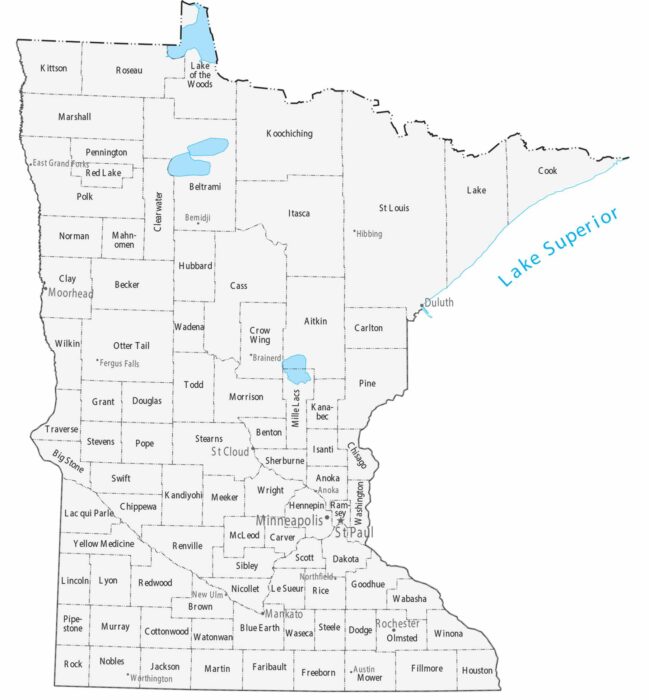
Counties stretch large across northern Minnesota, while southern counties are smaller and more numerous. Our map highlights the Twin Cities.
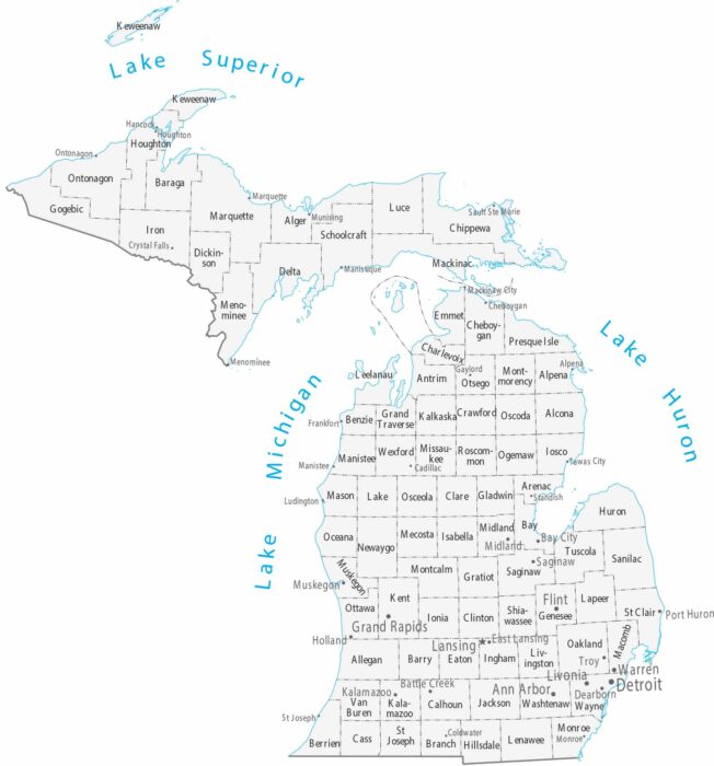
Our map displays counties and cities across both peninsulas. You’ll notice that cities concentrate near the Great Lakes.
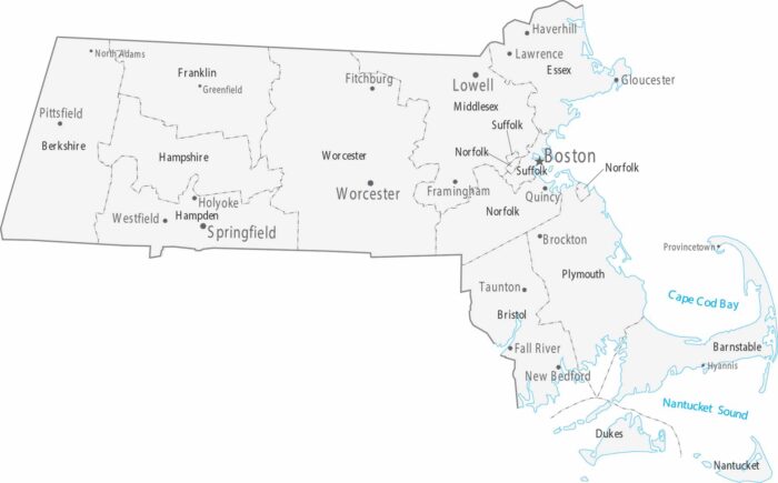
Our map shows Boston and its suburbs taking up most of the eastern part of the state. The counties are small and packed with cities.
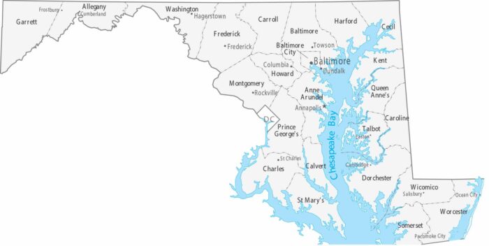
Maryland features 23 counties and the independent city of Baltimore. Our map shows Annapolis as the capital on the Chesapeake Bay.
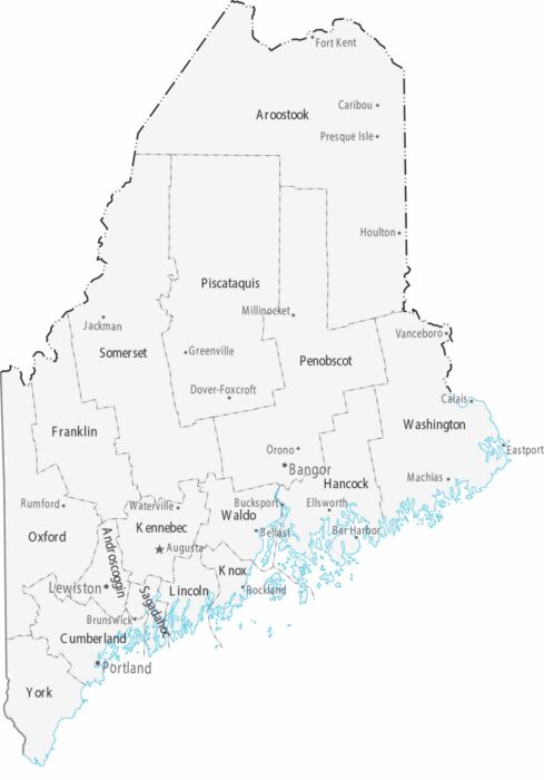
Maine’s 16 counties have vast forests and a jagged Atlantic coastline. Augusta is the capital, while Portland is the most populous.
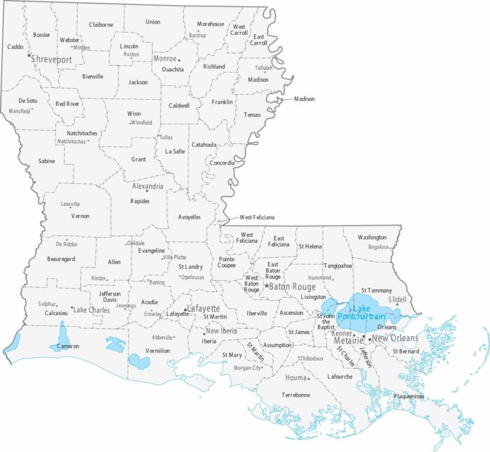
Parishes replace counties in Louisiana. Our county and cities map shows its 64 parishes and major population centers.
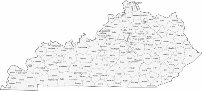
Kentucky is split into 120 small counties. Our map displays its counties and cities. County boundaries become more irregular in the mountains.
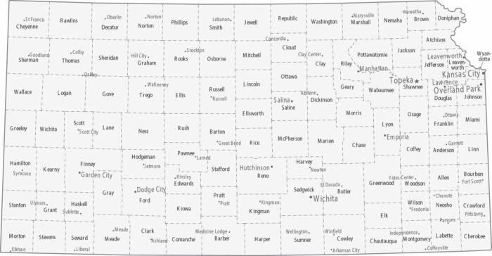
Counties in Kansas form a clean grid statewide. Topeka holds down the capital in the northeast with Kansas City not too far away.
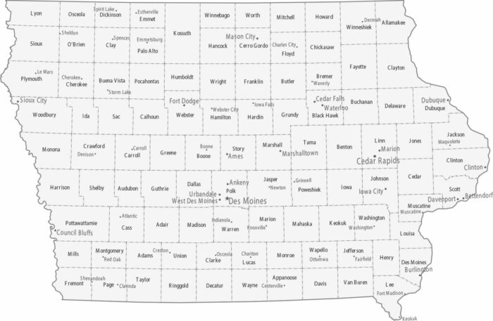
Iowa’s map is an orderly grid of 99 counties. Des Moines is the capital and central business hub near the center of the state.
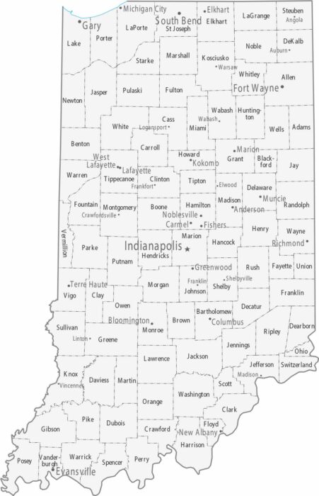
Our map of Indiana has Indianapolis sitting almost perfectly in the center. Fort Wayne anchors the northeast and Evansville the southwest.
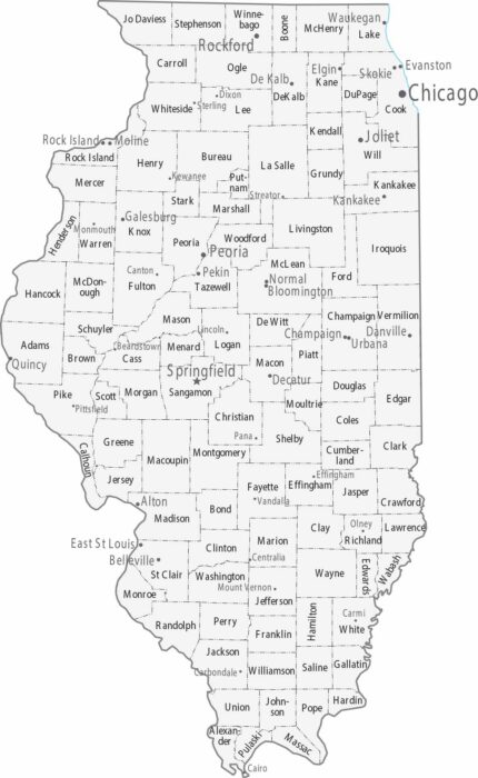
Chicago absolutely dominates the northeast corner of Illinois, while the rest of Illinois is mostly smaller cities across flat farmland.
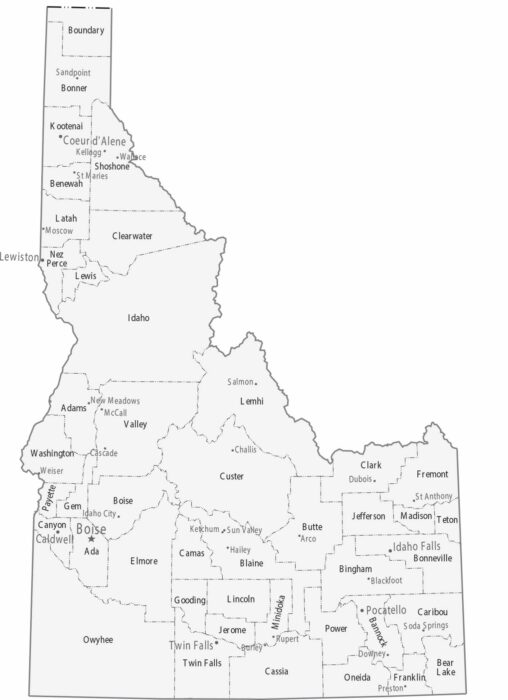
Our Idaho map shows its 44 counties. Boise is the capital and largest city in the southwest. Coeur d’Alene is the main hub in the north.
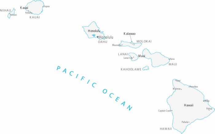
In Hawaii, counties align with island boundaries rather than land divisions. Cities cluster along coastlines, especially on Oahu