Uptown Dallas Map, Texas
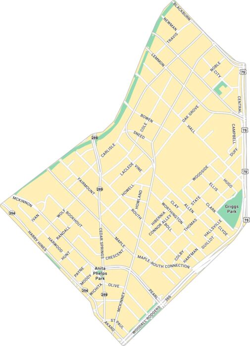
Uptown Dallas feels modern with a lot of heart. Our map highlights McKinney Avenue, the Katy Trail, and its entire road network.
Uptown Dallas feels modern with a lot of heart. Our map highlights McKinney Avenue, the Katy Trail, and its entire road network.
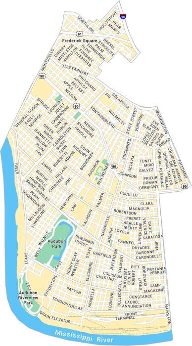
Our map of Uptown, New Orleans shows Magazine Street, Audubon Park, and every turn leading toward the Mississippi River.
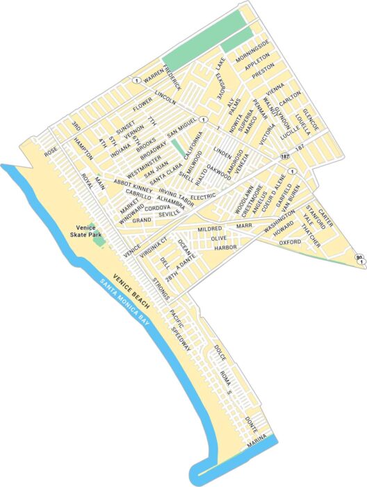
Venice feels like its own world by Santa Monica Bay. Our map of Venice highlights Venice Beach, parks and its streets.
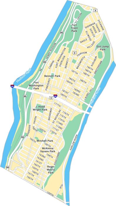
Our map of Washington Heights highlights its steep streets, the George Washington Bridge, and stretches of Fort Tryon Park.
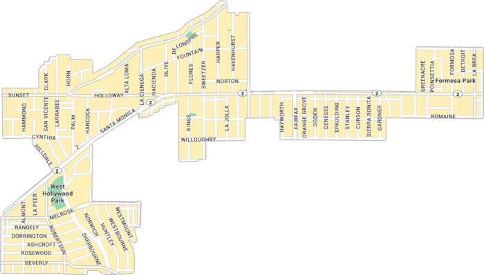
West Hollywood buzzes with character. Our map of West Hollywood shows Sunset Boulevard, Melrose Avenue, and its residential streets.
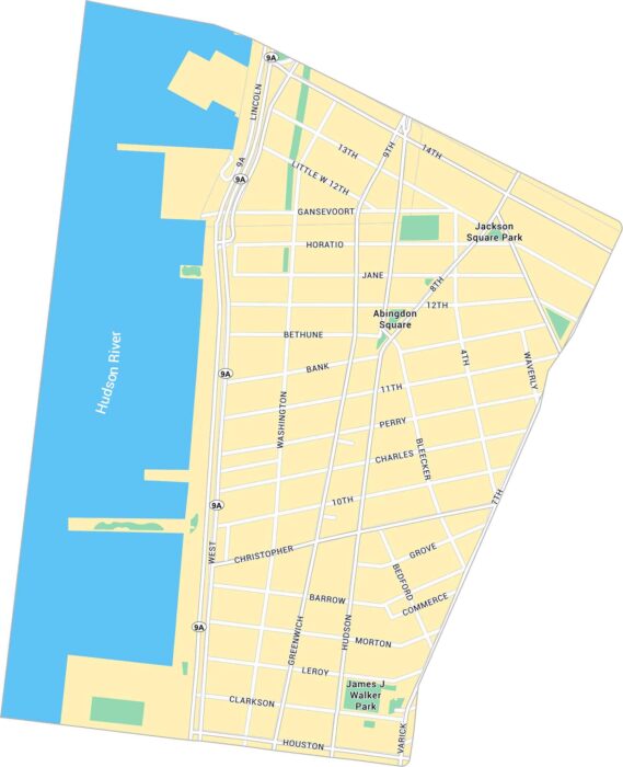
The West Village feels like its own little world. Our map of West Village guides you through its winding layout along the Hudson River.
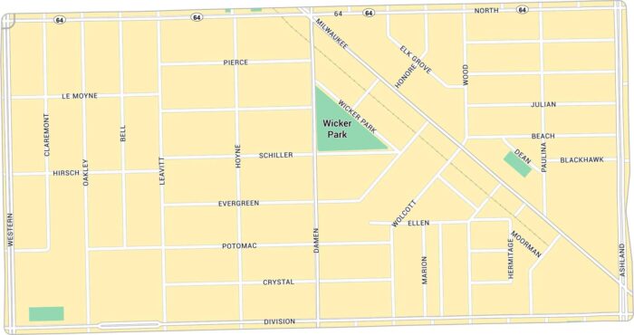
Wicker Park has lots of life to it. Our map lays out every corner, from the busy six-corner intersection to quiet side streets.
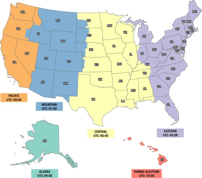
Time is different depending on where you are. Eastern, Central, Mountain, Pacific, Alaska and Hawaii time zones are on our US timezone map.
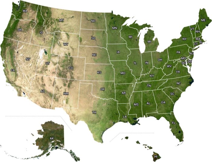
From above, the U.S. looks wild and alive. From the west to east coast, it’s a view that makes you realize how big this country really is.
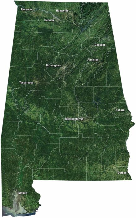
Get to know Alabama our satellite map. Forests and farmland cover the area. Down south, the Gulf Coast shines with bays, beaches and Mobile.
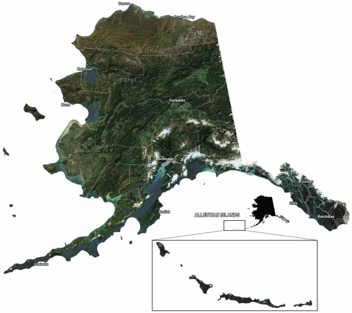
Our satellite map of Alaska shows mountains, glaciers, and endless forest. You can spot Anchorage, Juneau, and the Aleutian Islands out west.
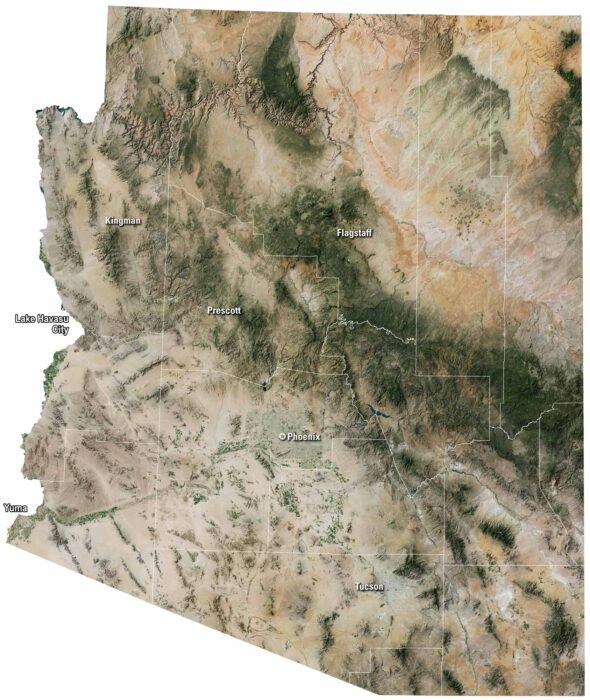
Our satellite map of Arizona shows its desert landscape. There are patches of green forests up north, but most of the land is brown and open.
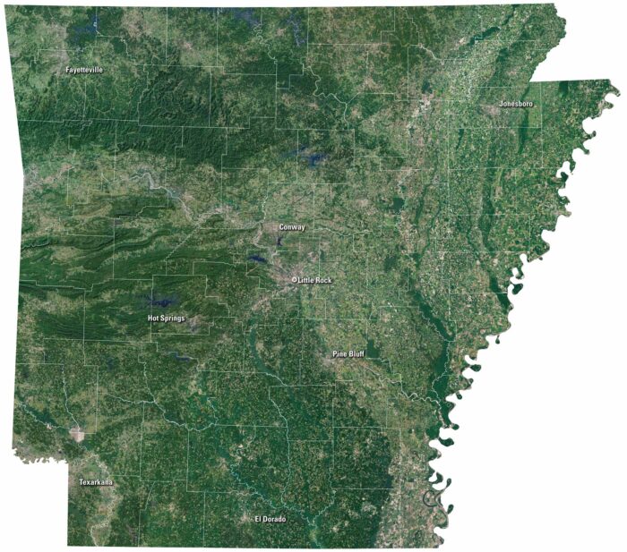
On our satellite map of Arkansas, green covers most of the state. The Ozark Mountains spread out in the north. Little Rock is near the middle.
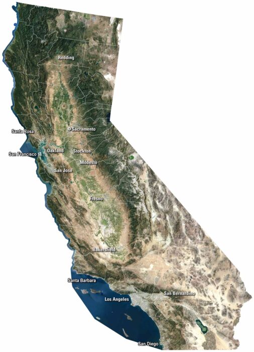
Our satellite map shows cities like San Diego and San Francisco along the coast. The Sierra Nevada rises east, while deserts cover the south.
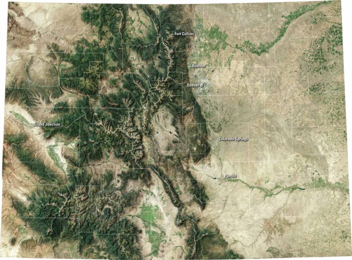
Colorado bursts with variety. Our satellite map shows the capital of Denver, the Rocky Mountains to the west, and wide plains to the east.