North Carolina National Parks and Forests Map
Great Smoky Mountains National Park dominates the west, with Pisgah and Nantahala spreading out around it.
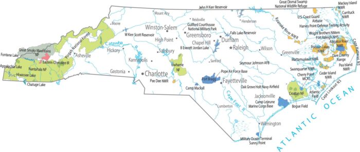
Great Smoky Mountains National Park dominates the west, with Pisgah and Nantahala spreading out around it.
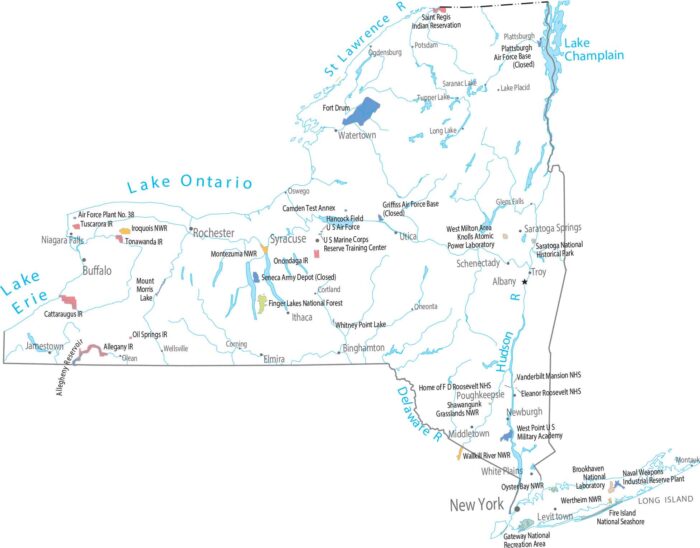
Surprisingly, there are no national parks in New York. But it does have one national forest by the name of Finger Lakes National Forest.
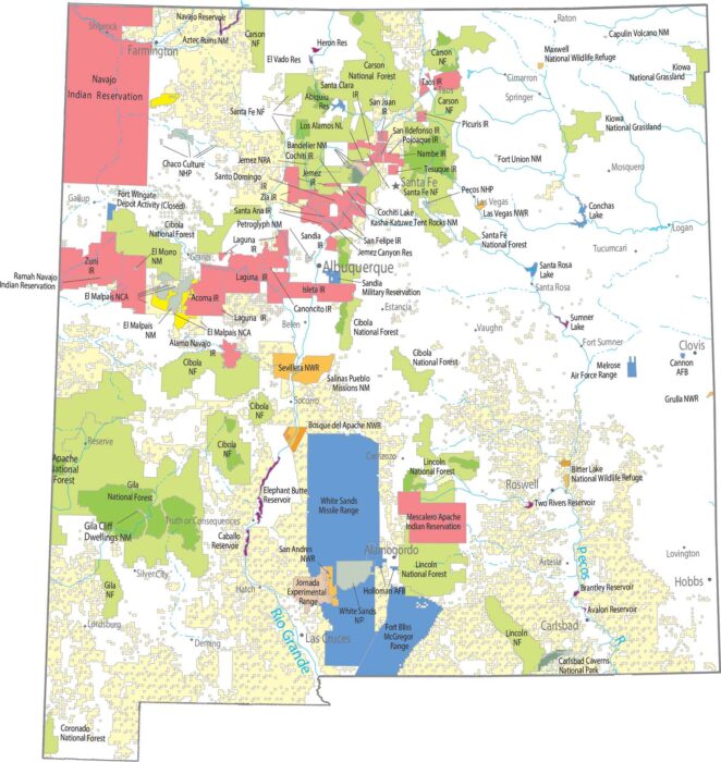
Caves below, dunes above. Carlsbad Caverns goes straight underground, while White Sands is wide open and hard to miss.
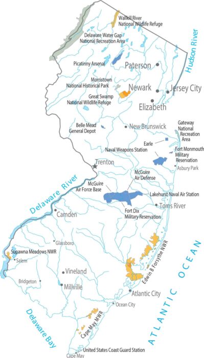
New Jersey has no national parks and forests. Federal land here shows up like the Delaware Water Gap National Recreation Area.
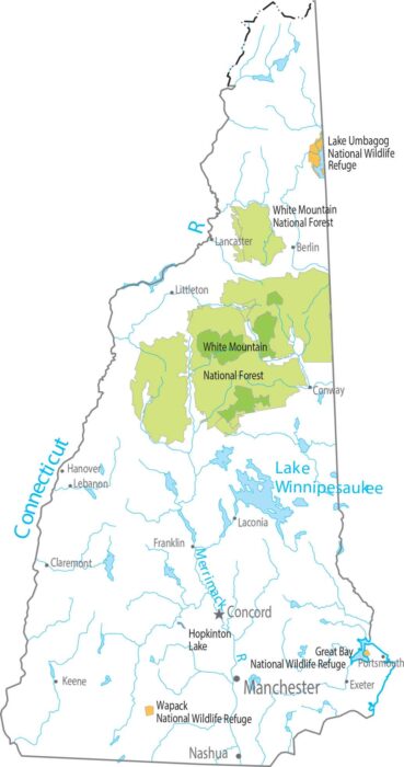
New Hampshire has no national parks. But it does have one of the most significant national forests – White Mountain National Forest.
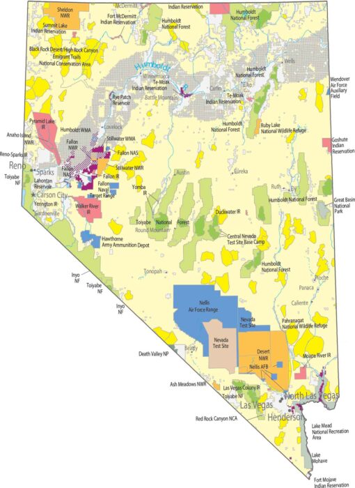
Check out our Nevada map of national parks and forests. You’ll find Great Basin NP, Death Valley NP and Humboldt-Toiyabe National Forest.
Protected land is sparse and easy to overlook at first glance. Our map shows small national forest blocks in the northwest.
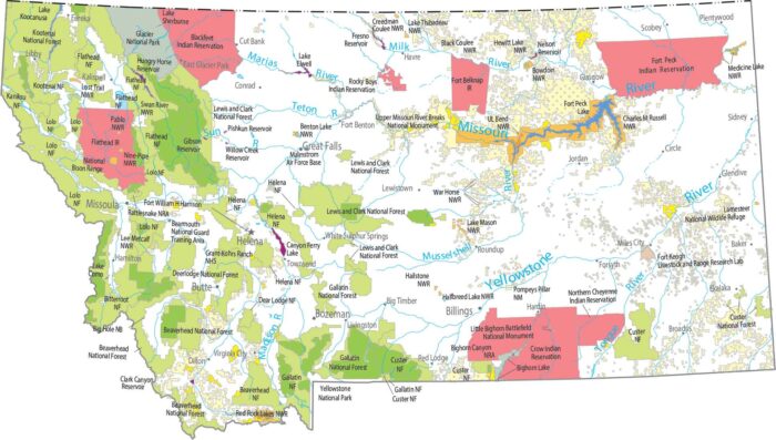
Our map shows national parks and forests like Glacier against the Canadian border. There’s also Flathead, Lewis and Clark National Forests.
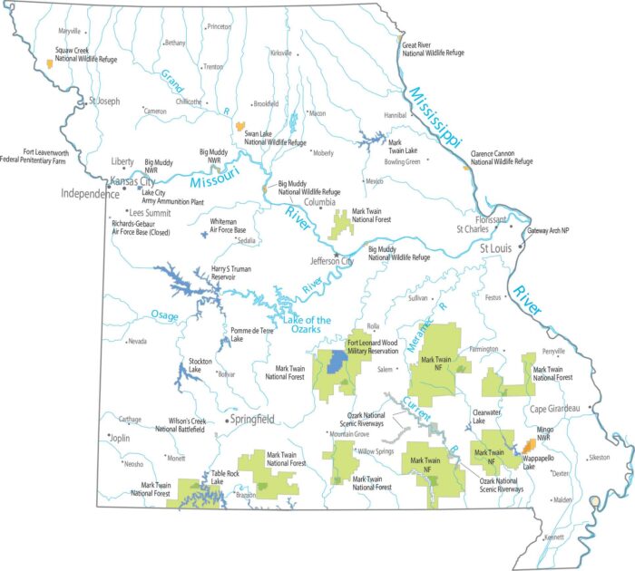
Our national forests and parks map highlights Mark Twain National Fores. The southern half is in the Ozark highlands with scattered forests.
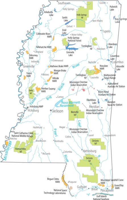
Our map shows forest land in small, broken pieces. Forests include Delta, Bienville, Homochitto, Tombigbee, and Holly Springs.
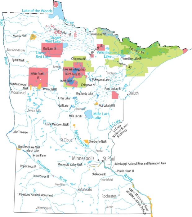
Minnesota stretches from prairie in the south to thick forests in the north. Voyageurs National Park protects the lake next to Canada.
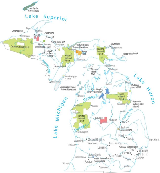
Forests spread wide across both peninsulas of Michigan. Our map shows Isle Royale in the north. Southern Michigan has more cities and towns.
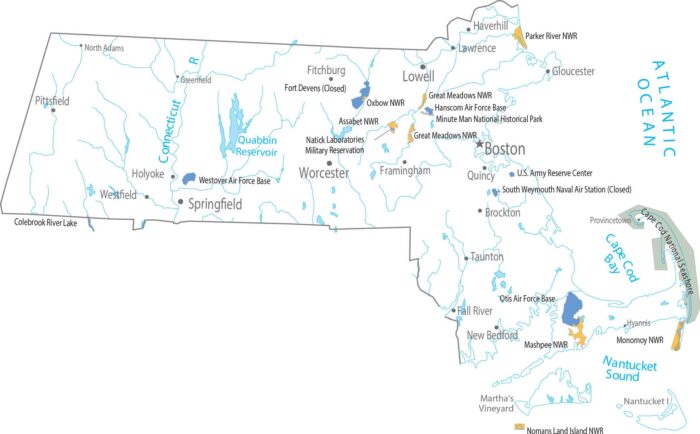
Our map shows how this tiny state crams an ocean, mountains, and a giant fishhook peninsula into one package with federal lands.
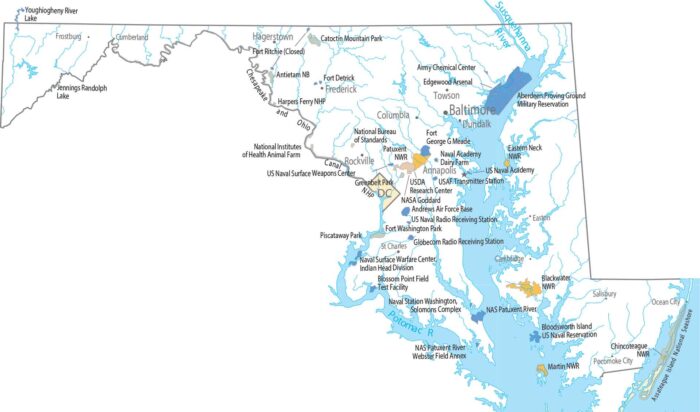
Our map shows federal lands in Maryland. Most open land clings to the western edge, while development presses in from the east.
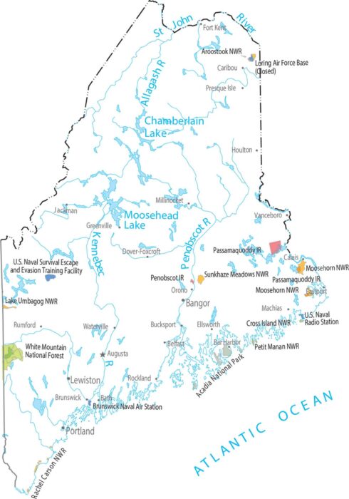
Our map shows national forests, parks and federal lands. Acadia National Park pops along the rocky coast in the south.