Map of El Cerrito, California
Our map of El Cerrito shows this hillside community overlooking San Francisco Bay. Streets climb toward the Berkeley Hills.
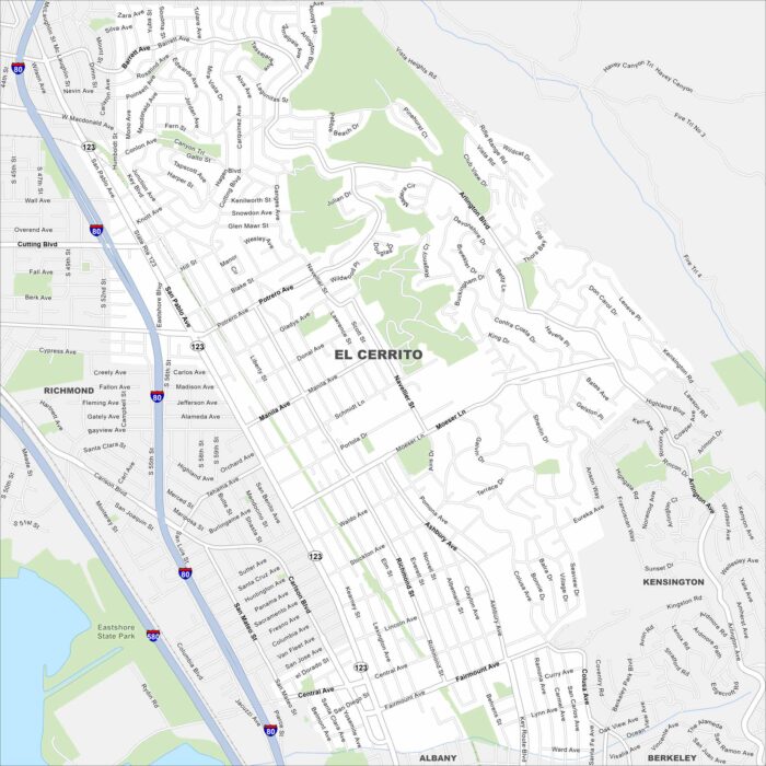
Our map of El Cerrito shows this hillside community overlooking San Francisco Bay. Streets climb toward the Berkeley Hills.
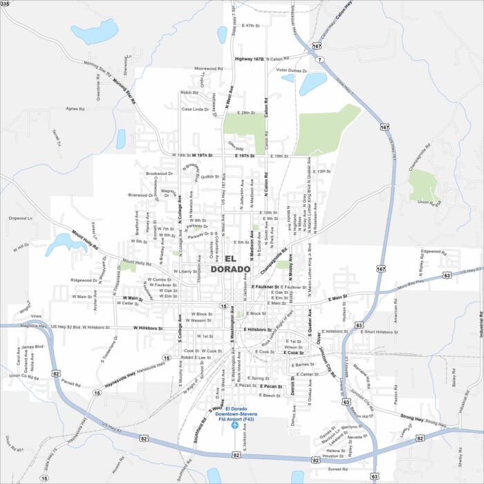
El Dorado is in southern Arkansas near the Ouachita River. Our map reveals its downtown surrounded by wooded countryside.
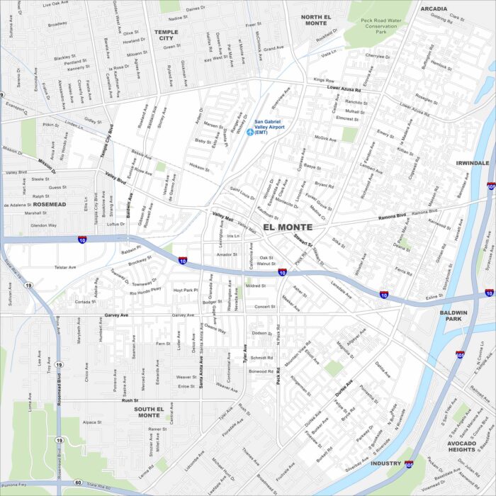
Explore El Monte, California in the San Gabriel Valley. The San Gabriel River runs along the edge of the city.
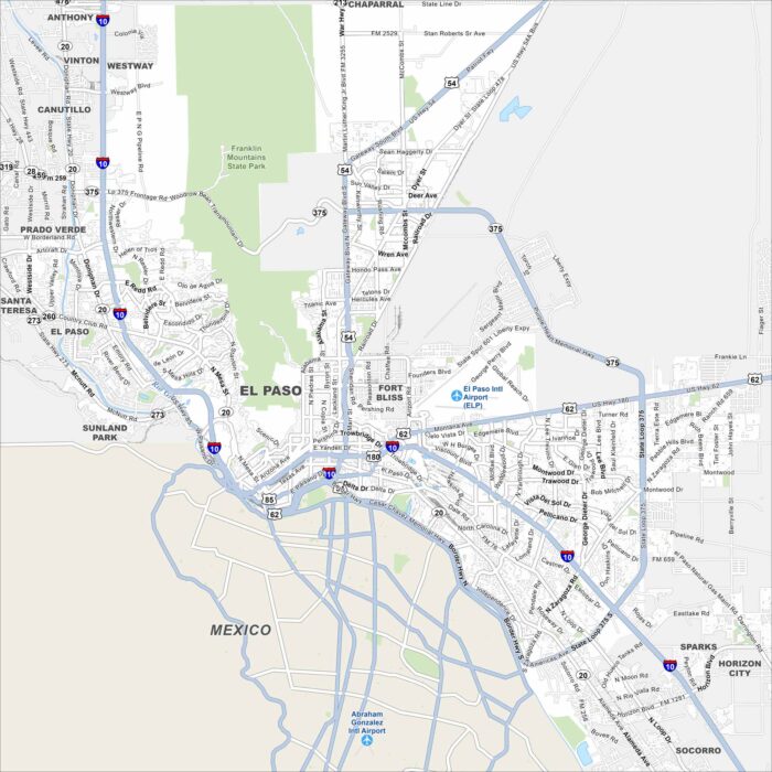
Our map of El Paso shows the Rio Grande carving a boundary with Mexico. The Franklin Mountains rise to the north.
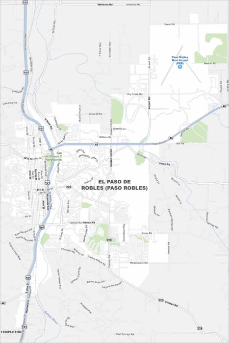
Paso Robles spreads across a rolling valley surrounded by vineyards. The Salinas River winds quietly through the region.
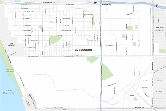
El Segundo hugs the coast just south of LAX. On the map, you’ll spot its wide beaches and industrial areas inland.
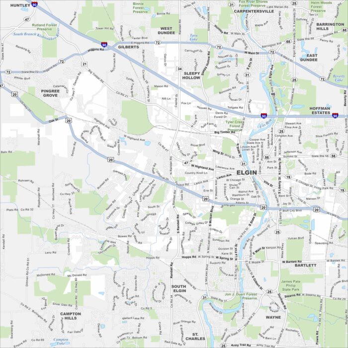
Our map of Elgin highlights the Fox River. Green parks and trails line both riverbanks. It’s known as “The City in the Suburbs”
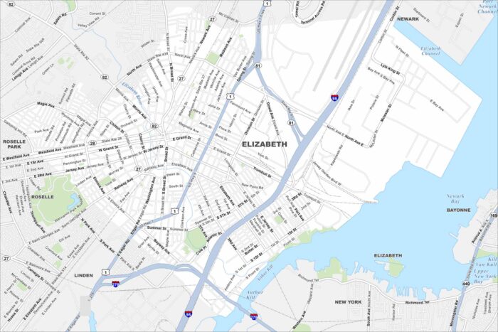
Elizabeth sits on Newark Bay with busy port terminals along the shoreline. Dense city blocks stretch westward.
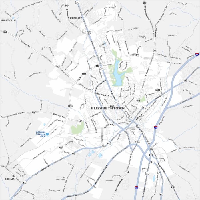
Check out Elizabethtown in the heart of Kentucky. Our map shows its compact downtown. Locals simply call it “E-town”.
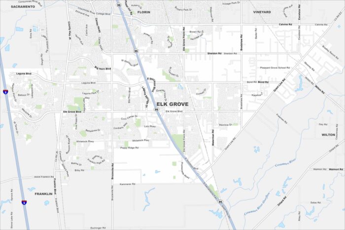
Elk Grove lies just south of Sacramento. It’s now one of California’s fastest-growing cities, thanks to its location near the capital.
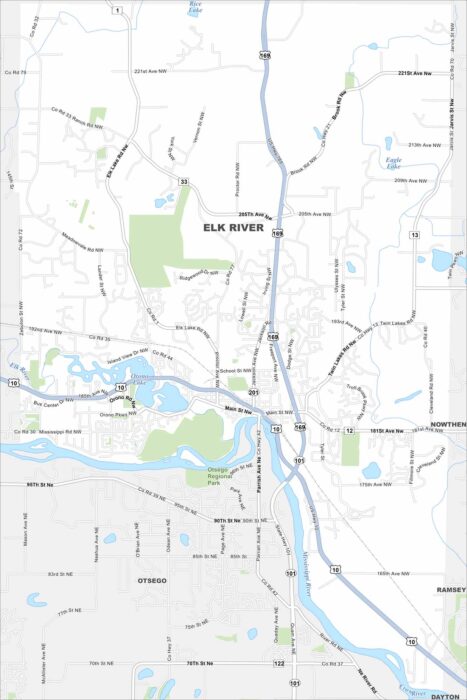
Explore our map of Elk River to see the junction of Highways 10 and 169. The Mississippi River runs along the city’s edge.
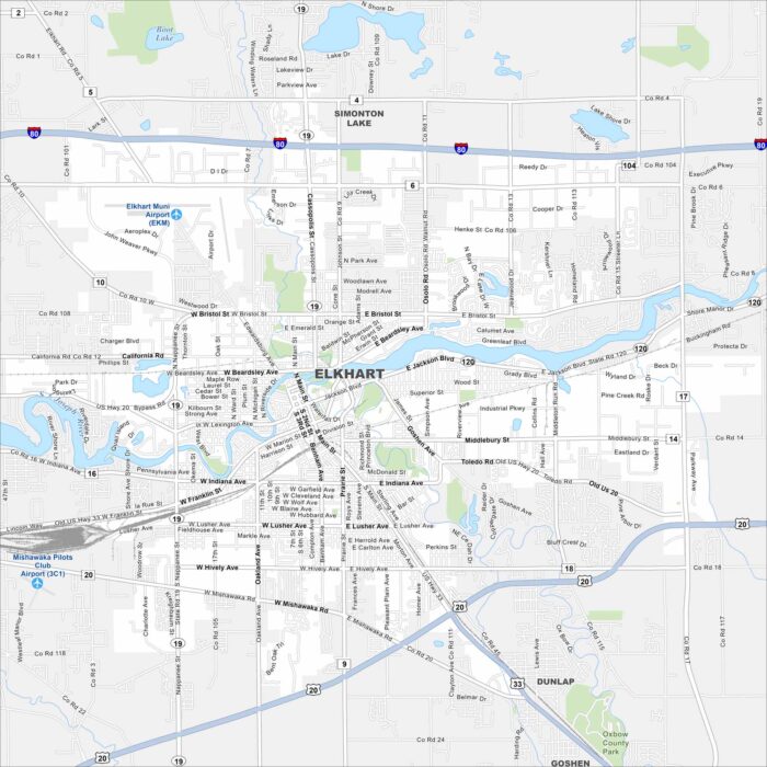
Our map of Elkhart shows the St. Joseph River flowing through the city. Major routes like the I-80 and U.S. 20 pass nearby.
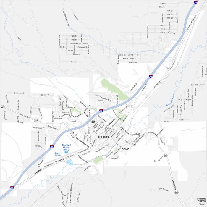
Elko is a high-desert city surrounded by mountain ranges. You’ll spot I-80 running east–west across the area.
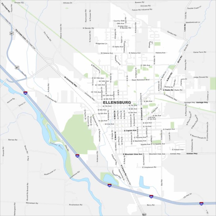
Check out our map of Ellensburg with I-90 cutting right through on the west side. The Yakima River flows nearby on the west as well.
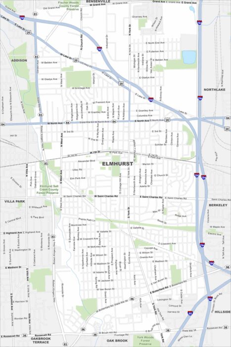
Elmhurst is a western suburb of Chicago with lots of parks. Our map of Elmhurst highlights its main routes like I-290.