Map of Maple Grove, Minnesota
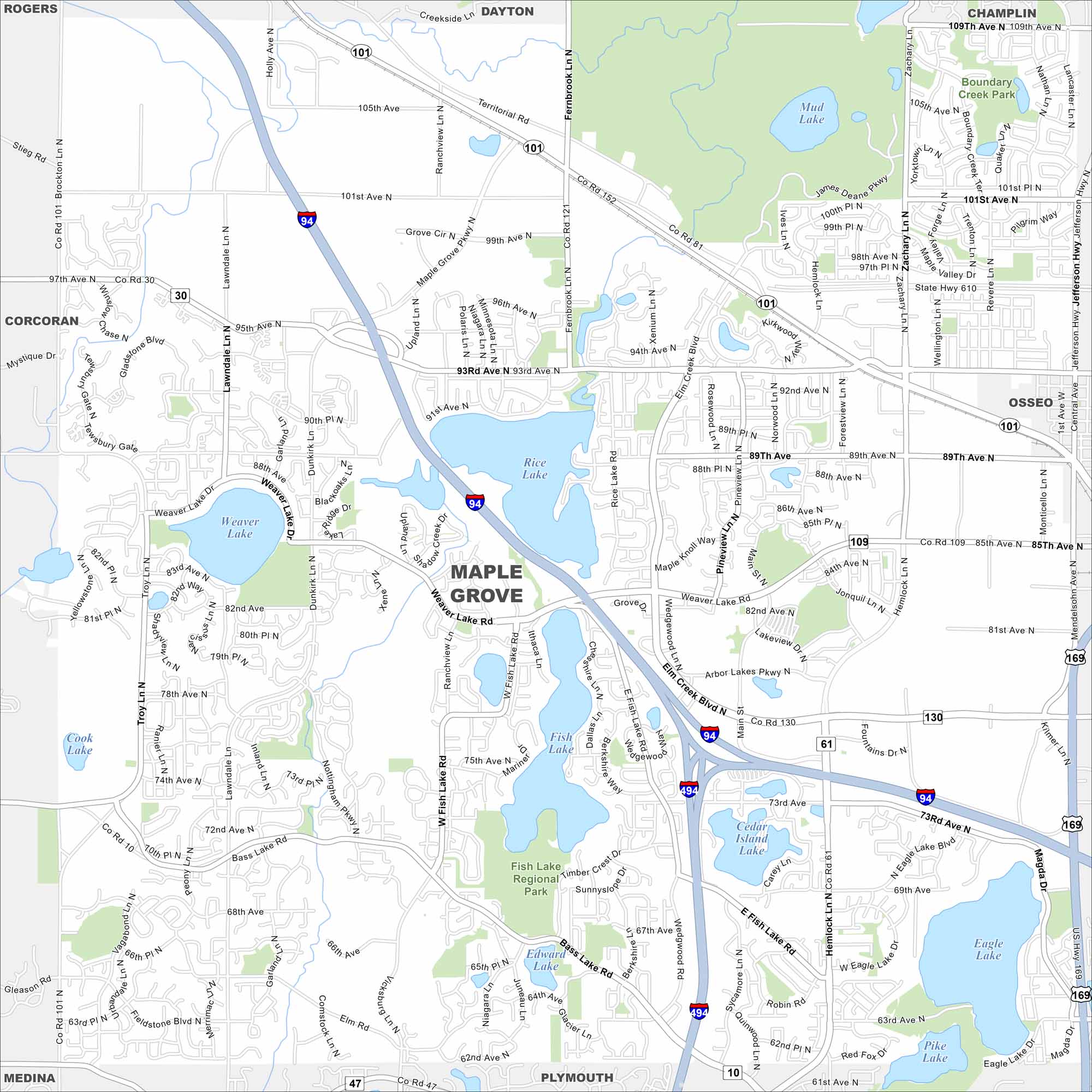
See Maple Grove on our road map. Lakes and parks break up its suburban grid. Highways connect it quickly into the Twin Cities.
Map Information
On the Map
Interstates/Highways: I-94, I-494, US Hwy 169, State Rte 610 Major Roads: Bass Lake Rd, Elm Creek Blvd, Weaver Lake Rd, 93rd Ave, 85th Ave, 101st Ave, 109th Ave, 63rd Ave, 73rd Ave, Hemlock Ln, Zachary Ln, Fernbrook Ln, Maple Grove Pkwy, Rice Lake Rd, Vicksburg Ln, Lawndale Ln, Troy Ln, Jefferson Hwy, Revere Ln, Main St Lakes and Reservoirs: Weaver Lake, Rice Lake, Fish Lake, Cedar Island Lake, Eagle Lake, Pike Lake, Edward Lake, Mud Lake Parks and Preserves: Fish Lake Regional Park, Boundary Creek Park Nearby Communities: Rogers, Dayton, Champlin, Osseo, Plymouth, Medina, CorcoranMinnesota State Maps
Explore every lake in our state maps of Minnesota


Minnesota City Maps
Browse through our city maps of Minnesota


