Map of Malden, Massachusetts
Malden lies just north of Boston. Our map shows its dense neighborhoods and rail connections. Highways link it quickly into the metro area.
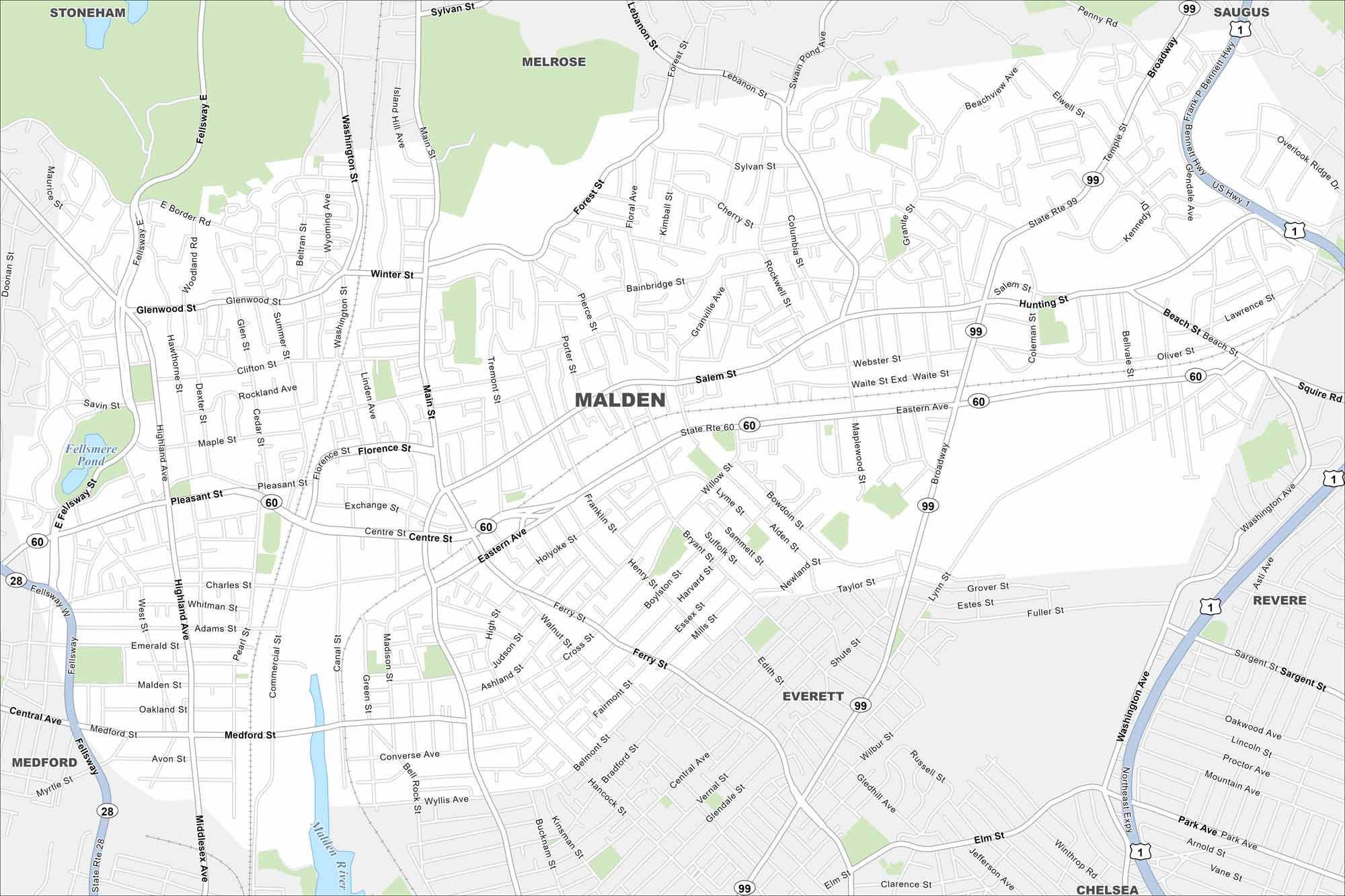
Map Information
On the Map
Interstates/Highways: US Hwy 1, State Rte 60, State Rte 99, State Rte 28 Major Roads: Main St, Broadway, Eastern Ave, Salem St, Pleasant St, Ferry St, Washington St, Highland Ave, Medford St, Centre St, Cross St, Beach St, Lynn St, Bryant St, Faulkner St, Forest St, Sylvan St, Glenwood St, Winter St, Clifton St Lakes and Reservoirs: Fellsmere Pond Major Rivers: Malden River Nearby Communities: Everett, Melrose, Revere, Chelsea, Medford, Stoneham, SaugusMassachusetts State Maps
Here’s our state maps of Massachusetts


City Maps of Massachusetts
Explore Boston and other urban areas in Massachusetts


