Map of Lynn, Massachusetts
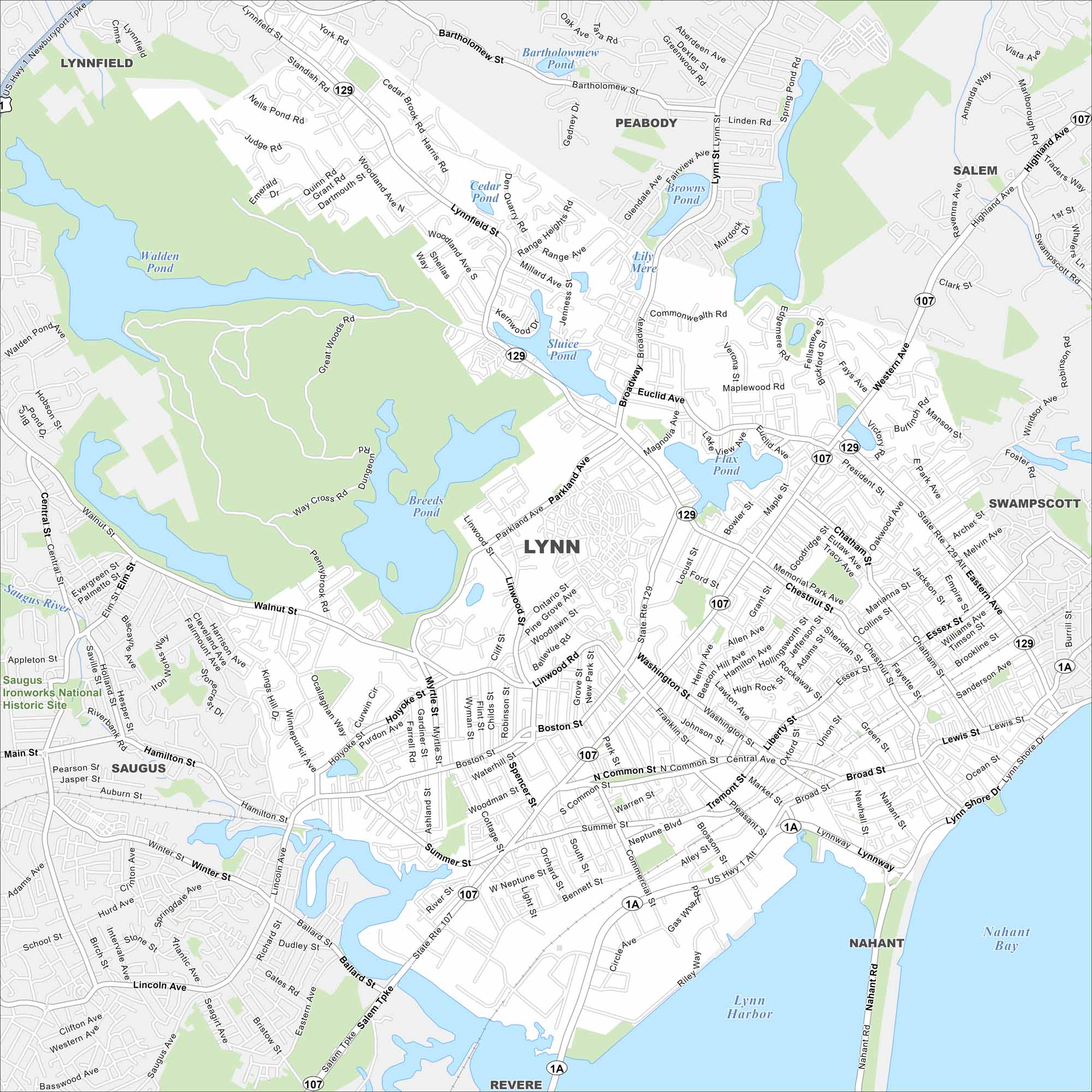
Check out Lynn, situated on the Massachusetts coast north of Boston. Our map shows its shoreline and dense city blocks. It’s known as “City of Firsts” because of its innovations that started here.
Map Information
On the Map
Interstates/Highways: US Hwy 1, State Rte 107, State Rte 129, State Rte 1A Major Roads: Broadway, Western Ave, Lynnway, Washington St, Essex St, Chestnut St, Boston St, Walnut St, Wyoma St, Parkland Ave, Lynnfield St, Eastern Ave, Nahant Rd, Central Ave, Union St, Broad St, Market St, Franklin St, Neptune Blvd, Summer St Lakes and Reservoirs: Breed’s Pond, Flax Pond, Sluice Pond, Walden Pond, Birch Pond, Cedar Pond, Floating Bridge Pond, Brown’s Pond, Lily Mere, Lynn Harbor, Nahant Bay, Bartholomew Pond Major Rivers: Saugus River Parks and Preserves: Saugus Ironworks National Historic Site Nearby Communities: Saugus, Nahant, Swampscott, Salem, Peabody, Lynnfield, RevereMassachusetts State Maps
Here’s our state maps of Massachusetts


City Maps of Massachusetts
Explore Boston and other urban areas in Massachusetts


