Map of Loveland, Colorado
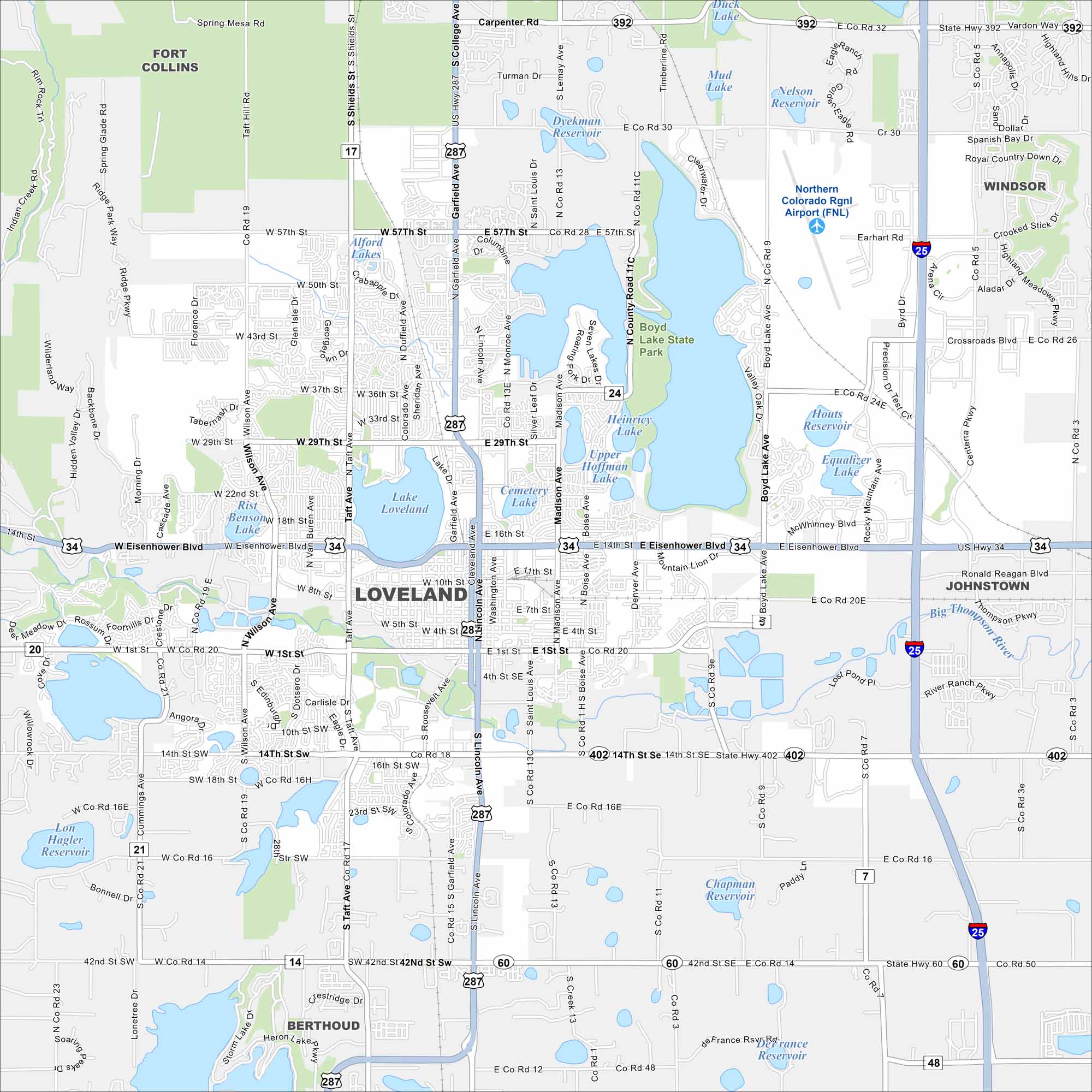
Loveland lies along the Front Range of the Rockies. Our map shows its lakes and access to Rocky Mountain canyons. Highways connect it north to Fort Collins and south to Denver.
Colorado State Maps
Browse Colorado with our detailed state maps


Map Information
On the Map
Interstates/Highways: I-25, US Hwy 34, US Hwy 287, State Hwy 402, State Hwy 60, State Hwy 392 Major Roads: Eisenhower Blvd, Lincoln Ave, Garfield Ave, Taft Ave, Wilson Ave, Madison Ave, Boyd Lake Ave, 1st St, 14th St, 29th St, 37th St, 57th St, Carpenter Rd, County Rd 11, Namaqua Rd, Boise Ave, Denver Ave, Rocky Mountain Ave, Cascade Ave, Rossum Dr Airports: Northern Colorado Rgnl Airport (FNL) Lakes and Reservoirs: Boyd Lake, Lake Loveland, Hoffman Lake, Heinricy Lake, Equalizer Lake, Houts Reservoir, Boedecker Lake, Lon Hagler Reservoir, Seven Lakes, Westerdoll Lake, Mud Lake, Nelson Reservoir, Duck Lake, Chapman Reservoir, Dykeman Reservoir, Alford Lakes Major Rivers: Big Thompson River Parks and Preserves: Boyd Lake State Park, Benson Park Nearby Communities: Fort Collins, Windsor, Johnstown, BerthoudColorado City Maps
Here are maps of Colorado’s urban areas


