Map of Longview, Texas
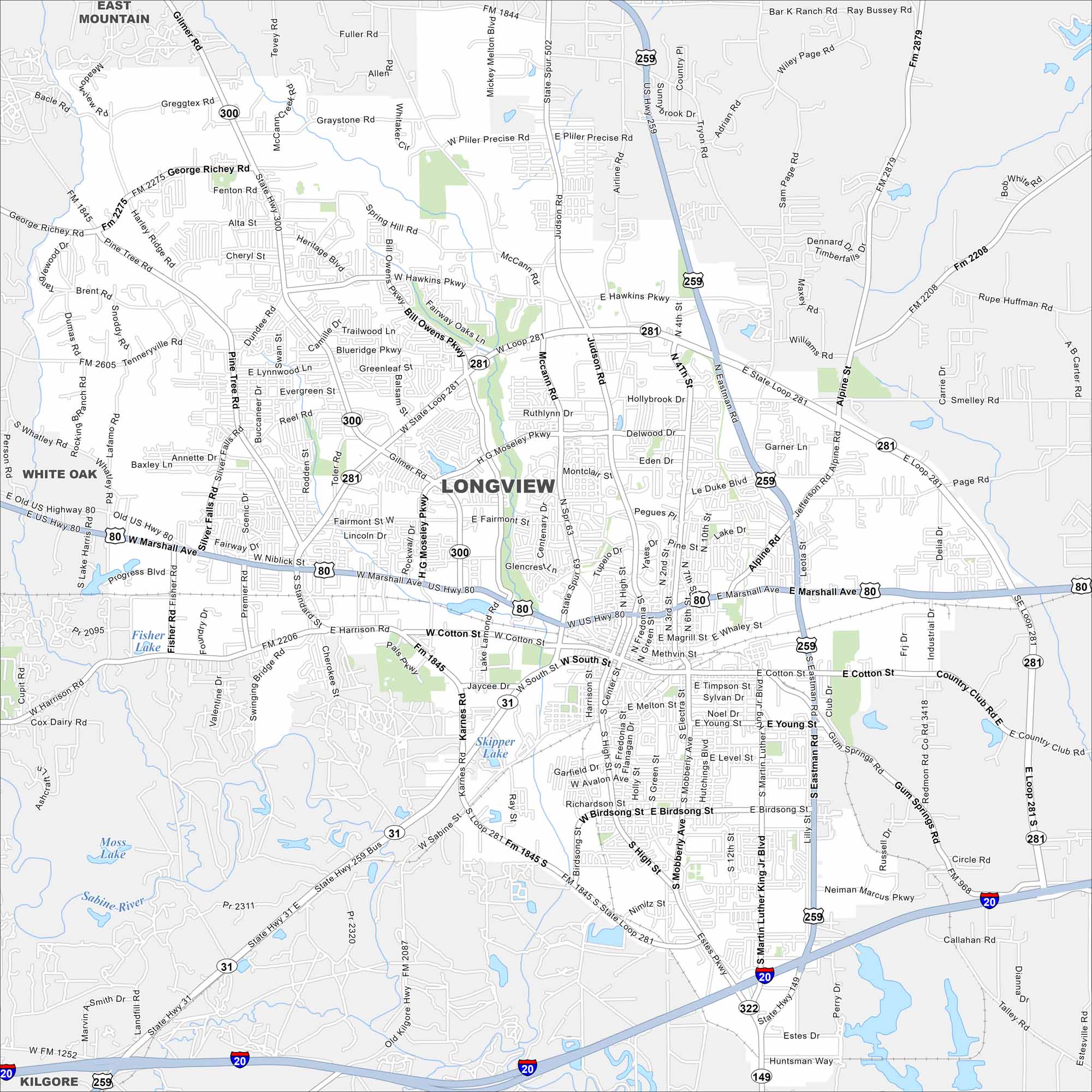
See Longview on our map in east Texas. You’ll find interstates and rail lines that cut through the city. Pine forests and lakes surround the area.
Map Information
On the Map
Interstates/Highways: I-20, US Hwy 259, US Hwy 80, US Hwy 149, State Hwy 300, State Hwy 31, State Loop 281 Major Roads: Marshall Ave, Loop 281, Cotton St, High St, Fourth St, Bill Owens Pkwy, George Richey Rd, Pine Tree Rd, Judson Rd, Hawkins Pkwy, McCann Rd, Hollybrook Dr, Mobberly Ave, Eastman Rd, Martin Luther King Jr Blvd, Birdsong St, Harrison Rd, Gilmer Rd, Alpine Rd, Page Rd Lakes and Reservoirs: Skipper Lake, Fisher Lake Major Rivers: Sabine River Nearby Communities: East Mountain, White Oak, KilgoreTexas State Maps
Scan our maps of the massive southern state of Texas.


City Maps of Texas
Explore our map collection of Texas cities.


