Map of Little Elm, Texas
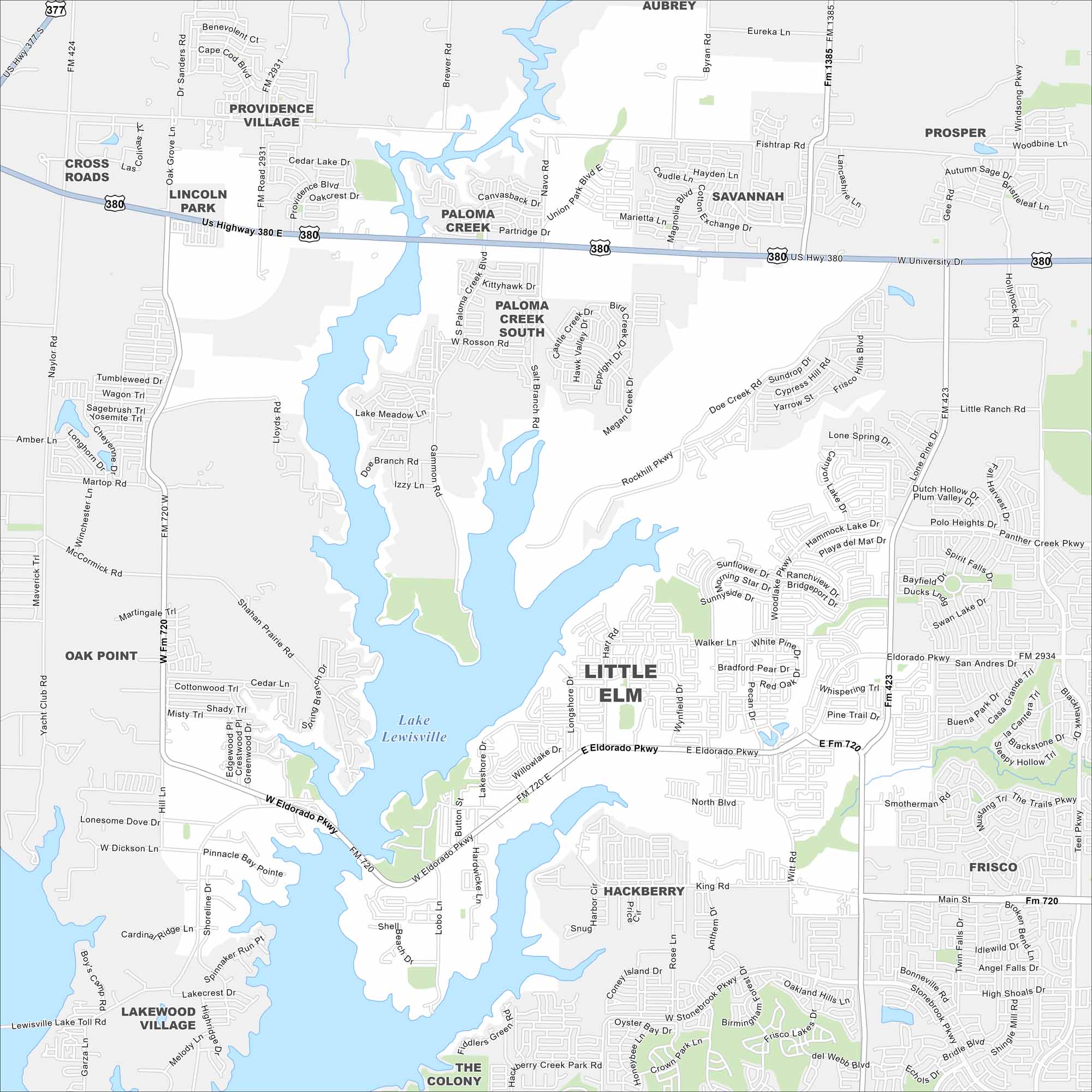
Check out Little Elm on the shores of Lewisville Lake. Our map highlights its growing neighborhoods along the water. Highways tie it into the Dallas-Fort Worth metro.
Map Information
On the Map
Interstates/Highways: US Hwy 380, US Hwy 377 Major Roads: Eldorado Pkwy, University Dr, Main St, Witt Rd, Woodlake Pkwy, Rockhill Pkwy, Navo Rd, Paloma Creek Blvd, Fishtrap Rd, King Rd, Stonebrook Pkwy, Oak Grove Ln, Lloyds Rd, Shahan Prairie Rd, Martingale Trl, McCormick Rd, Naylor Rd, Smotherman Rd, Teel Pkwy, Walker Ln Lakes and Reservoirs: Lake Lewisville Nearby Communities: Cross Roads, Lincoln Park, Providence Village, Paloma Creek, Paloma Creek South, Savannah, Aubrey, Prosper, Frisco, Hackberry, The Colony, Lakewood Village, Oak PointTexas State Maps
Scan our maps of the massive southern state of Texas.


City Maps of Texas
Explore our map collection of Texas cities.


