Map of Leander, Texas
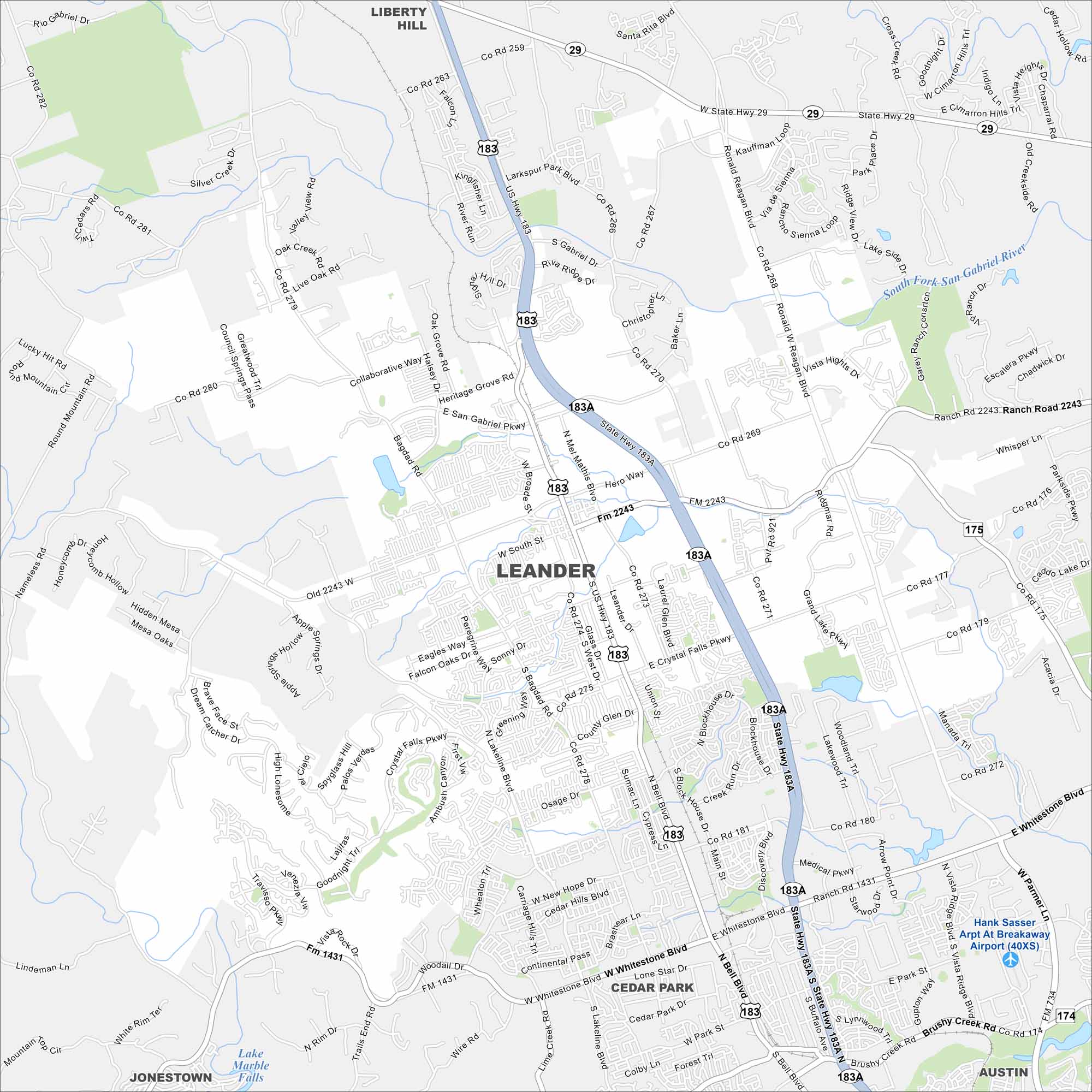
Leander appears on the map northwest of Austin. New subdivisions spread outward from its historic core. Rolling Hill Country terrain frames the edges.
Map Information
On the Map
Interstates/Highways: US Hwy 183 Major Roads: Whitestone Blvd, Crystal Falls Pkwy, Bagdad Rd, San Gabriel Pkwy, Nameless Rd, Ronald Reagan Blvd, Lakeline Blvd, Woodall Dr, Old 2243 W, Hero Way, South St, Osage Dr, Sonny Dr, Journey Pkwy, Collaborative Way, Halsey Dr, Mel Mathis Blvd, Horizon Park Blvd, Larkspur Park Blvd Airports: Hank Sasser Arpt At Breakaway Airport (40XS) Lakes and Reservoirs: Lake Marble Falls Major Rivers: South Fork San Gabriel River Nearby Communities: Liberty Hill, Cedar Park, Jonestown, AustinTexas State Maps
Scan our maps of the massive southern state of Texas.


City Maps of Texas
Explore our map collection of Texas cities.


