Map of Lawton, Oklahoma
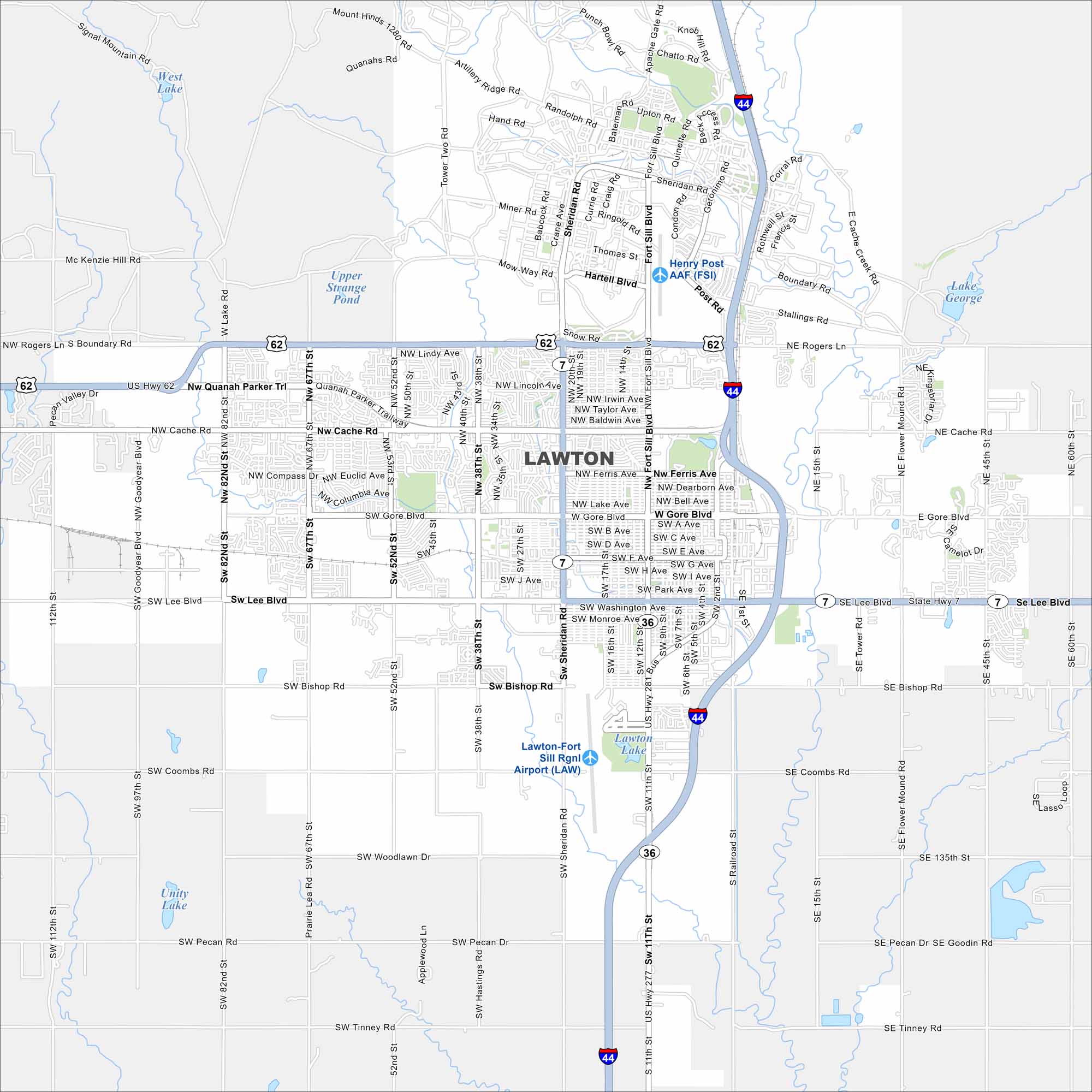
Our map of Lawton places it at the base of the Wichita Mountains. Fort Sill (Henry Post AAF) occupies a large section to the north. But open prairie spreads beyond the city.
Map Information
On the Map
Interstates/Highways: I-44, US Hwy 62, US Hwy 277, US Hwy 281, State Rte 7, State Rte 36 Major Roads: Cache Rd, Gore Blvd, Lee Blvd, Sheridan Rd, Fort Sill Blvd, Rogers Ln, Ferris Ave, Bishop Rd, 82nd St, 67th St, 52nd St, 38th St, 11th St, 2nd St, Quanah Parker Trl, Lake Rd, Boundary Rd, Coombs Rd, Woodlawn Dr, Pecan Rd Airports: Henry Post AAF (FSI), Lawton-Fort Sill Rgnl Airport (LAW) Lakes and Reservoirs: West Lake, Upper Strange Pond, Lawton Lake, Lake George, Unity LakeOklahoma State Maps
Here is our map collection of the Sooner State.


City Maps of Oklahoma
Explore Oklahoma’s cities with our maps


