Map of Lancaster, Texas
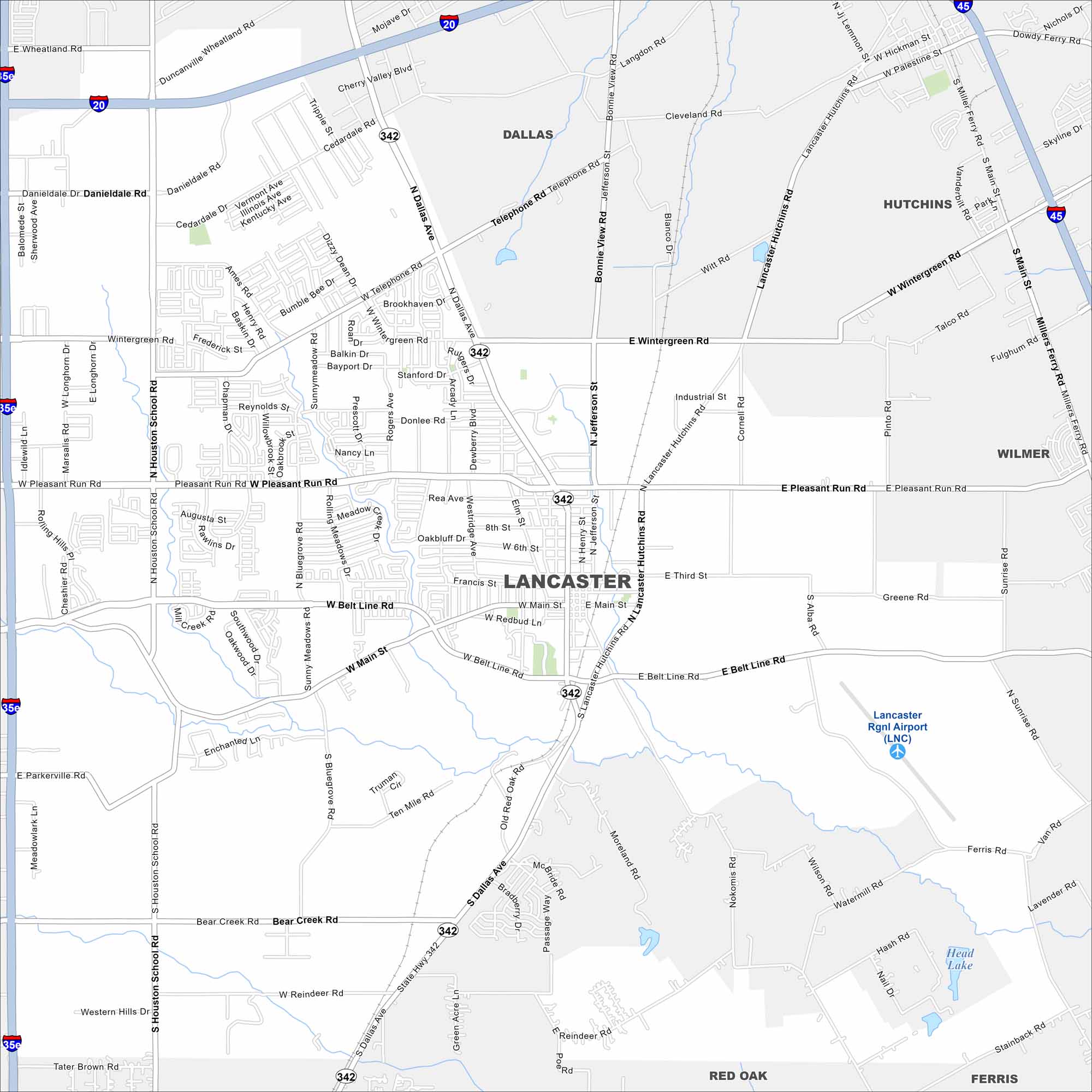
Lancaster, Texas is located south of Dallas. Our map includes highways, roads, rivers, lakes and parks. The city links directly to I-35. Open land surrounds the southern edge.
Map Information
On the Map
Interstates/Highways: I-20, I-35E, I-45, State Rte 342 Major Roads: Belt Line Rd, Main St, Pleasant Run Rd, Houston School Rd, Dallas Ave, Jefferson St, Lancaster Hutchins Rd, Wintergreen Rd, Bear Creek Rd, Danieldale Rd, Wheatland Rd, Telephone Rd, Bonnie View Rd, Bluegrove Rd, Ferris Rd, Millers Ferry Rd, Wintergreen Rd, Sunrise Rd, Nokomis Rd, Ten Mile Rd Airports: Lancaster Rgnl Airport (LNC) Lakes and Reservoirs: Head Lake Nearby Communities: Dallas, Hutchins, Wilmer, Red Oak, FerrisTexas State Maps
Scan our maps of the massive southern state of Texas.


City Maps of Texas
Explore our map collection of Texas cities.


