Map of Lakewood, Colorado
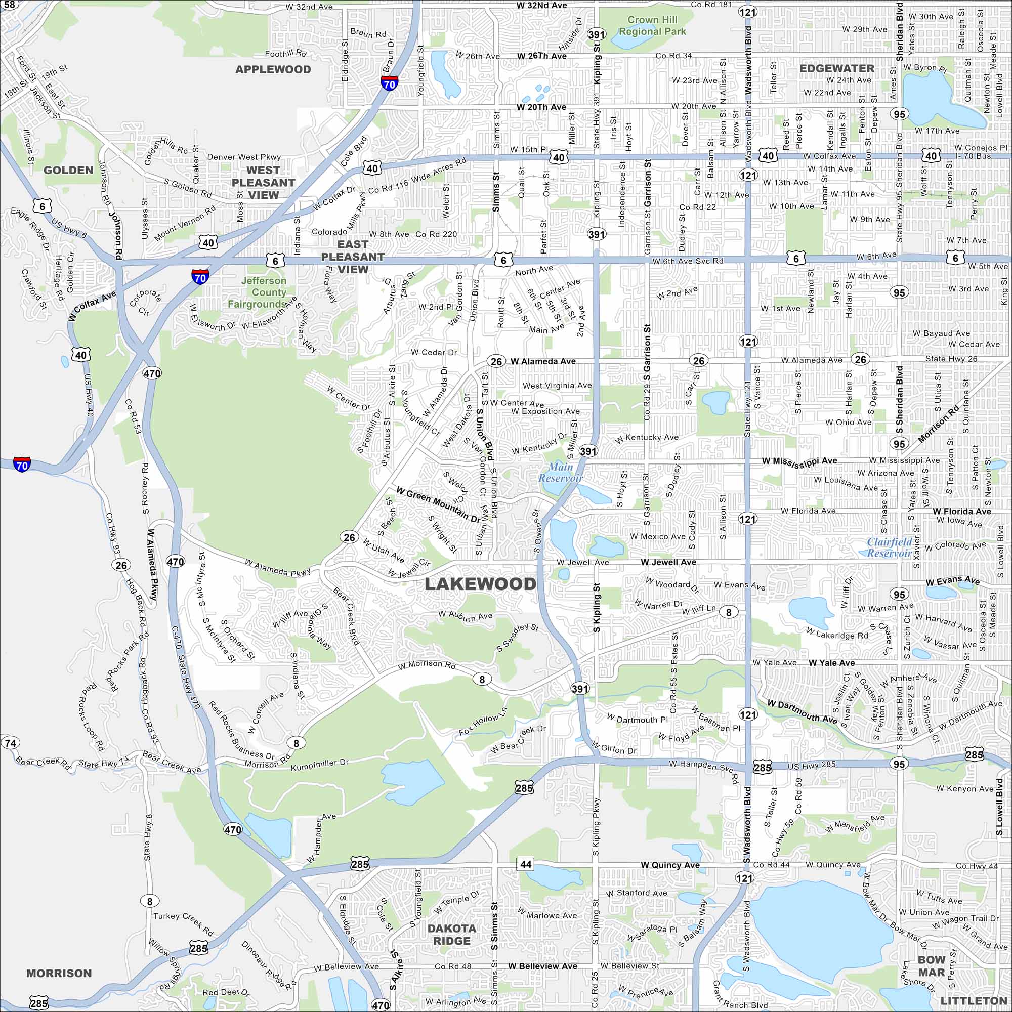
Mountains rise just west of Lakewood. This map shows highways streaming toward downtown Denver. Green parks and open space cut across the city.
Colorado State Maps
Browse Colorado with our detailed state maps


Map Information
On the Map
Interstates/Highways: I-70, US Hwy 6, US Hwy 40, US Hwy 285, State Hwy 121, State Hwy 391, State Hwy 470, State Hwy 26, State Hwy 95, State Hwy 8 Major Roads: Colfax Ave, Alameda Ave, Wadsworth Blvd, Kipling St, Sheridan Blvd, 6th Ave, 20th Ave, 26th Ave, 32nd Ave, 10th Ave, 14th Ave, 1st Ave, Cedar Ave, Mississippi Ave, Florida Ave, Jewell Ave, Evans Ave, Yale Ave, Hampden Ave, Quincy Ave Lakes and Reservoirs: Main Reservoir, Smith Reservoir Parks and Preserves: Crown Hill Regional Park, Jefferson County Fairgrounds, Bear Creek Lake Park Nearby Communities: Golden, Applewood, West Pleasant View, East Pleasant View, Edgewater, Dakota Ridge, MorrisonColorado City Maps
Here are maps of Colorado’s urban areas


