Map of Lakeville, Minnesota
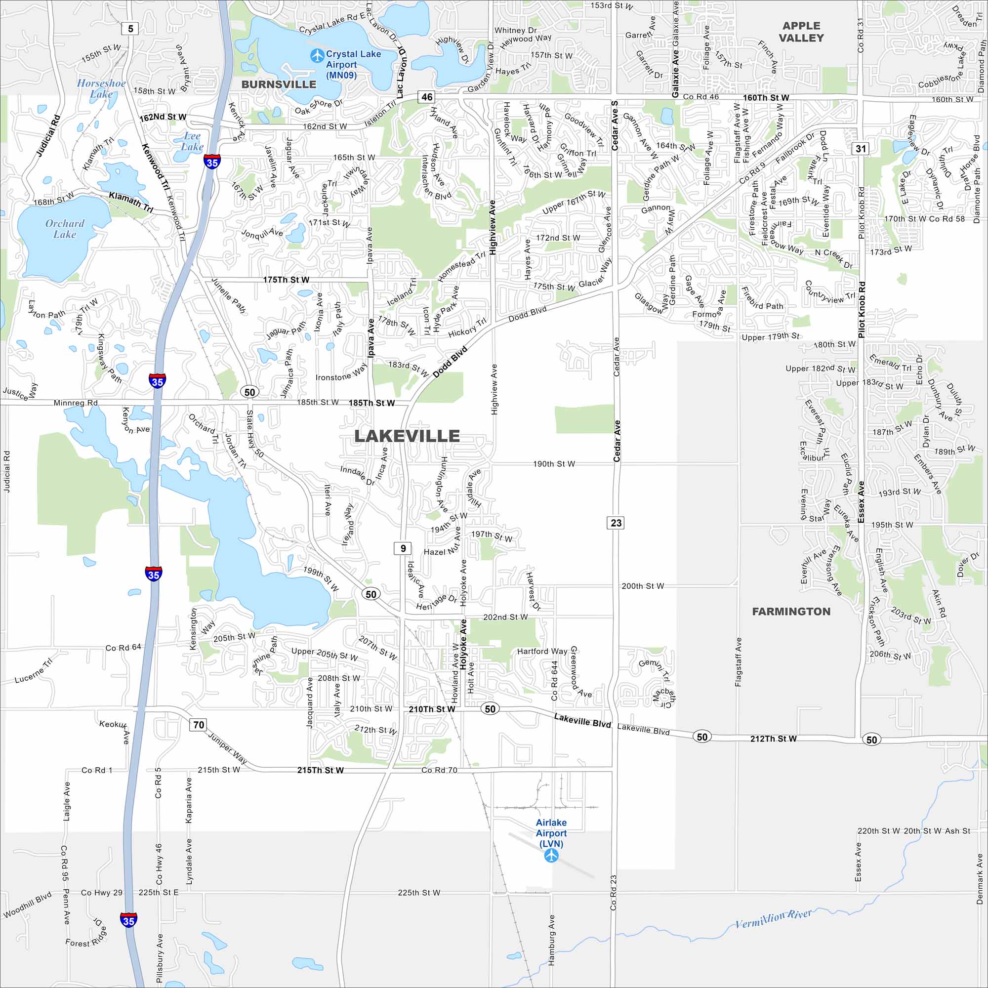
Lake Marion and Orchard Lake stand out on our map of Lakeville, Minnesota. Subdivisions fill the space between farmland and water. I-35 runs straight through the city.
Map Information
On the Map
Interstates/Highways: I-35, US Hwy 50 Major Roads: 210th St, 185th St, Cedar Ave, Highview Ave, 175th St, 160th St, 215th St, 225th St, Dodd Blvd, 162nd St, 170th St, 190th St, 202nd St, 212th St, Ipava Ave, Holyoke Ave, Kenwood Trl, Flagstaff Ave, Pilot Knob Rd, Galaxie Ave Airports: Crystal Lake Airport (MN09), Airlake Airport (LVN) Lakes and Reservoirs: Crystal Lake, Orchard Lake Major Rivers: Vermillion River Nearby Communities: Burnsville, Apple Valley, FarmingtonMinnesota State Maps
Explore every lake in our state maps of Minnesota


Minnesota City Maps
Browse through our city maps of Minnesota


