Map of Lake Jackson, Texas
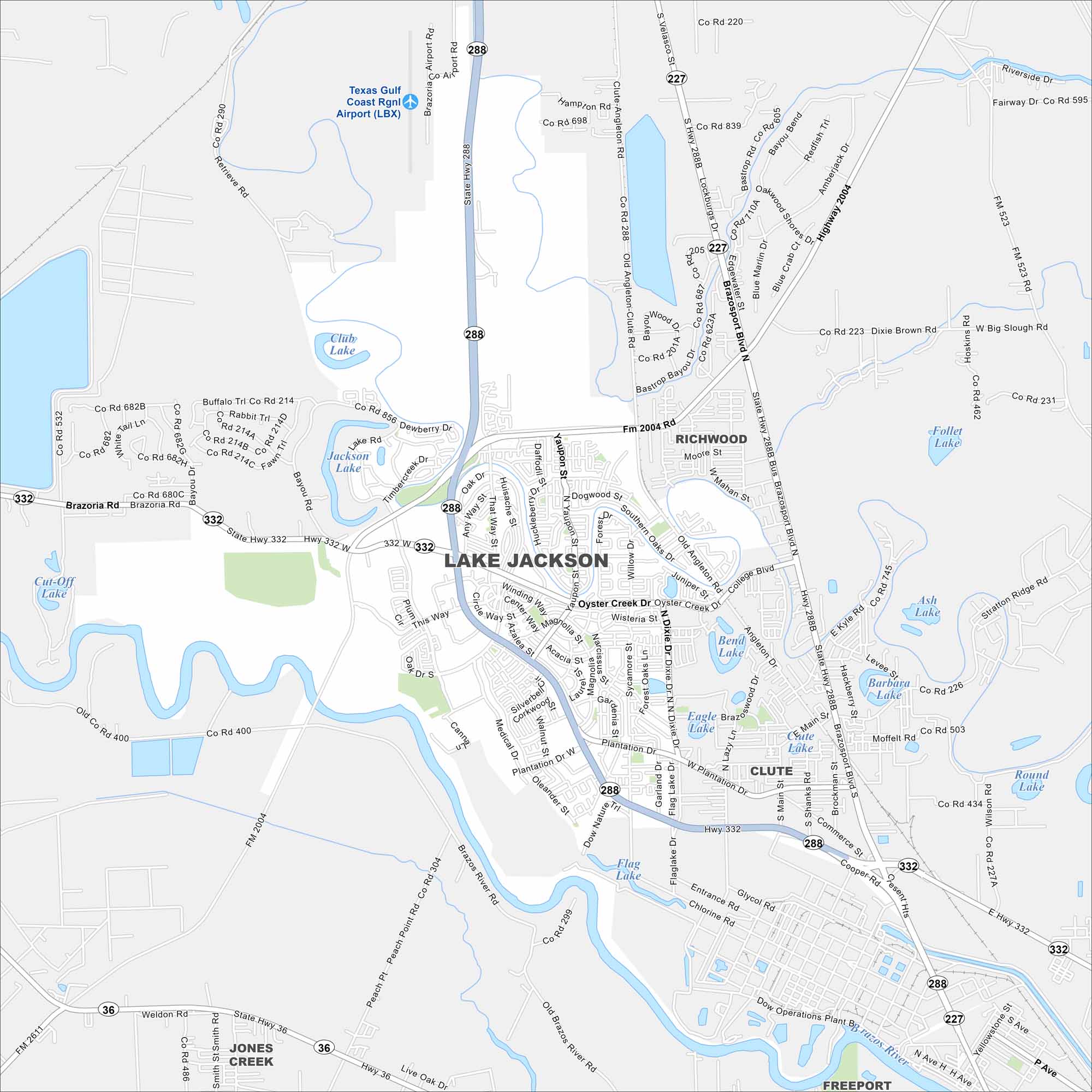
This map shows a curving street layout designed like a “tree”. While waterways flow through town, highways connect it to the Gulf Coast.
Map Information
On the Map
Interstates/Highways: State Rte 288, State Rte 332, State Rte 36, State Rte 227 Major Roads: Plantation Dr, This Way, That Way, Any Way, Oyster Creek Dr, Dixie Dr, College Blvd, Medical Dr, Oak Dr, Abner Jackson Pkwy, Brazosport Blvd, Clute-Angleton Rd, Old Angleton-Clute Rd, Flag Lake Dr, Main St, Commerce St, Brockman St, Shanks Rd, Velasco St, Highway 2004 Airports: Texas Gulf Coast Rgnl Airport (LBX) Lakes and Reservoirs: Jackson Lake, Club Lake, Cut-Off Lake, Flag Lake, Eagle Lake, Bend Lake, Clute Lake, Barbara Lake, Ash Lake, Follet Lake, Round Lake Major Rivers: Brazos River Nearby Communities: Richwood, Clute, Jones Creek, FreeportTexas State Maps
Scan our maps of the massive southern state of Texas.


City Maps of Texas
Explore our map collection of Texas cities.


