Map of Killeen, Texas
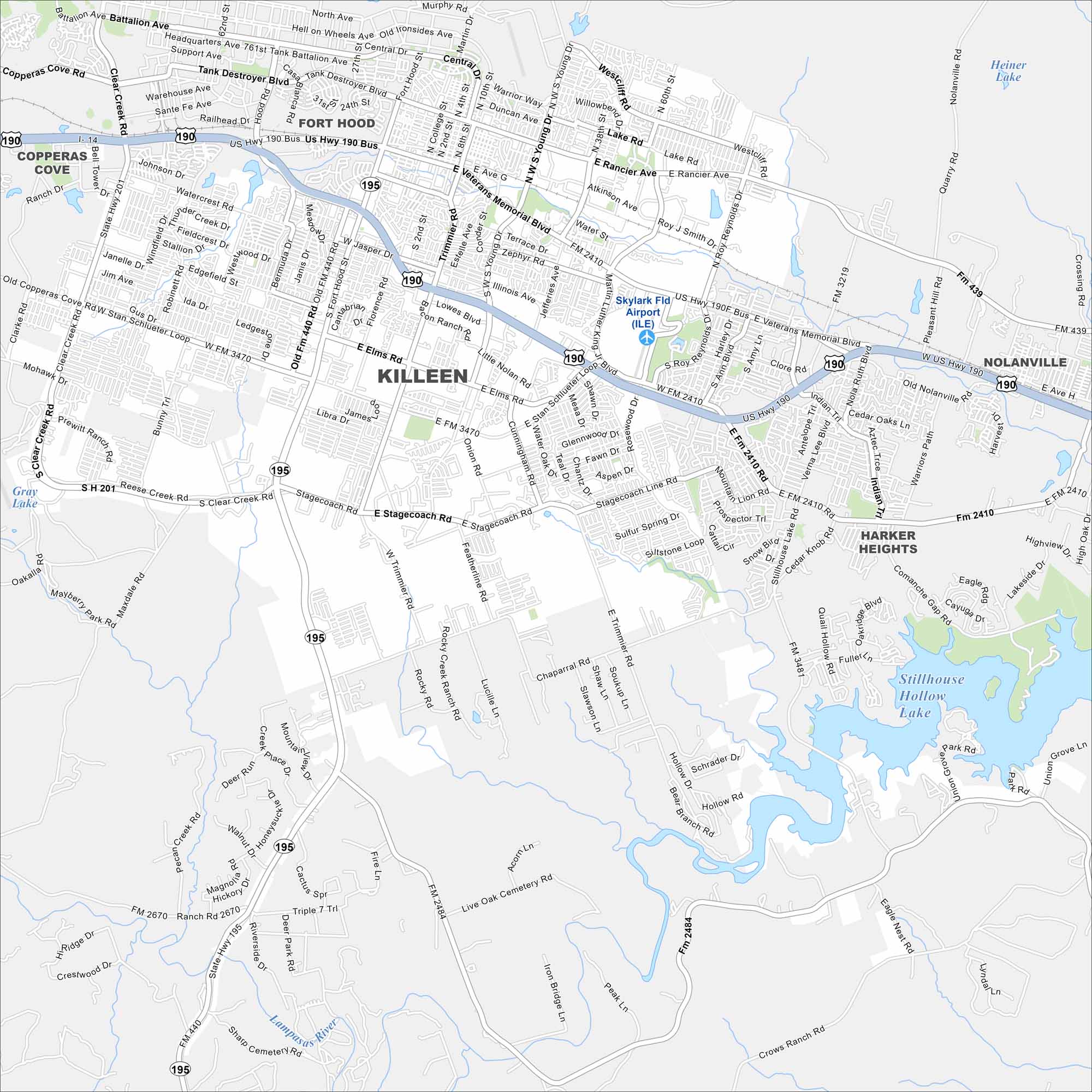
Killeen is anchored by Fort Hood. Our map shows wide highways cutting through the city. Neighborhoods sprawl outward from the military base.
Map Information
On the Map
Interstates/Highways: US Hwy 190, State Rte 195, State Rte 201 Major Roads: Veterans Memorial Blvd, Stan Schlueter Loop, Elms Rd, Stagecoach Rd, Trimmier Rd, Fort Hood St, Rancier Ave, Lake Rd, Jasper Dr, Central Ave, Willowbend Dr, Atkinson Ave, Water St, Illinois Ave, Zephyr Rd, Young Dr, W S Young Dr, Knights Way, Clear Creek Rd, Bunny Trl Airports: Skylark Fld Airport (ILE) Lakes and Reservoirs: Stillhouse Hollow Lake, Heiner Lake, Gray Lake Major Rivers: Lampasas River Nearby Communities: Copperas Cove, Fort Hood, Nolanville, Harker HeightsTexas State Maps
Scan our maps of the massive southern state of Texas.


City Maps of Texas
Explore our map collection of Texas cities.


