Map of Kerrville, Texas
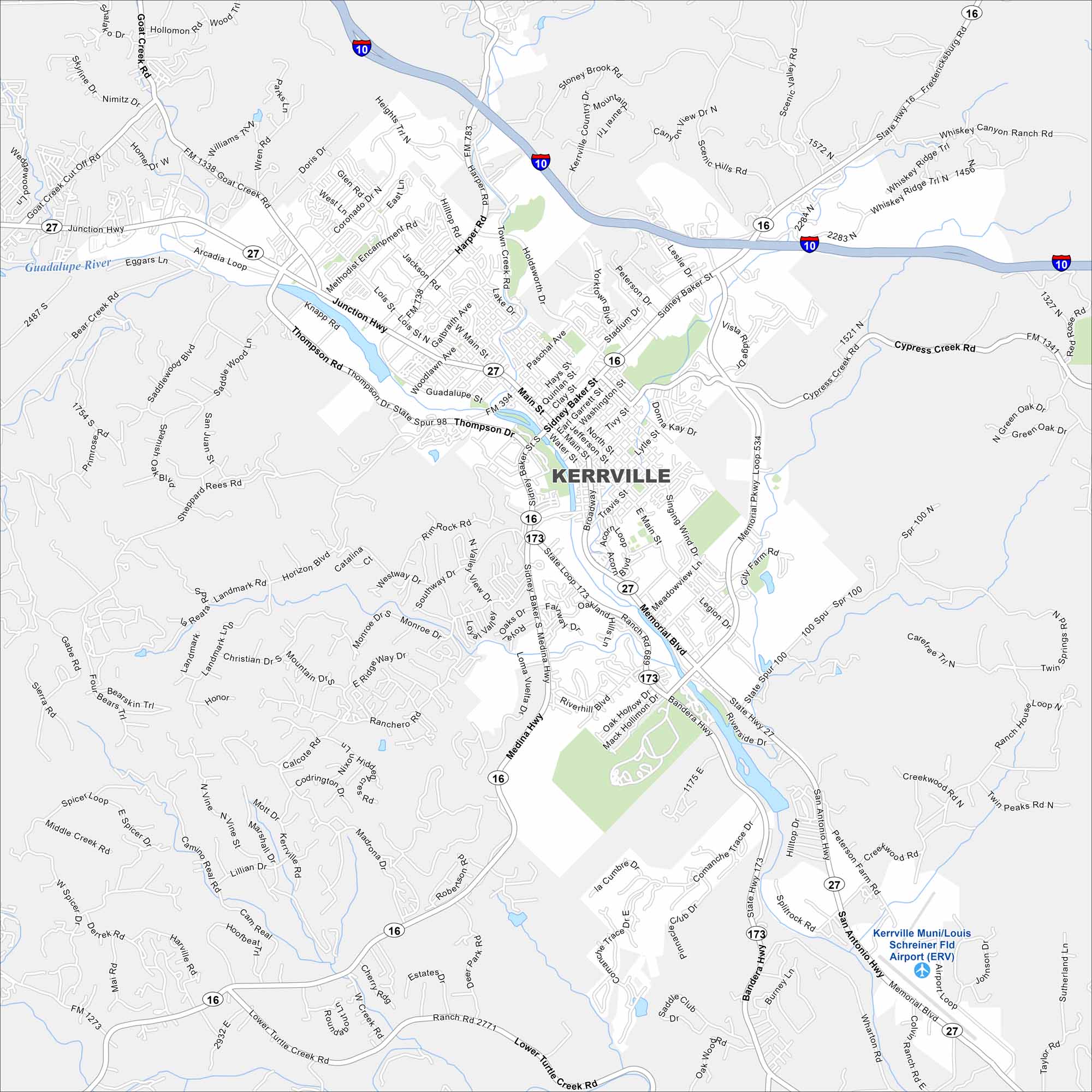
Kerrville is situated in the Texas Hill Country. Our map shows the Guadalupe River winding through the city. We also show parks, roads and lakes.
Map Information
On the Map
Interstates/Highways: I-10, US Hwy 290, US Hwy 87, State Rte 16, State Rte 27, State Rte 173, State Rte 534 Major Roads: Thompson Dr, Main St, Sidney Baker St, Memorial Blvd, Junction Hwy, Broadway, Water St, Quinlan St, Jefferson St, Tivy St, Lytle St, Singing Wind Dr, Meadowview Ln, Legion Dr, Bandera Hwy, Riverside Dr, Cypress Creek Rd, Harper Rd, Holdsworth Dr, Town Creek Rd Airports: Kerrville Muni/Louis Schreiner Fld Airport (ERV) Major Rivers: Guadalupe RiverTexas State Maps
Scan our maps of the massive southern state of Texas.


City Maps of Texas
Explore our map collection of Texas cities.


