Map of Johnstown, Colorado
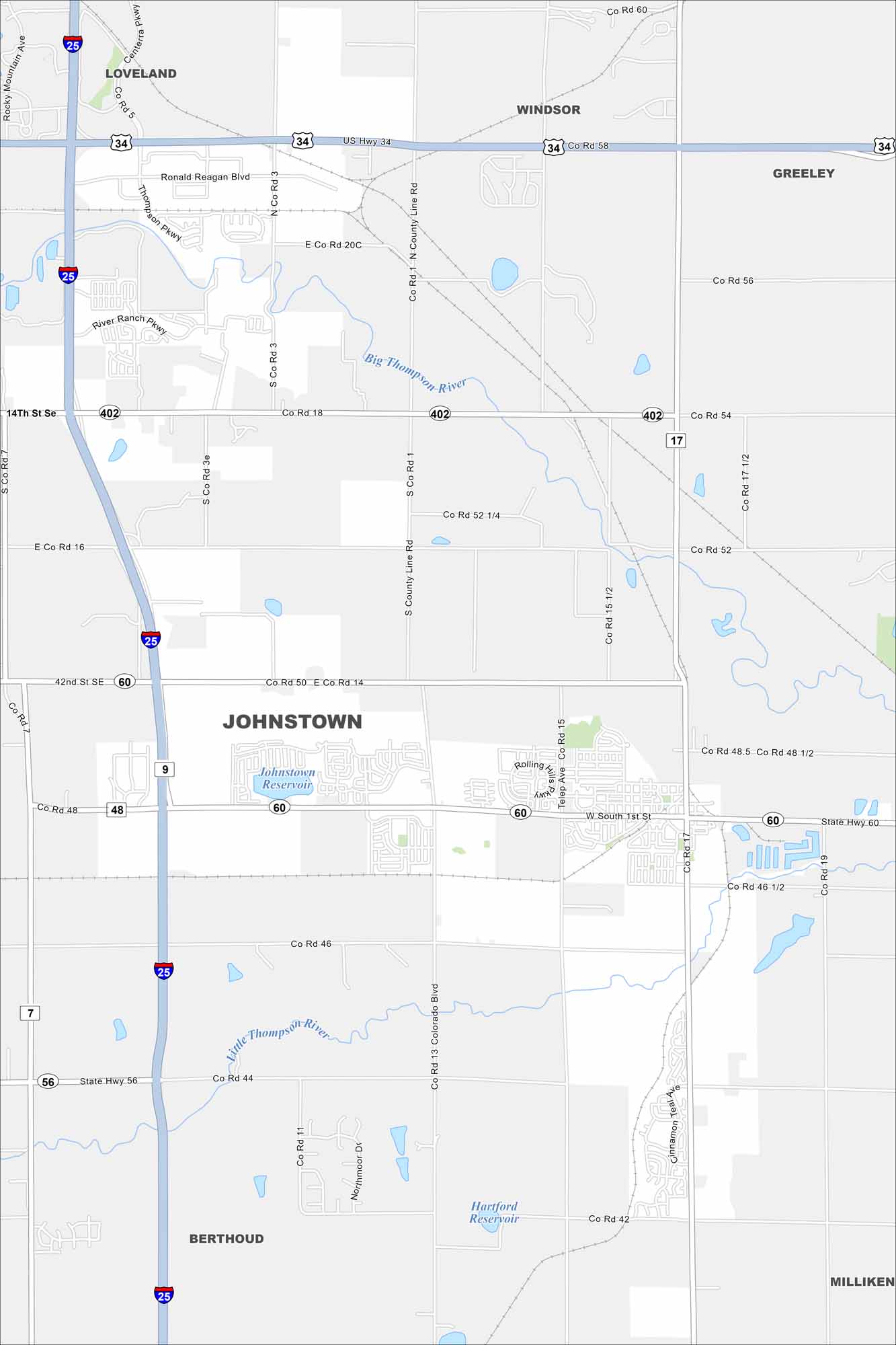
Our map of Johnstown shows a small but growing community between Loveland and Greeley. Highways I-25 and US-34 meet close by. The Rockies rise clearly to the west.
Colorado State Maps
Browse Colorado with our detailed state maps


Map Information
On the Map
Interstates/Highways: I-25, US Hwy 34, State Hwy 60, State Hwy 56, State Hwy 17 Major Roads: Colorado Blvd, County Line Rd, Co Rd 17, Co Rd 18, Co Rd 14, Co Rd 3, Co Rd 5, Co Rd 7, Co Rd 11, Co Rd 13, Co Rd 15, Co Rd 42, Co Rd 44, Co Rd 46, Co Rd 48, Co Rd 50, Co Rd 52, Co Rd 54, Co Rd 56, Co Rd 58 Lakes and Reservoirs: Johnstown Reservoir, Hartford Reservoir Major Rivers: Big Thompson River, Little Thompson River Nearby Communities: Loveland, Windsor, Greeley, Milliken, BerthoudColorado City Maps
Here are maps of Colorado’s urban areas


