Map of Iowa City, Iowa
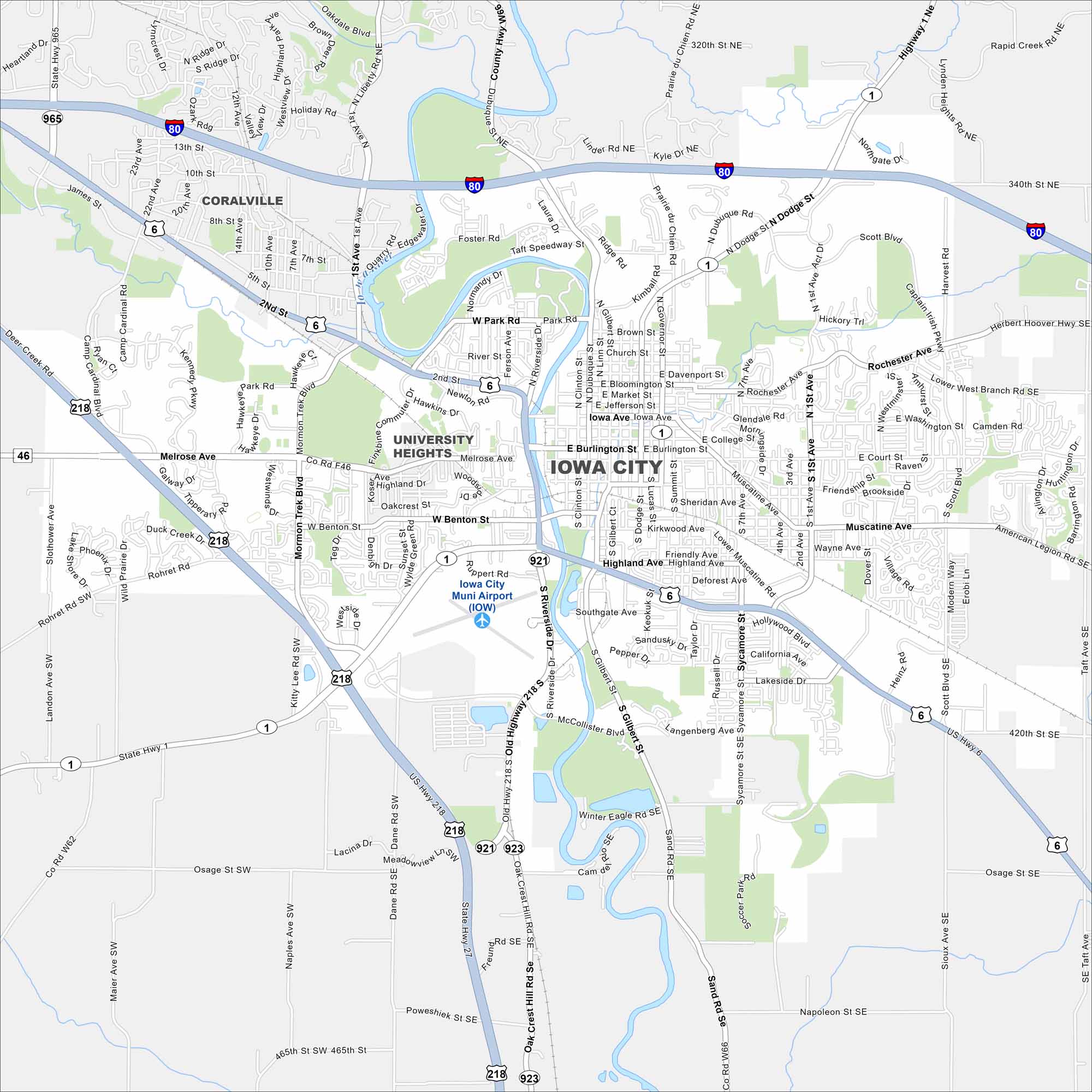
Check out our map of Iowa City with the Iowa River running through its core. Neighborhoods and cultural spots surround the river. You can also find the University of Iowa campus here.


Map Information
On the Map
Interstates/Highways: I-80, US Hwy 6, US Hwy 218, State Rte 1, State Rte 27, State Rte 46, State Rte 921, State Rte 923, State Rte 965 Major Roads: Riverside Dr, Burlington St, Iowa Ave, Melrose Ave, Gilbert St, Clinton St, Dubuque St, Dodge St, Muscatine Ave, Keokuk St, Mormon Trek Blvd, 1st Ave, Scott Blvd, Rochester Ave, Park Rd, Benton St, Highland Ave, Waterfront Dr, Highway 1 Ne, Highway 6 Airports: Iowa City Muni Airport (IOW) Major Rivers: Iowa River Nearby Communities: Coralville, University HeightsIowa City Maps
Browse city maps in the state of Iowa


