Map of Inver Grove Heights, Minnesota
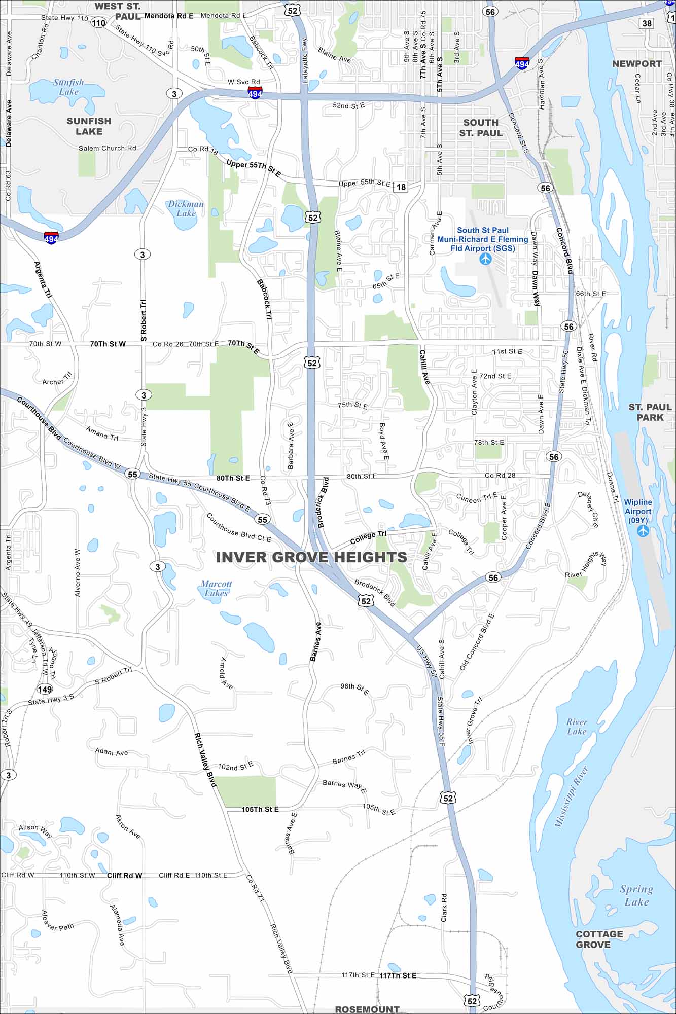
Our map of Inver Grove Heights shows its location along the Mississippi River. Highways curve around lakes and parks. The river bluffs make up the eastern side.
Map Information
On the Map
Interstates/Highways: I-494, US Hwy 52, State Rte 55, State Rte 56 Major Roads: Robert St, Cahill Ave, Concord Blvd, 70th St, 80th St, 117th St, Rich Valley Blvd, Barnes Ave, Broderick Blvd, Babcock Trl, Courthouse Blvd, Argenta Trl, 50th St, 52nd St, 65th St, 75th St, 105th St, 110th St, Clark Rd, Akron Ave Airports: South St Paul Muni-Richard E Fleming Fld Airport (SGS), Wipline Airport (09Y) Lakes and Reservoirs: Marcott Lakes, Sunfish Lake, Dickman Lake, River Lake, Spring Lake Major Rivers: Mississippi River Nearby Communities: West St. Paul, South St. Paul, Sunfish Lake, Newport, St. Paul Park, Cottage Grove, RosemountMinnesota State Maps
Explore every lake in our state maps of Minnesota


Minnesota City Maps
Browse through our city maps of Minnesota


