Map of Indianapolis, Indiana
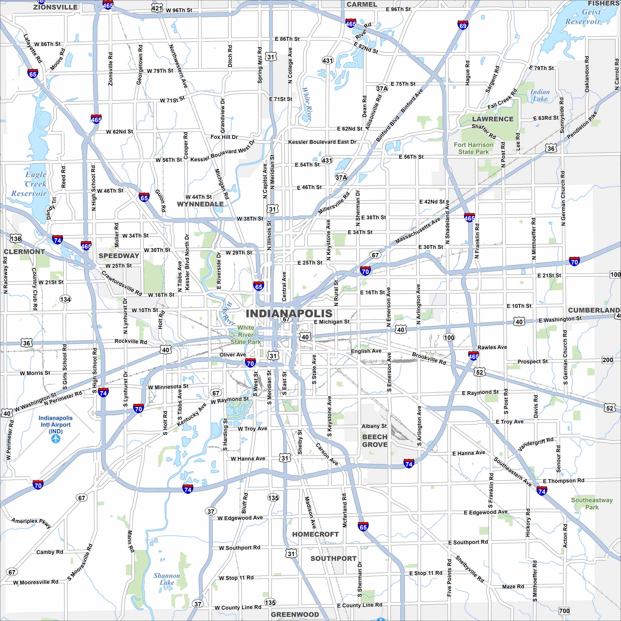
Check out our map of Indianapolis with its famous “Mile Square” downtown. Interstates form a ring around the city. The White River winds right through the middle with its own state park downtown.
Indiana State Maps
Study about Indiana with our map collection


Map Information
On the Map
Interstates/Highways: I-65, I-69, I-70, I-74, I-465, US Hwy 31, US Hwy 36, US Hwy 40, US Hwy 52, US Hwy 136, US Hwy 421, State Rte 37, State Rte 37A, State Rte 67, State Rte 100, State Rte 134, State Rte 135, State Rte 431 Major Roads: Washington St, Meridian St, Michigan St, 86th St, 38th St, Raymond St, Keystone Ave, Allisonville Rd, Binford Blvd, Madison Ave, Fall Creek Pkwy, Kessler Blvd, Tibbs Ave, High School Rd, Lynhurst Dr, Emerson Ave, Arlington Ave, Shadeland Ave, Pendleton Pike, Southport Rd Airports: Indianapolis Intl Airport (IND) Lakes and Reservoirs: Eagle Creek Reservoir, Indian Lake, Shannon Lake, Geist Reservoir Major Rivers: White River Parks and Preserves: Fort Harrison State Park, White River State Park Nearby Communities: Wynnedale, Speedway, Beech Grove, Homecroft, Southport, Greenwood, Cumberland, Lawrence, Carmel, Zionsville, Clermont Neighborhoods: Downtown IndianapolisIndiana City Maps
Here are our maps of Indianapolis and Indiana cities


