Map of Haltom City, Texas
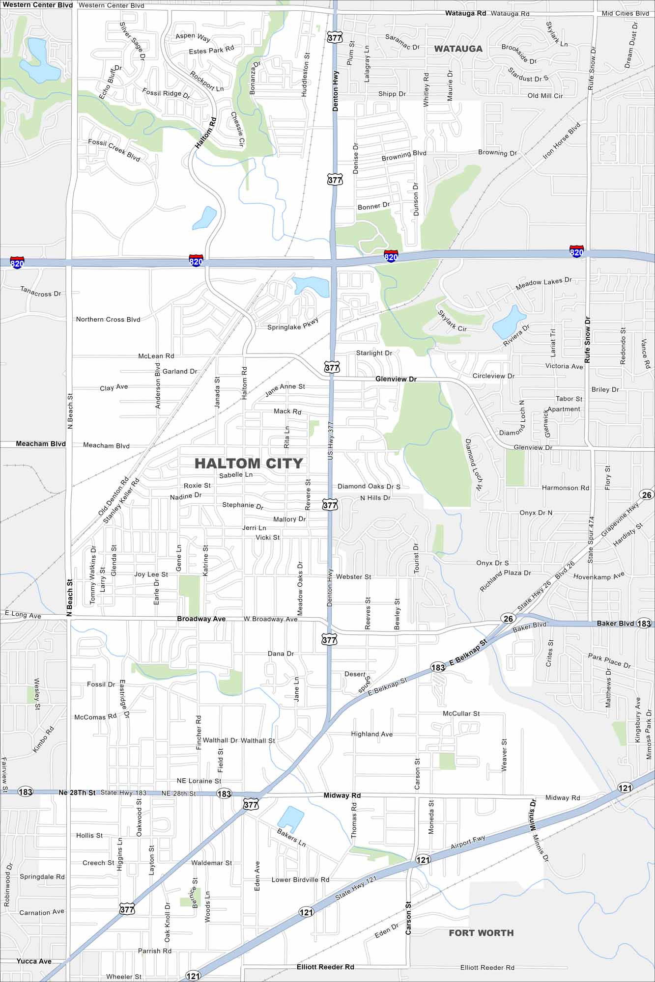
Haltom City is part of the Fort Worth area in north Texas. This map shows dense neighborhoods tied together by major roads. Its location places it right in the heart of the metroplex.
Map Information
On the Map
Interstates/Highways: I-820, US Hwy 377, State Hwy 26, State Hwy 121, State Hwy 183 Major Roads: Denton Hwy, Belknap St, Broadway Ave, 28th St, Haltom Rd, Beach St, Airport Fwy, Glenview Dr, Carson St, Minnis Dr, Elliott Reeder Rd, Northern Cross Blvd, McLean Rd, Fossil Creek Blvd, Stanley Keller Rd, Old Denton Rd, Midway Rd, High Diamond Dr, Iron Horse Blvd, Mid Cities Blvd Nearby Communities: Watauga, Fort WorthTexas State Maps
Scan our maps of the massive southern state of Texas.


City Maps of Texas
Explore our map collection of Texas cities.


