Map of Grapevine, Texas
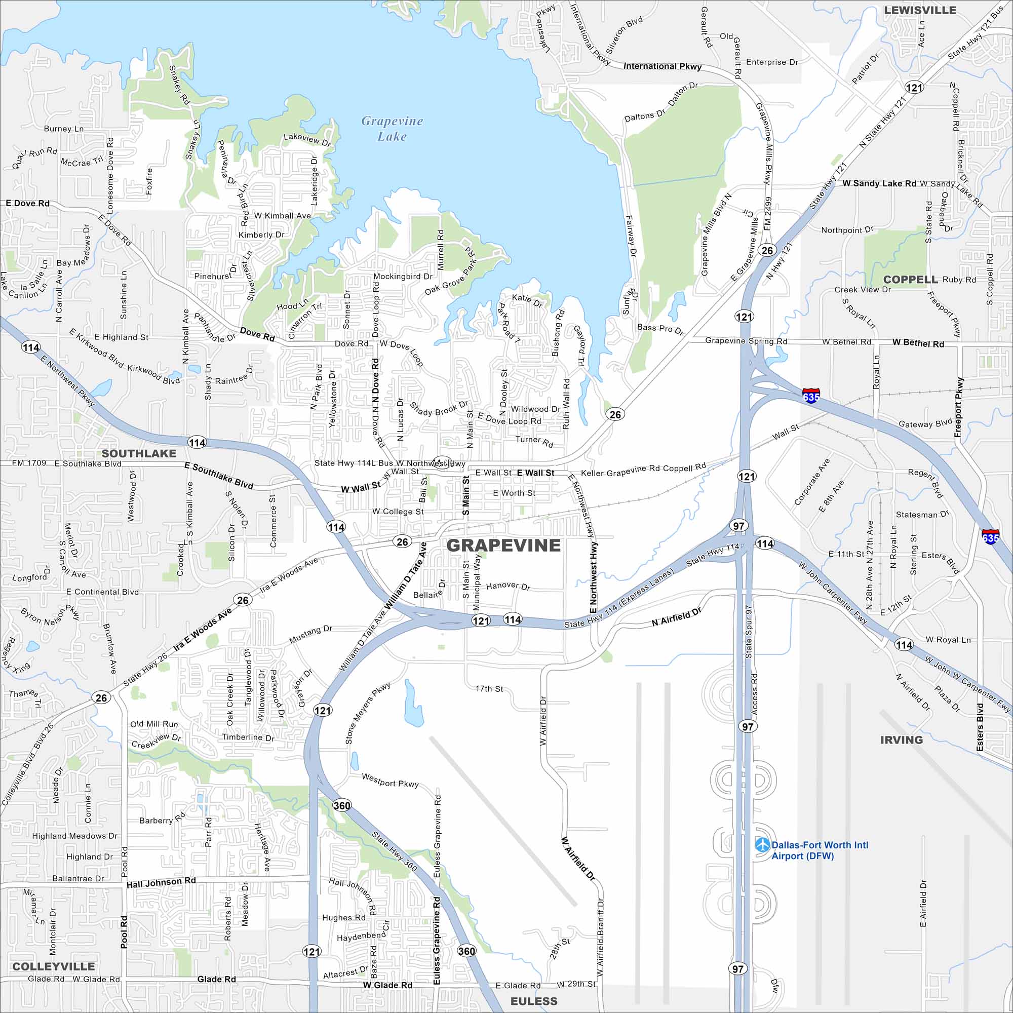
Grapevine is in the Dallas-Fort Worth area near Grapevine Lake. This map outlines the lake, major roadways and the historic downtown. The city is well known for its wineries.
Map Information
On the Map
Interstates/Highways: I-635, State Hwy 114, State Hwy 121, State Hwy 26, State Hwy 360, State Spur 97 Major Roads: Main St, Northwest Hwy, William D Tate Ave, Ira E Woods Ave, Grapevine Mills Pkwy, International Pkwy, Bass Pro Dr, Dove Rd, Continental Blvd, Hall Johnson Rd, Glade Rd, Texan Trl, Wall St, Worth St, College St, Dallas Rd, Mustang Dr, Stone Myers Pkwy, Euless Grapevine Rd, Airfield Dr Airports: Dallas-Fort Worth Intl Airport (DFW) Lakes and Reservoirs: Grapevine Lake Nearby Communities: Southlake, Coppell, Lewisville, Irving, Euless, ColleyvilleTexas State Maps
Scan our maps of the massive southern state of Texas.


City Maps of Texas
Explore our map collection of Texas cities.


