Map of Grand Prairie, Texas
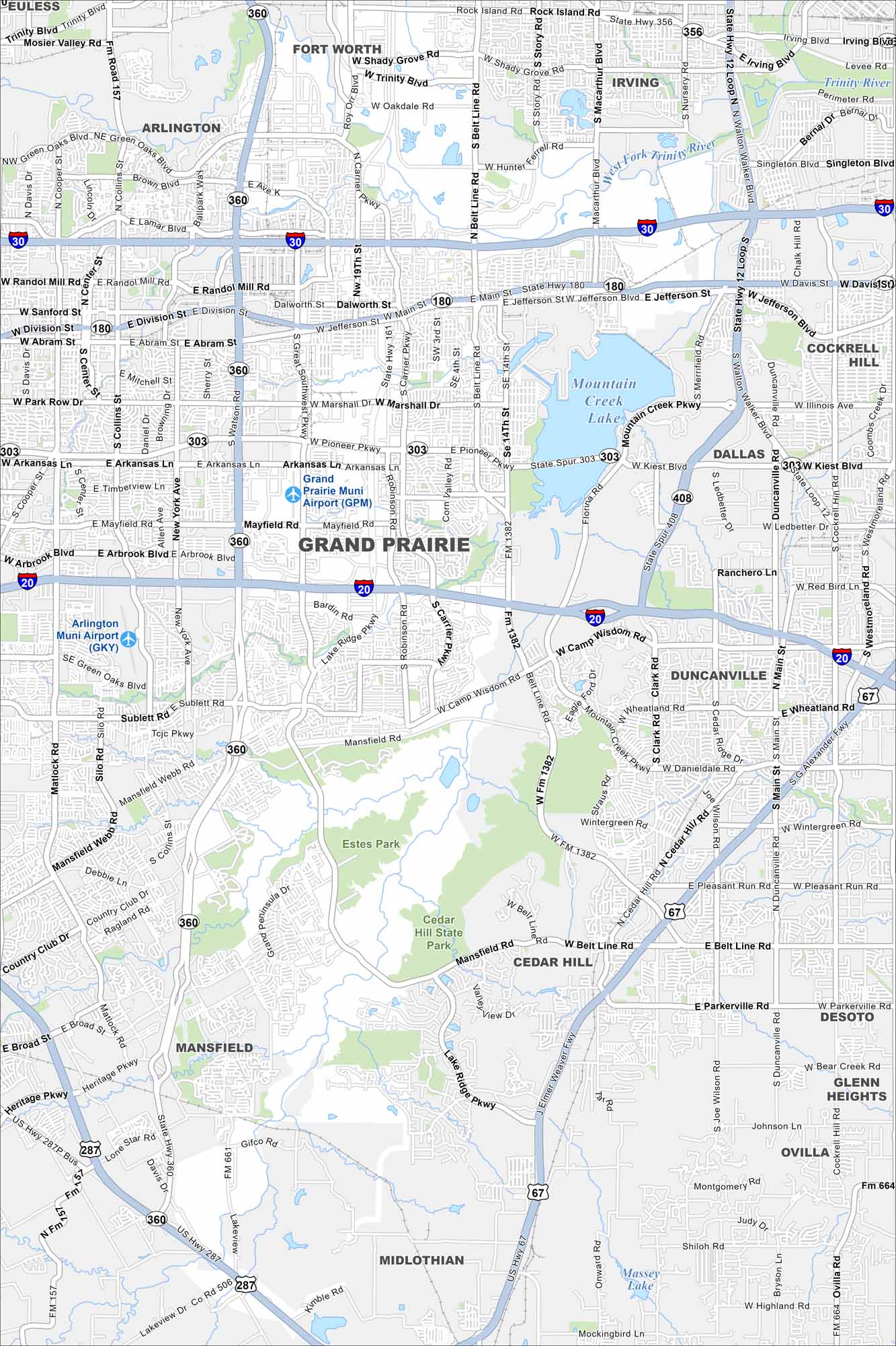
Grand Prairie is located between Dallas and Fort Worth. This map shows main roadways, local lakes, and residential areas. It stands out for its central position in the metroplex.
Map Information
On the Map
Interstates/Highways: I-20, I-30, State Hwy 360, State Hwy 161, State Hwy 180, US Hwy 67, US Hwy 287, State Spur 303, State Spur 408 Major Roads: Main St, Jefferson St, Belt Line Rd, Carrier Pkwy, Great Southwest Pkwy, Mayfield Rd, Camp Wisdom Rd, Lake Ridge Pkwy, Mansfield Webb Rd, Polo Rd, Robinson Rd, Corn Valley Rd, Collins St, Cooper St, Division St, Abram St, Park Row Dr, Arkansas Ln, Pioneer Pkwy, Tarrant Rd Airports: Grand Prairie Muni Airport (GPM), Arlington Muni Airport (GKY) Lakes and Reservoirs: Mountain Creek Lake, Joe Pool Lake, Massey Lake Major Rivers: West Fork Trinity River Parks and Preserves: Cedar Hill State Park, Estes Park Nearby Communities: Arlington, Irving, Dallas, Cockrell Hill, Duncanville, Cedar Hill, Desoto, Glenn Heights, Ovilla, Midlothian, MansfieldTexas State Maps
Scan our maps of the massive southern state of Texas.


City Maps of Texas
Explore our map collection of Texas cities.


