Map of Grand Junction, Colorado
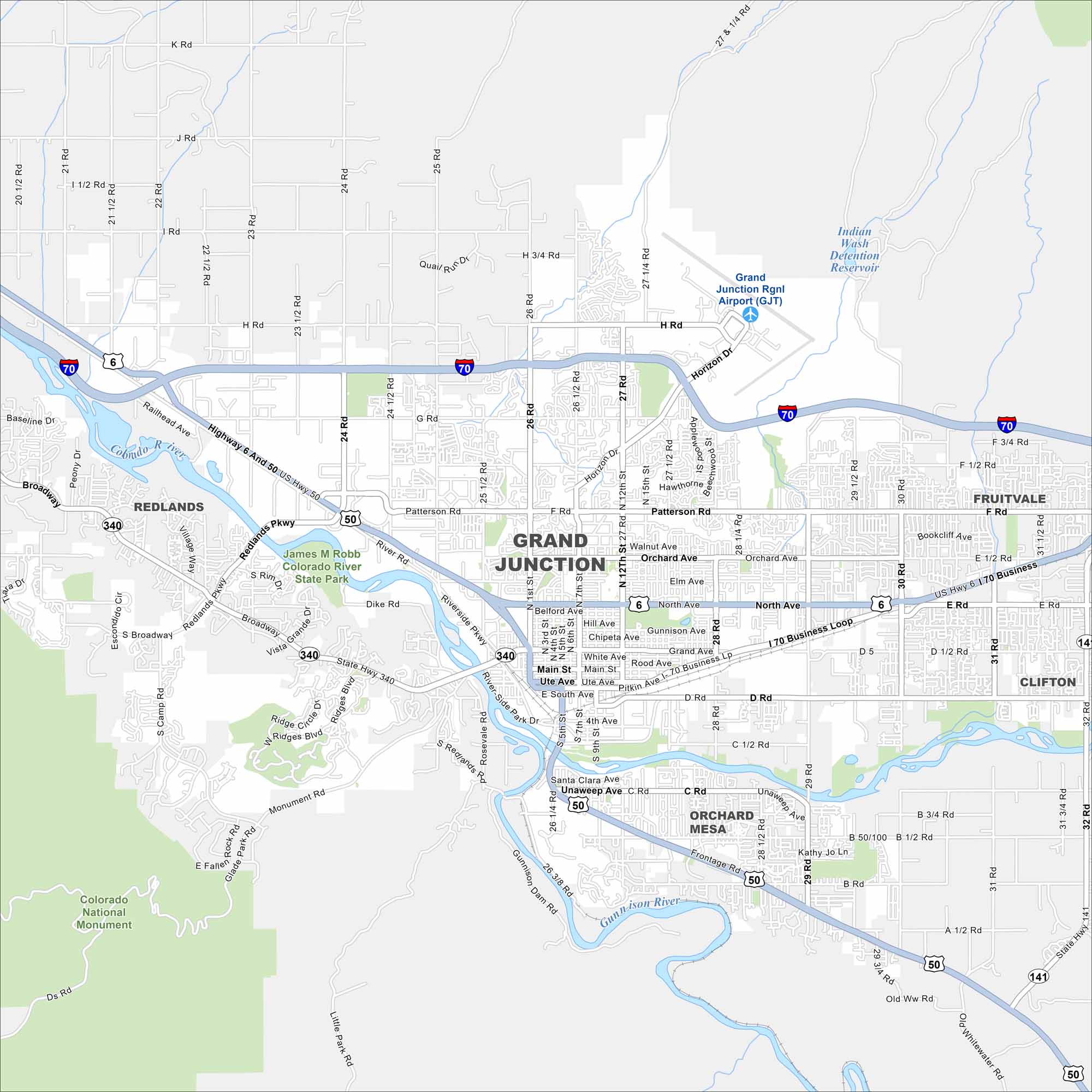
Explore our map of Grand Junction in western Colorado. This city sits at the meeting of the Gunnison and Colorado Rivers, with surrounding plateaus. It’s the gateway to Colorado’s wine country and red rock landscapes.
Colorado State Maps
Browse Colorado with our detailed state maps


Map Information
On the Map
Interstates/Highways: I-70, US Hwy 6, US Hwy 50, State Hwy 340, State Hwy 141 Major Roads: Main St, North Ave, Patterson Rd, Horizon Dr, 1st St, 4th St, 5th St, 7th St, 12th St, 15th St, 24 Rd, 25 Rd, 26 Rd, 27 Rd, 28 Rd, 29 Rd, Broadway, Grand Ave, Riverside Pkwy, Orchard Ave Airports: Grand Junction Rgnl Airport (GJT) Lakes and Reservoirs: Indian Wash Detention Reservoir Major Rivers: Colorado River, Gunnison River Parks and Preserves: James M Robb Colorado River State Park, Colorado National Monument Nearby Communities: Redlands, Orchard Mesa, Fruitvale, CliftonColorado City Maps
Here are maps of Colorado’s urban areas


