Map of Golden, Colorado
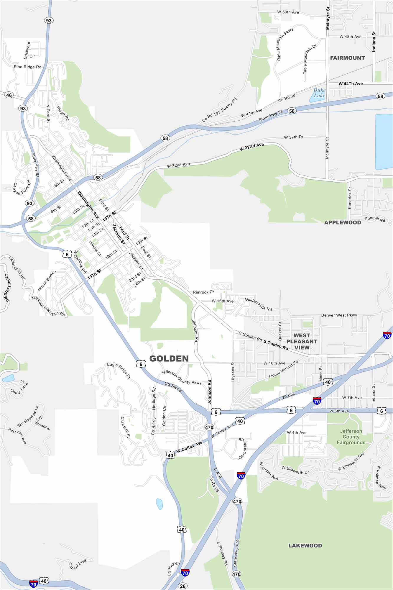
Golden is tucked against the foothills west of Denver. Trails and open spaces stretch into the mountains. It’s known as the “Gateway to the Rockies”.
Colorado State Maps
Browse Colorado with our detailed state maps


Map Information
On the Map
Interstates/Highways: I-70, US Hwy 6, US Hwy 40, State Hwy 58, State Hwy 93 Major Roads: Colfax Ave, Golden Rd, Washington Ave, 19th St, Johnson Rd, Heritage Rd, Ford St, McIntyre St, Indiana St, Table Mountain Pkwy, Easley Rd, 32nd Ave, 44th Ave, 50th Ave, Corporate Dr, Ulysses St, Quaker St, Denver West Pkwy, Lariat Loop Rd, Lookout Mountain Rd Lakes and Reservoirs: Duke Lake, Cedar Lake Parks and Preserves: Jefferson County Fairgrounds, Clear Creek Canyon Park, Mount Zion Nearby Communities: Fairmount, Applewood, West Pleasant View, LakewoodColorado City Maps
Here are maps of Colorado’s urban areas


