Map of Framingham, Massachusetts
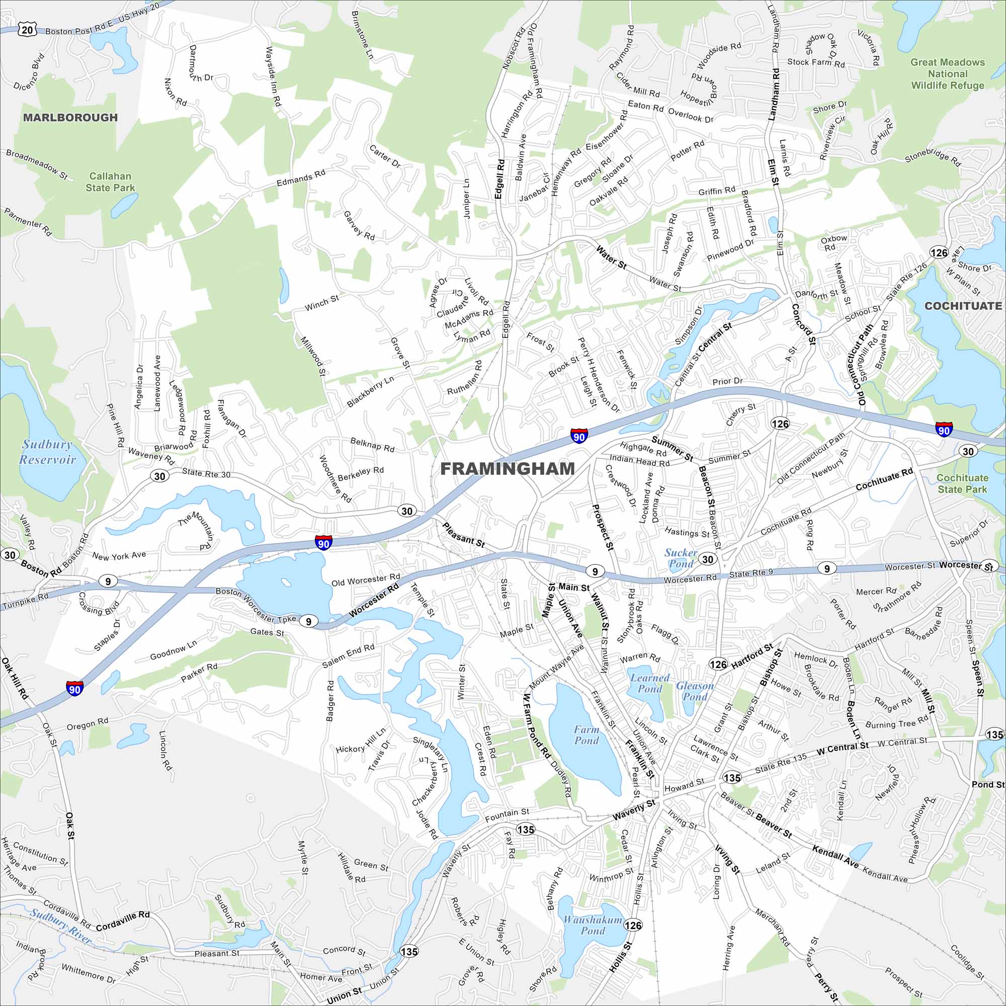
Framingham is west of Boston in a mix of suburbs and woods. Route 9 and the Mass Pike (I-90) both slice across the map. Lake Cochituate adds a central natural landmark.
Map Information
On the Map
Interstates/Highways: I-90, US Hwy 20, State Rte 9, State Rte 30, State Rte 126, State Rte 135 Major Roads: Worcester Rd, Cochituate Rd, Waverly St, Concord St, Union Ave, Main St, Edgell Rd, Pleasant St, Framingham Rd, Nobscot Rd, Central St, Old Connecticut Path, Hartford St, Bishop St, Beaver St, Western Ave, Winter St, Temple St, Salem End Rd, Edmonds Rd Lakes and Reservoirs: Sudbury Reservoir, Foss Reservoir, Stearns Reservoir, Brackett Reservoir, Learned Pond, Gleason Pond, Sucker Pond, Waushakum Pond, Farm Pond, Farm Pond, Pelham Pond Major Rivers: Sudbury River Parks and Preserves: Callahan State Park, Great Meadows National Wildlife Refuge, Cochituate State Park Nearby Communities: Marlborough, Malden, CochituateMassachusetts State Maps
Here’s our state maps of Massachusetts


City Maps of Massachusetts
Explore Boston and other urban areas in Massachusetts


