Map of Fountain, Colorado
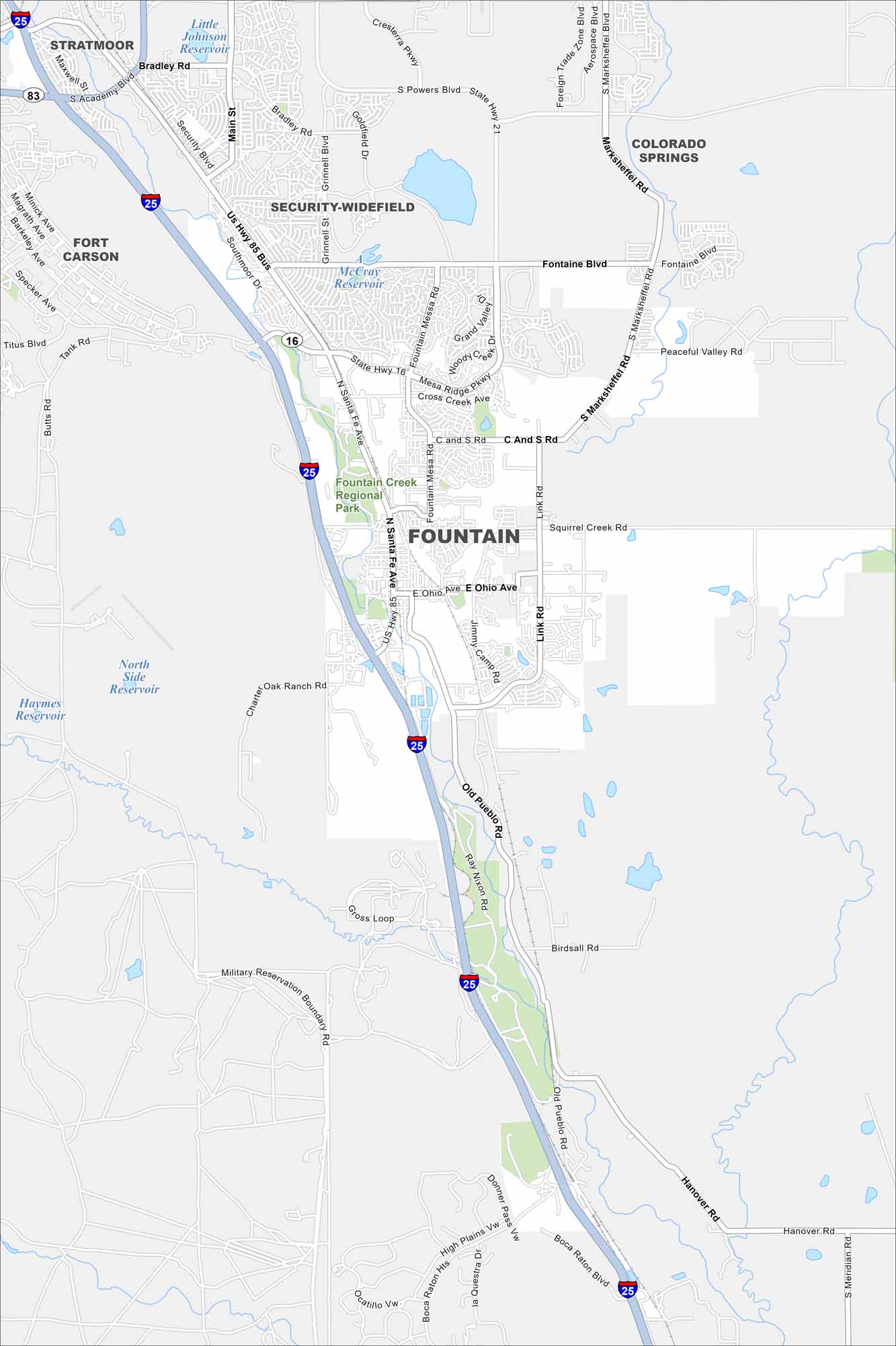
Fountain is south of Colorado Springs on the high plains. Fountain Creek runs through, including its own regional park. I-25 tracks the same path.
Colorado State Maps
Browse Colorado with our detailed state maps


Map Information
On the Map
Interstates/Highways: I-25, US Hwy 85 Bus, State Hwy 16, State Hwy 21 Major Roads: Fountain Mesa Rd, Fontaine Blvd, Marksheffel Rd, Link Rd, Santa Fe Ave, Main St, Bradley Rd, Academy Blvd, Squirrel Creek Rd, Ohio Ave, Old Pueblo Rd, Ray Nixon Rd, Creston Pkwy, Security Blvd, Southmoor Dr, Grinnell Blvd, Goldfield Dr, Woody Creek Dr, Mesa Ridge Pkwy, Cross Creek Ave Lakes and Reservoirs: Little Johnson Reservoir, McCray Reservoir, North Side Reservoir, Haymes Reservoir Parks and Preserves: Fountain Creek Regional Park Nearby Communities: Stratmoor, Security-Widefield, Fort Carson, Colorado SpringsColorado City Maps
Here are maps of Colorado’s urban areas


