Map of Fort Collins, Colorado
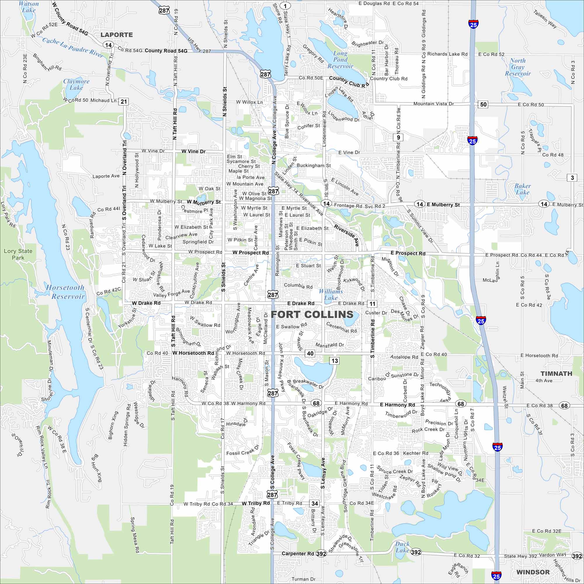
Fort Collins is at the base of the Rocky Mountain foothills. The Cache la Poudre River runs through town toward the plains. Our map shows green spaces, lakes, highways and rivers.
Colorado State Maps
Browse Colorado with our detailed state maps


Map Information
On the Map
Interstates/Highways: I-25, US Hwy 287, State Rte 14, State Rte 392, State Rte 68 Major Roads: College Ave, Mulberry St, Harmony Rd, Prospect Rd, Drake Rd, Horsetooth Rd, Riverside Ave, Shields St, Taft Hill Rd, Overland Trl, Timberline Rd, Lemay Ave, Ziegler Rd, Vine Dr, Elizabeth St, Trilby Rd, Kechter Rd Lakes and Reservoirs: Horsetooth Reservoir, Williams Lake, Long Pond Reservoir, Richards Lake, Duck Lake, Baker Lake Major Rivers: Cache La Poudre River Parks and Preserves: Lory State Park Nearby Communities: Laporte, Timnath, WindsorColorado City Maps
Here are maps of Colorado’s urban areas


