Map of Flower Mound, Texas
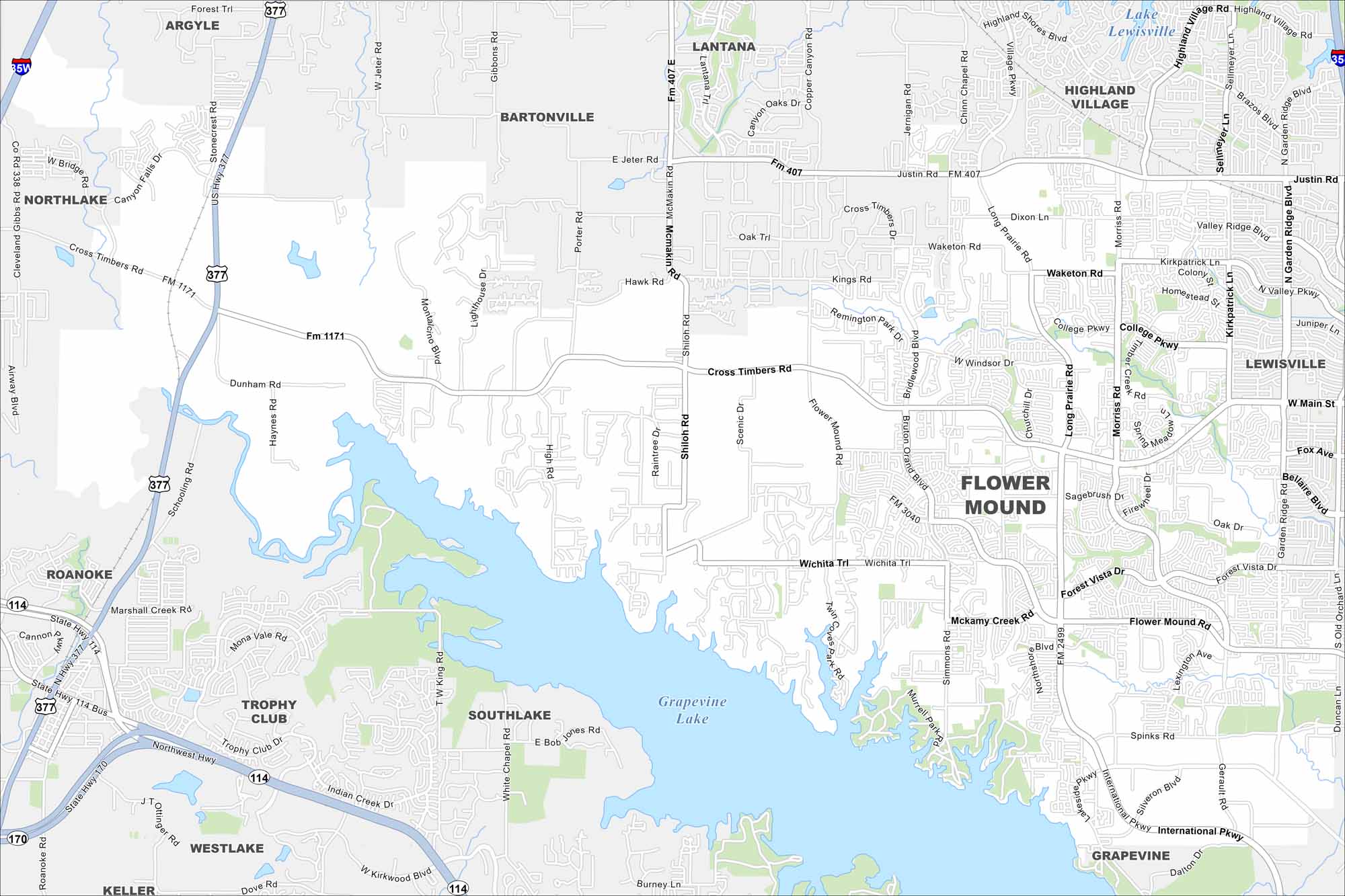
Check out our map of Flower Mound north of the Dallas–Fort Worth area. Grapevine Lake stretches along its eastern edge. Our map shows its lakes, highways and green spaces.
Map Information
On the Map
Interstates/Highways: I-35W, I-35, US Hwy 377, State Rte 114, State Rte 170, State Rte 121 Major Roads: Cross Timbers Rd, Flower Mound Rd, Long Prairie Rd, FM 1171, FM 407, FM 3040, FM 2499, Justin Rd, Waketon Rd, College Pkwy, Windsor Dr, Kirkpatrick Ln, Garden Ridge Blvd, Forest Vista Dr, Spinks Rd, International Pkwy, Gerault Rd, Simmons Rd, Shiloh Rd, Dixon Ln Lakes and Reservoirs: Grapevine Lake, Lake Lewisville Nearby Communities: Flower Mound, Highland Village, Lewisville, Grapevine, Southlake, Trophy Club, Westlake, Roanoke, Northlake, Argyle, Bartonville, LantanaTexas State Maps
Scan our maps of the massive southern state of Texas.


City Maps of Texas
Explore our map collection of Texas cities.


