Map of Fergus Falls, Minnesota
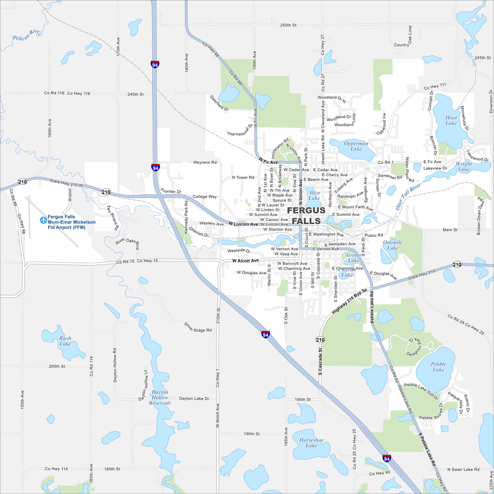
Fergus Falls sits in the heart of Minnesota lake country. The Otter Tail River cuts through town, connecting several small lakes.
Map Information
On the Map
Interstates/Highways: I-94, State Rte 210 Major Roads: Lincoln Ave, Union Ave, Cascade St, Pebble Lake Rd, Summit Ave, Fir Ave, Tower Rd, Friberg Ave, Buse St, Broadway, Court St, Mill St, Sheridan St, Washington Ave, Vernon Ave, Hampden Ave, Alcott Ave, Douglas Ave, Pebble Lake Rd, College Way Airports: Fergus Falls Muni-Einar Mickelson Fld Airport (FFM) Lakes and Reservoirs: Pebble Lake, Wright Lake, Hoot Lake, Opperman Lake, Alice Lake, Grotto Lake, Onemile Lake, Horseshoe Lake, Rush Lake, Dayton Hollow Reservoir Major Rivers: Otter Tail River, Pelican RiverMinnesota State Maps
Explore every lake in our state maps of Minnesota


Minnesota City Maps
Browse through our city maps of Minnesota


