Map of Fayetteville, Arkansas
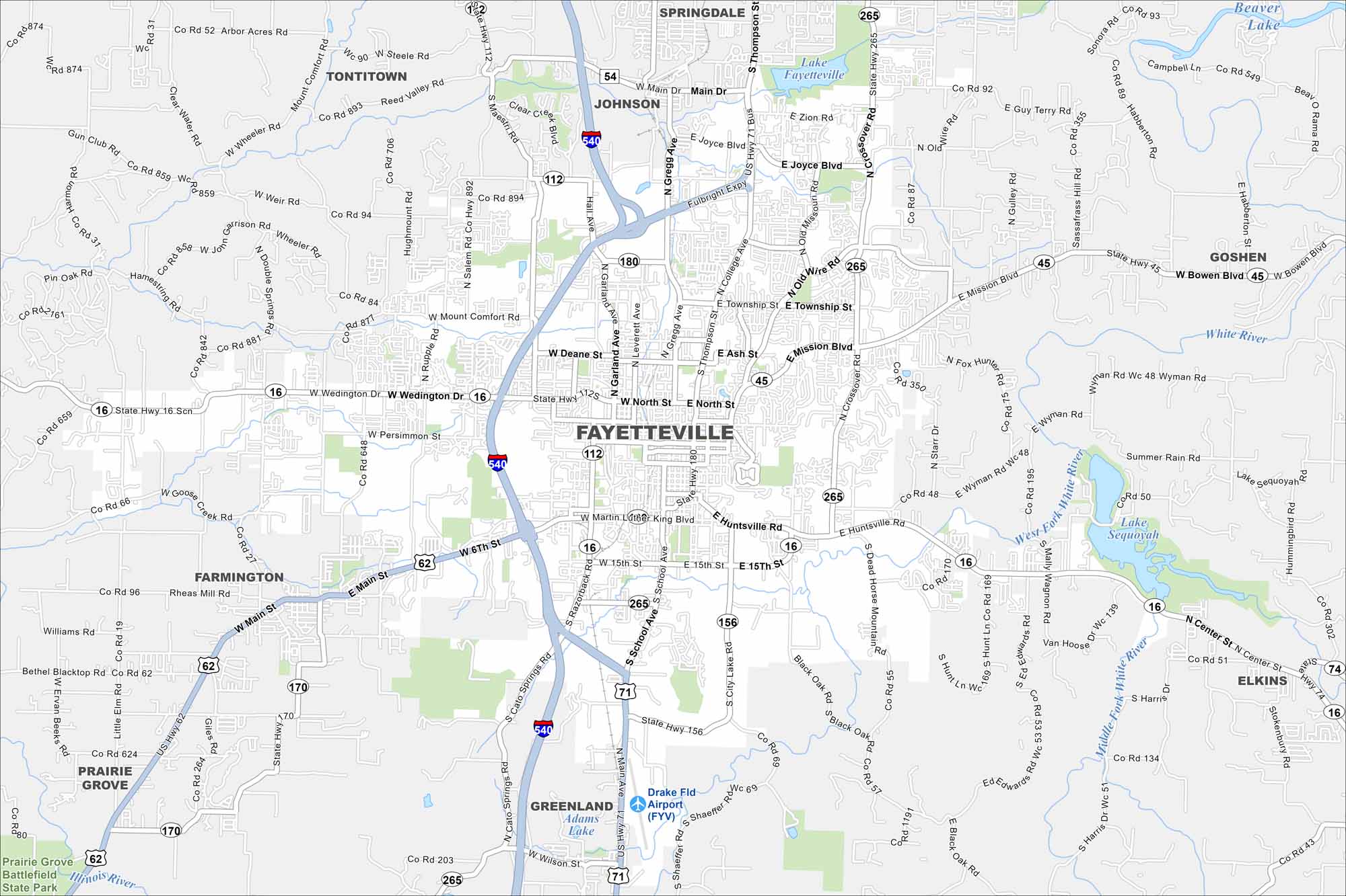
Fayetteville is in the Ozark Mountains of northwest Arkansas. Roads wind through hills and ridges across the city. The topography gives the map a layered, uneven look.
Arkansas State Maps
Check out our Arkansas maps here


Map Information
On the Map
Interstates/Highways: I-540, US Hwy 71, US Hwy 62, State Hwy 112, State Hwy 16, State Hwy 45, State Hwy 180, State Hwy 265, State Hwy 156, State Hwy 170, State Hwy 74 Major Roads: Fulbright Expy, College Ave, Wedington Dr, Martin Luther King Blvd, Joyce Blvd, Mission Blvd, Huntsville Rd, Township St, North St, School Ave, Garland Ave, Gregg Ave, Leverett Ave, Main St, Cato Springs Rd, Zion Rd, Rolling Hills Dr, Old Wire Rd, Crossover Rd, Lake Rd Airports: Drake Fld Airport (FYV) Lakes and Reservoirs: Lake Fayetteville, Lake Sequoyah, Adams Lake Major Rivers: West Fork White River, Middle Fork White River, White River, Illinois River Parks/Preserves/Forests: Prairie Grove Battlefield State Park Nearby Communities: Springdale, Johnson, Tontitown, Farmington, Prairie Grove, Greenland, Elkins, GoshenArkansas City Maps
Discover Arkansas through our city maps


