Map of Everett, Massachusetts
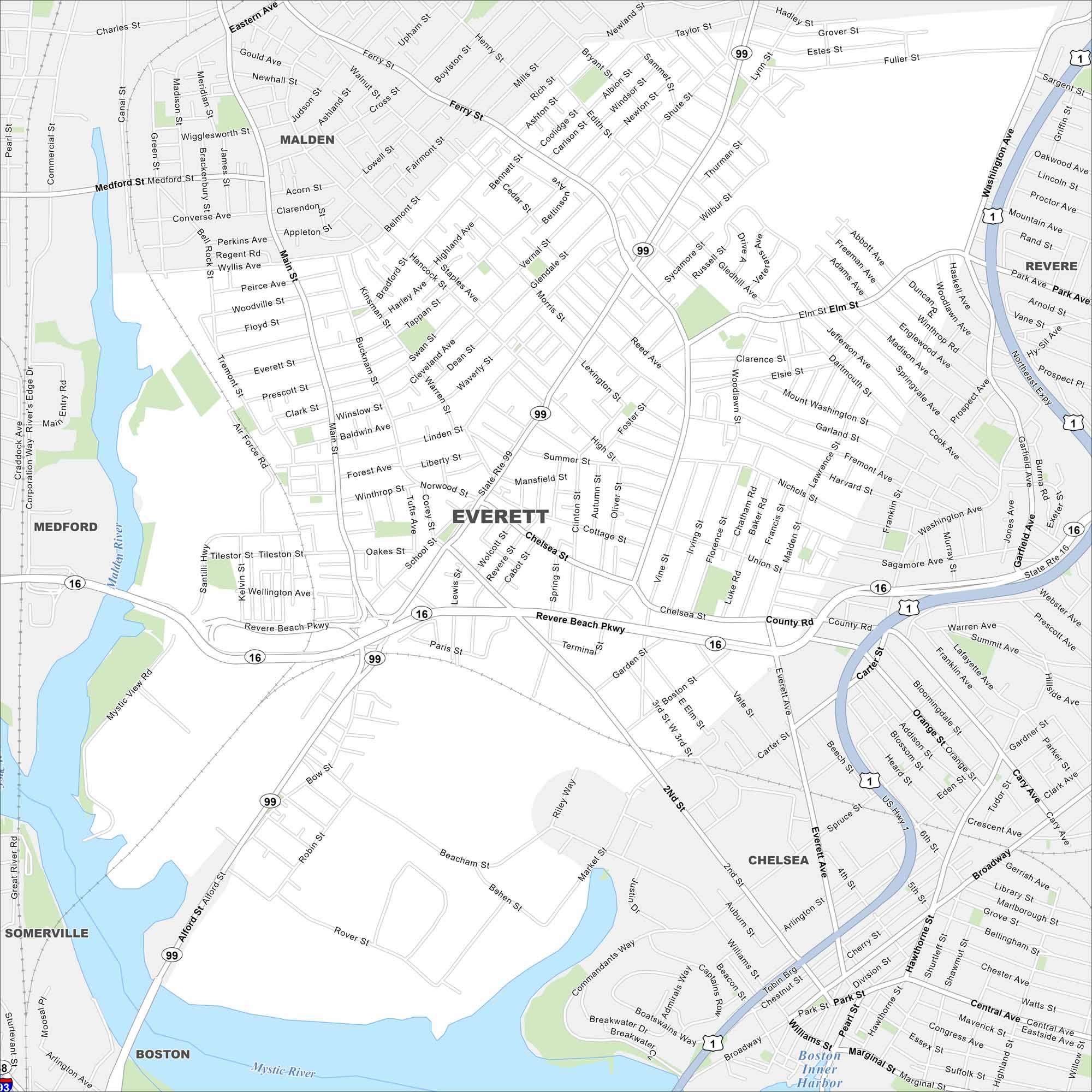
Everett is just north of Boston, bordered by the Mystic River and US Highway 1. Dense neighborhoods fill nearly every block.
Map Information
On the Map
Interstates/Highways: US Hwy 1, State Rte 99, State Rte 16, State Rte 1 Major Roads: Revere Beach Pkwy, Broadway, Main St, Ferry St, Chelsea St, Everett Ave, Northeast Expy, Beacham St, Second St, Alford St, Hancock St, Elm St, Santilli Hwy, Air Force Rd, Robin St, Rover St, Central Ave, Marginal St, Eastern Ave, Washington Ave Lakes and Reservoirs: Boston Inner Harbor Major Rivers: Mystic River, Malden River Nearby Communities: Boston, Chelsea, Malden, Revere, Medford, SomervilleMassachusetts State Maps
Here’s our state maps of Massachusetts


City Maps of Massachusetts
Explore Boston and other urban areas in Massachusetts


