Map of Euless, Texas
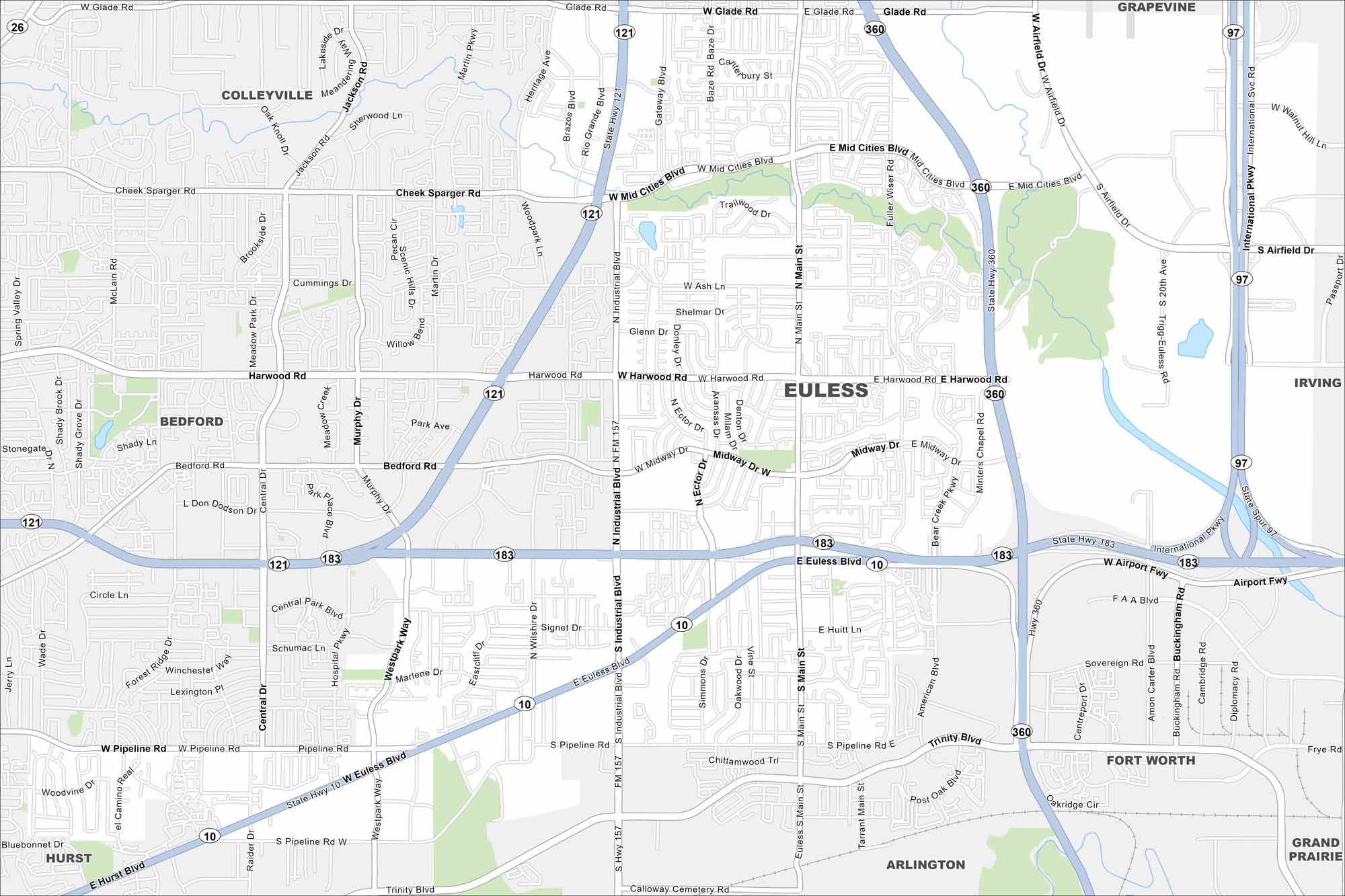
Euless lies in the heart of the Dallas-Fort Worth metroplex. Highways 183 and 121 meet in its center. Our map shows highways, waterways and parks.
Map Information
On the Map
Interstates/Highways: State Rte 10, State Rte 121, State Rte 157, State Rte 183, State Rte 360 Major Roads: Airport Fwy, Euless Blvd, Main St, Harwood Rd, Mid Cities Blvd, Pipeline Rd, Glade Rd, Industrial Blvd, Westpark Way, Murphy Dr, Ector Dr, Midway Dr, Bear Creek Pkwy, American Blvd, Minters Chapel Rd, Airfield Dr, International Pkwy, Centreport Dr, Amon Carter Blvd, Buckingham Rd Nearby Communities: Colleyville, Bedford, Hurst, Arlington, Grand Prairie, Fort Worth, Irving, GrapevineTexas State Maps
Scan our maps of the massive southern state of Texas.


City Maps of Texas
Explore our map collection of Texas cities.


